

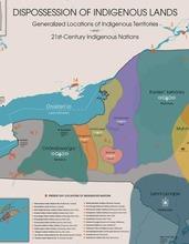
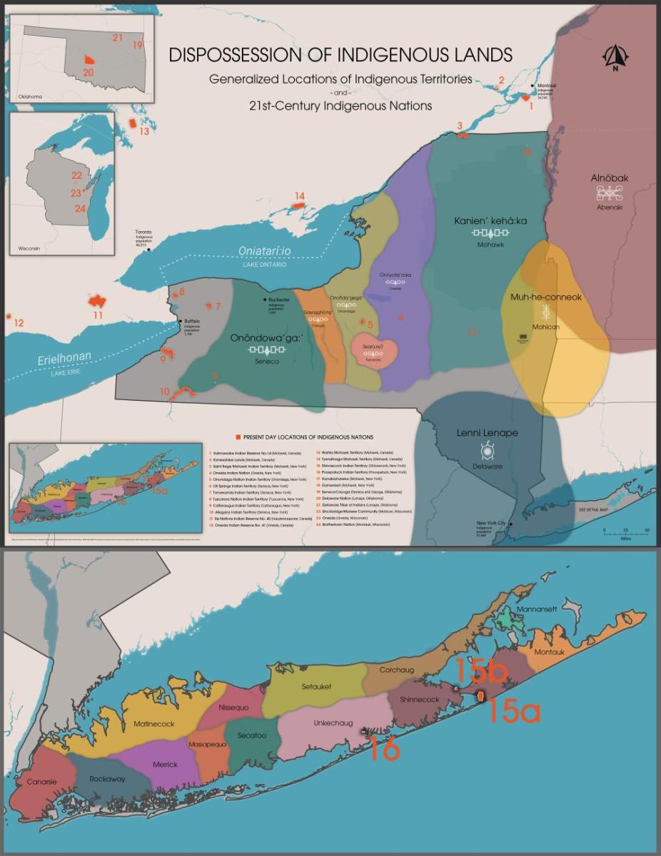
Dispossession of Indigenous Lands Map
Generalized Locations of Indigenous Territories and 21st-Century Indigenous Nations
This map provides an overview of territorial boundaries and locations of present-day Indigenous Nations and communities whose ancestral lands lie within what is now New York. The territorial boundaries depicted are not intended to be definitive. They were derived from multiple sources, including secondary and conglomerate maps available in the public domain. State Museum staff obtained locations of present-day Indigenous Nations through county, state, and federal land records and digital Geographic Information Systems (GIS) files. For New York State cities, the population numbers were obtained from the 2022 US Census Bureau QuickFacts population estimates. The population figures specifically reflect the count of individuals who identify as “American Indian and Alaska Native alone.” For Canadian cities, the population numbers are sourced from the 2016 Census of Population compiled by Statistics Canada.
View/Download Dispossession Map (PDF)
View the PDF version of this map to zoom in, save, and/or print the document.
Dispossession of Indigenous Lands Map (25.94 MB)
Present Day Locations of Indigenous Nations
(Indicated in Orange on the Map)
- Kahnawake Indian Reserve No.14 (Mohawk, Canada)
- Kanesatake Lands (Mohawk, Canada)
- Saint Regis Mohawk Indian Territory (Mohawk, New York)
- Oneida Nation Indian Territory (Oneida, New York)
- Onondaga Nation Indian Territory (Onondaga, New York)
- Oil Springs Indian Territory (Seneca, New York)
- Tonawanda Indian Territory (Seneca, New York)
- Tuscarora Nation Indian Territory (Tuscarora, New York)
- Cattaraugus Indian Territory (Cattaraugus, New York)
- Allegany Indian Territory (Seneca, New York)
- Six Nations Indian Reserve No. 40 (Haudenosaunee, Canada)
- Oneida Indian Reserve No. 41 (Oneida, Canada)
- Wahta Mohawk Territory (Mohawk, Canada)
- Tyendinaga Mohawk Territory (Mohawk, Canada)
- Shinnecock Indian Territory (Shinnecock, New York)
- Poospatuck Indian Territory (Poospatuck, New York)
- Kanatsiohareke (Mohawk, New York)
- Ganienkeh (Mohawk, New York)
- Seneca-Cayuga (Seneca and Cayuga, Oklahoma)
- Delaware Nation (Lenape, Oklahoma)
- Delaware Tribe of Indians (Lenape, Oklahoma)
- Stockbridge-Munsee Community (Mohican, Wisconsin)
- Oneida (Oneida, Wisconsin)
- Brothertown Nation (Montauk, Wisconsin)

Additional Resources
Visit these sites to learn more about the Indigenous Nations whose ancestral lands lie within what is now New York:
Haudenosaunee Confederacy:
https://www.haudenosauneeconfederacy.com/confederacys-creation/
Abenaki-Wabanaki:
https://wabanakialliance.com/who-we-are/
Stockbridge-Munsee Mohican Nation:
https://www.mohican.com/brief-history/
Delaware Nation-Anadarko:
https://www.delawarenation-nsn.gov/
Delaware Tribe of Indians-Bartlesville, OK:
http://delawaretribe.org/
Munsee Delaware Nation at Moraviantown-Canada:
https://www.facebook.com/people/Munsee-Delaware-Nation/100066265130726/
Shinnecock Nation:
https://www.shinnecock-nsn.gov/
Unkechaug Nation:
https://nativelongisland.com/
Seneca-Cayuga Nation (Oklahoma):
https://sctribe.com/
Brotherton Nation:
https://brothertownindians.org/
Delaware Nation (Oklahoma):
https://www.delawarenation-nsn.gov/
Delaware Tribe of Indians (Oklahoma):
https://delawaretribe.org/
Tyendinaga, Mohawks of the Bay of Quinte:
https://mbq-tmt.org/