

Utica North-South Arterial Reconstruction Project, Utica, New York
The Utica North-South Arterial Reconstruction Project is a multi-phase project which was initially excavated in 2006 by both the CRSP and one of our sub-consultants, then completely taken over in 2012 by the Cultural Resource Survey Program for the Phase III data recoveries and the construction monitoring. More than eleven sites were recommended for data recovery in which six were completed. These sites include the 705 Roberts Street site, the 1019 Sunset Avenue site, the N.A. White and Sons Pottery site, the 705/707 Bristol Avenue site, 1026/1028 Lincoln Avenue site, and the 613 Court Street site. In addition to the data recovery excavations, CRSP archaeologists have monitored the demolition of structures and the highway as well as the excavations related to the placement of new utilities. The construction monitoring efforts which began in 2013 are still ongoing today.
Project Directors: Sean Higgins, Joel Ross, Heather Clark, Steve Moragne, Scott Cardinal, David Staley, Barry Dale
Individual Sites:
705 Roberts Street
Project Director: Sean Higgins
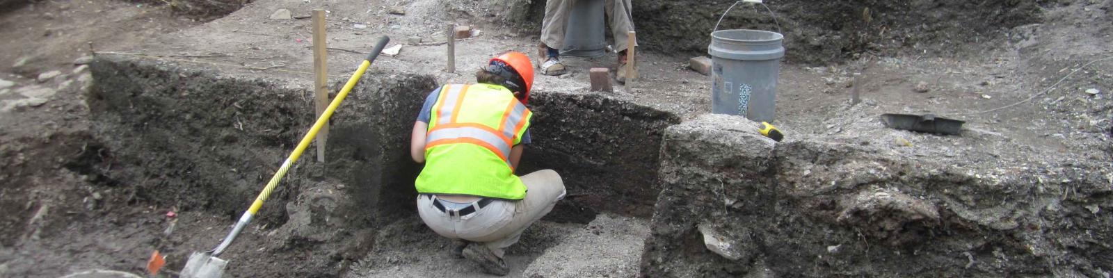
Excavations at 705 Roberts began in mid to late November of 2012, and ended in the first week of January, 2013. During the second week of November, a crew monitored the removal of the asphalt parking area south of 705 Roberts, and adjacent to 700 Bristol. The site located at 705 Roberts was a nineteenth to twentieth century office and residence. The neighborhood in which 705 Roberts is located had, at one time, a heavy German and later Polish, ethnic population. Excavations at this location were geared toward the identification of cultural remains representing these populations. The second half of the testing area was located to the south of 705 Roberts, which prior to testing was a paved parking lot. During the nineteenth and twentieth centuries, this site served a number of purposes. First, it was a small local stone workshop which shaped architectural stones. It has been suggested that the residence at 705 Roberts was perhaps a later office/house for the workshop manager. At some point during the early twentieth century, the workshop ceased to operate. During the mid-twentieth century and forward, the lot was paved over. Investigation of this site would help document local small economy, something that is absent from the other sites investigated during these data recoveries.
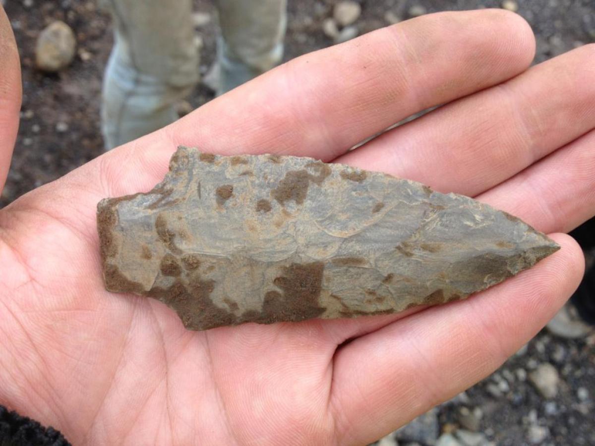
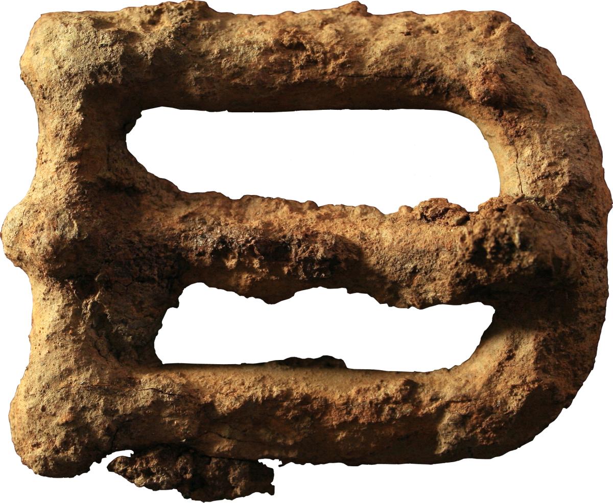
Though the artifact analysis is still ongoing, some notable artifacts recovered during the excavations include a variety of domestic artifacts relating to the residential structure, as well as some relating to the stone workshop. Many of the artifacts recovered from under the parking lot relate to a short-lived restaurant at the adjacent property of 700 Bristol. Interestingly, a Late Archaic Genesee projectile point was recovered from a unit, which was found at what archaeologist have determined to be a buried nineteenth century surface, under periods of historic fill and topped with the asphalt parking lot. This point appears to be historically curated, or historically redeposited and not to be part of any prehistoric occupation at this location.
705/707 Bristol Avenue
Project Director: Steve Moragne
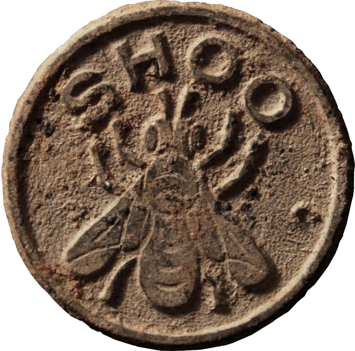
705/707 Bristol Avenue was constructed sometime around 1870 and between then and 1930 it served as an immigrant tenement for multiple families, with census data showing that between those dates over 200 people lived there, rarely staying for more than a few years and always in the company of at least one other unrelated family. While this area of Utica is known as, “Little Poland,” it is only after approximately 1915 that Polish immigrants came to occupy this building. Prior to that year, the tenants included immigrants from Switzerland, the Province of Saxony, the Kingdom of Wurtemburg (now southern Germany), England, Austria, Prussia, Ireland, France, Germany, and Russia. The available census data shows that during that 60 year span there were never fewer than 16 people living in this duplex at one time and usually the tenants’ numbers were in the low 20s. In 1880, 29 people lived there, fifteen of whom were children under the age of 13. While many of the adult tenants were factory workers at some of the area mills, there was also an array of other jobs listed for the immigrants including: shoemaker, woolen mill worker, dress maker, stationer and news dealer, cigar maker, varnisher, teamster, cotton spooler, spinner (twice), stone cutter, mill hand (twice), flagman, tailor, errand boy (twice), molder, boiler worker (twice), highland mill worker, knitting mill worker (twice), baker (twice), spinner at silk mill, wagon maker, butcher, laborer, brewery man, tinsmith, driver, cutter, rim maker, waiter, spinner at cotton miller, twister at woolen mill, dorfer at woolen mill, chauffer, bookkeeper, dyer, cutter at cutlery factory, laborer at cutlery factory, salesman, dairy laborer, and cotton mill laborer.
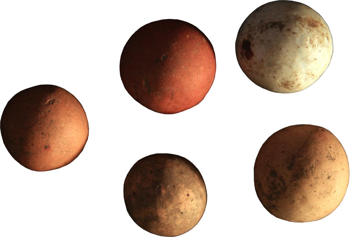
Archaeologically, the site includes a sheet midden and three shaft features – two cisterns near the rear of the house and one privy at the back of the lot. The artifact assemblages from the two are very distinct, a result of the different kinds of behaviors that led to their creation. The sheet midden accumulated slowly over time and likely reflect inputs from every person who ever lived in this house. Given that situation, it could be seen as very difficult to tease out the contributions of one group over another, but from the artifacts it is clear that a great deal of the sheet midden assemblage is the creation of children and it includes numerous doll parts, marbles, buttons, and other toys along with more traditional architectural and domestic debris. This is exciting because it provides a window into the life of children around the turn of the 20th century in immigrant Utica. On the other hand, the artifact assemblage from the shaft features was deposited very quickly, likely around 1905 when Utica began phasing out the use of privies and cisterns in favor of indoor plumbing. The deposits from these features likely represent bulk assemblages of domestic debris that may have either fallen out of style or were being replaced as a new household moved in, but either way they provide a snapshot of material life of immigrant families at the turn of the century in Utica, NY.
1019 Sunset Avenue
Project Director: Heather Clark
1019 Sunset Avenue consists of two long term family occupations that spanned from the mid-nineteenth to the early twentieth century in Utica, New York. Though the site was primarily a domestic residence, both families incorporated personal businesses into their space. The residents operated both a cigar shop and a greenhouse during the latter half of the 19th century and a slate roofing company in the beginning of the 20th century. Unlike the surrounding West Utican populations, 1019 Sunset was occupied by families of English and Irish descent. Excavations at the site were aimed towards finding information that would help to delineate the use of space between the domestic and business use of the property.
1026-1028 Lincoln Avenue Site
Project Director: David Staley
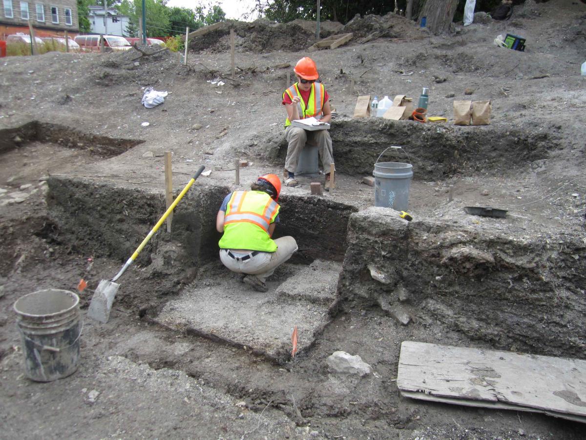
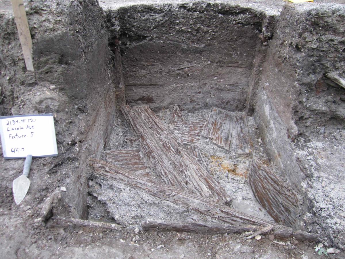
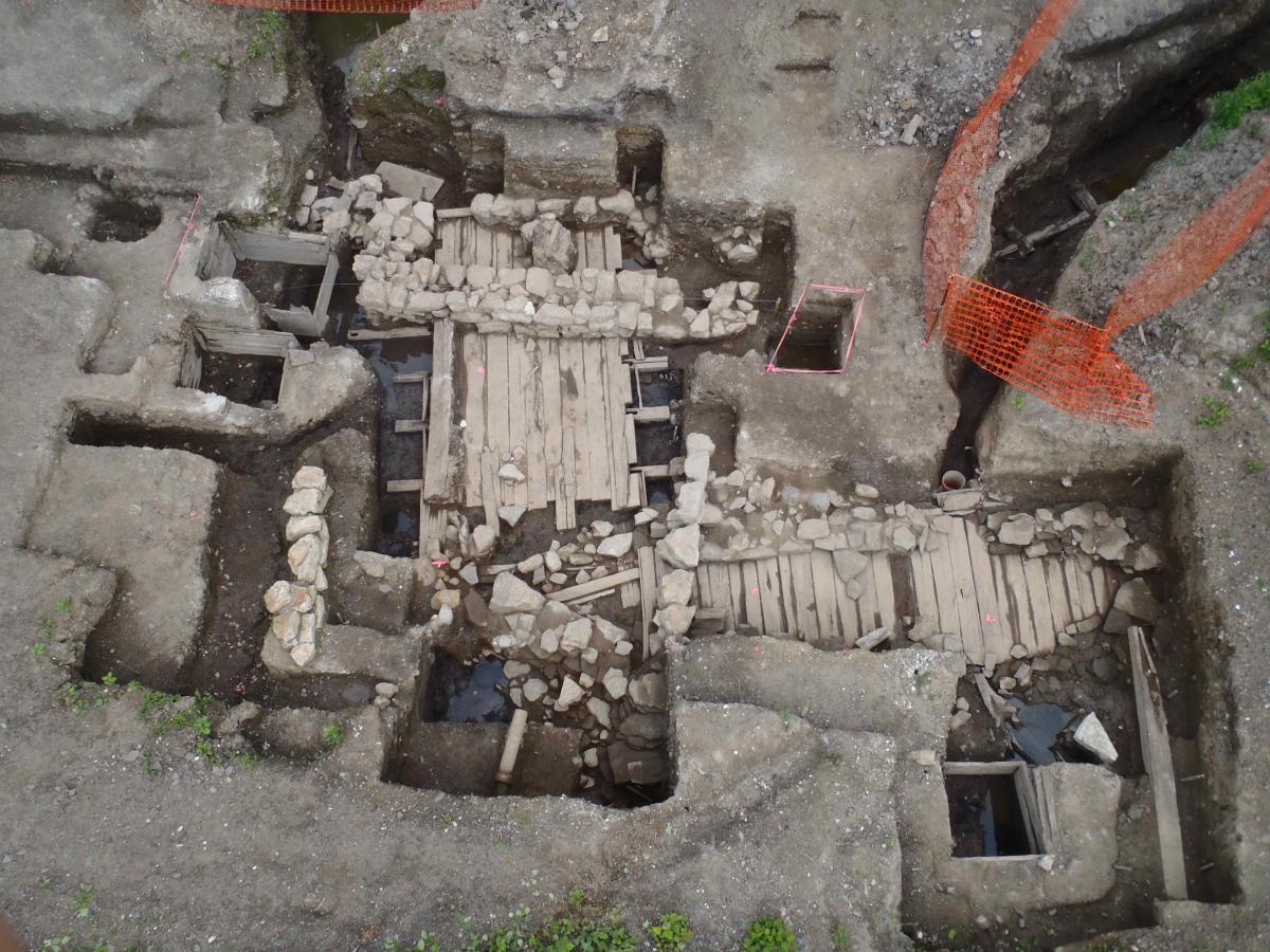
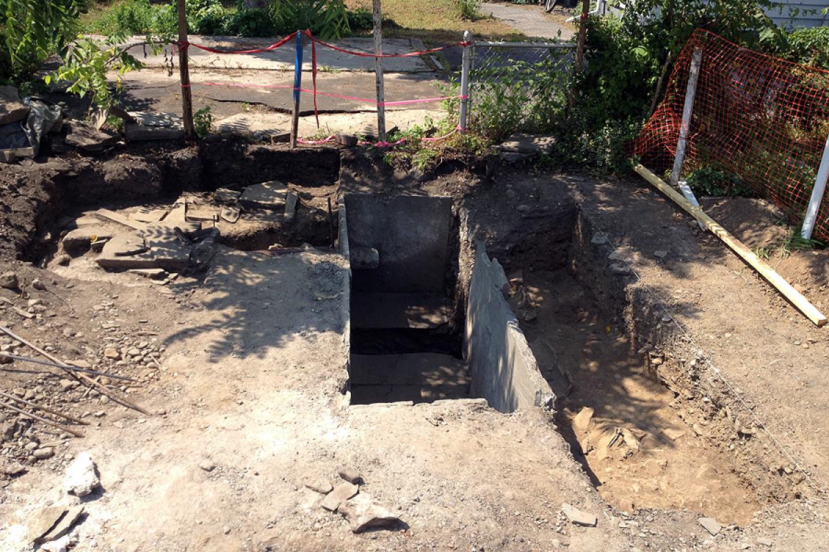
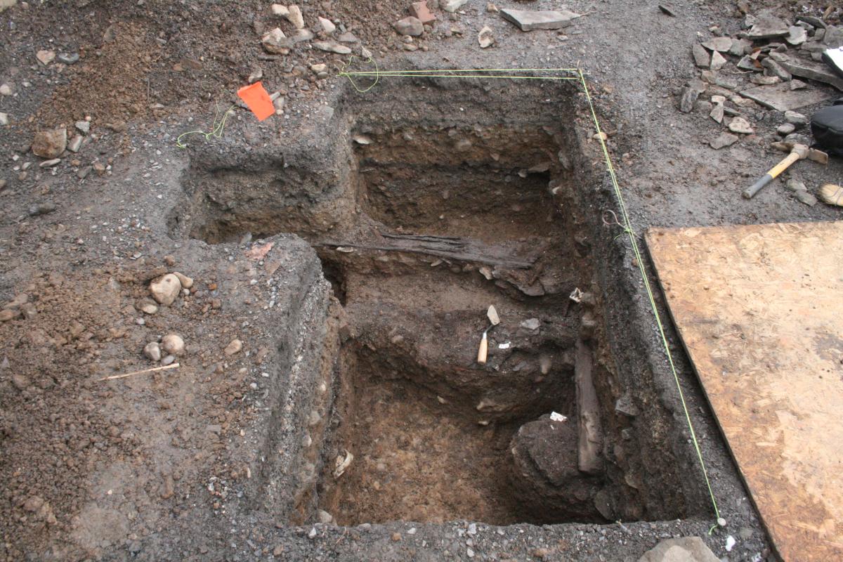
Data recovery efforts at 1026-1028 Lincoln Avenue, conducted between October 2012 and January 2013 and again from April to August 2013, documented and collected data from 16 features whose dates span from the late 20th century back to 1835. The excavated portion of the site included the backyards of two residences that were built in the late 1870s and demolished in the 1990s. These backyards bordered Utica’s transportation corridor and the site includes evidence of the Chenango Canal (1835-1878), railroad spurs (1870-1960), even deposits related to the original N-S Arterial (1960-2016).
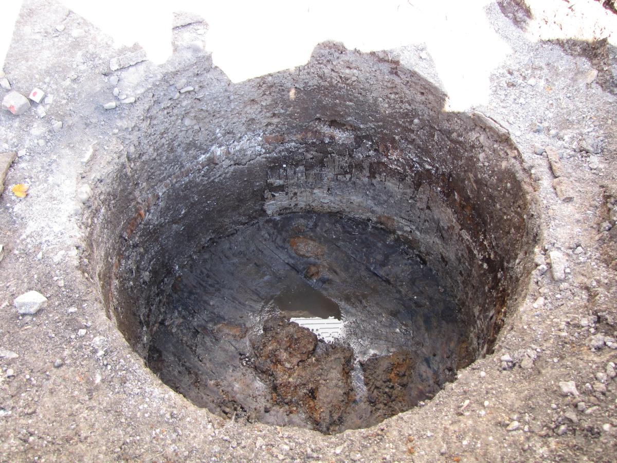
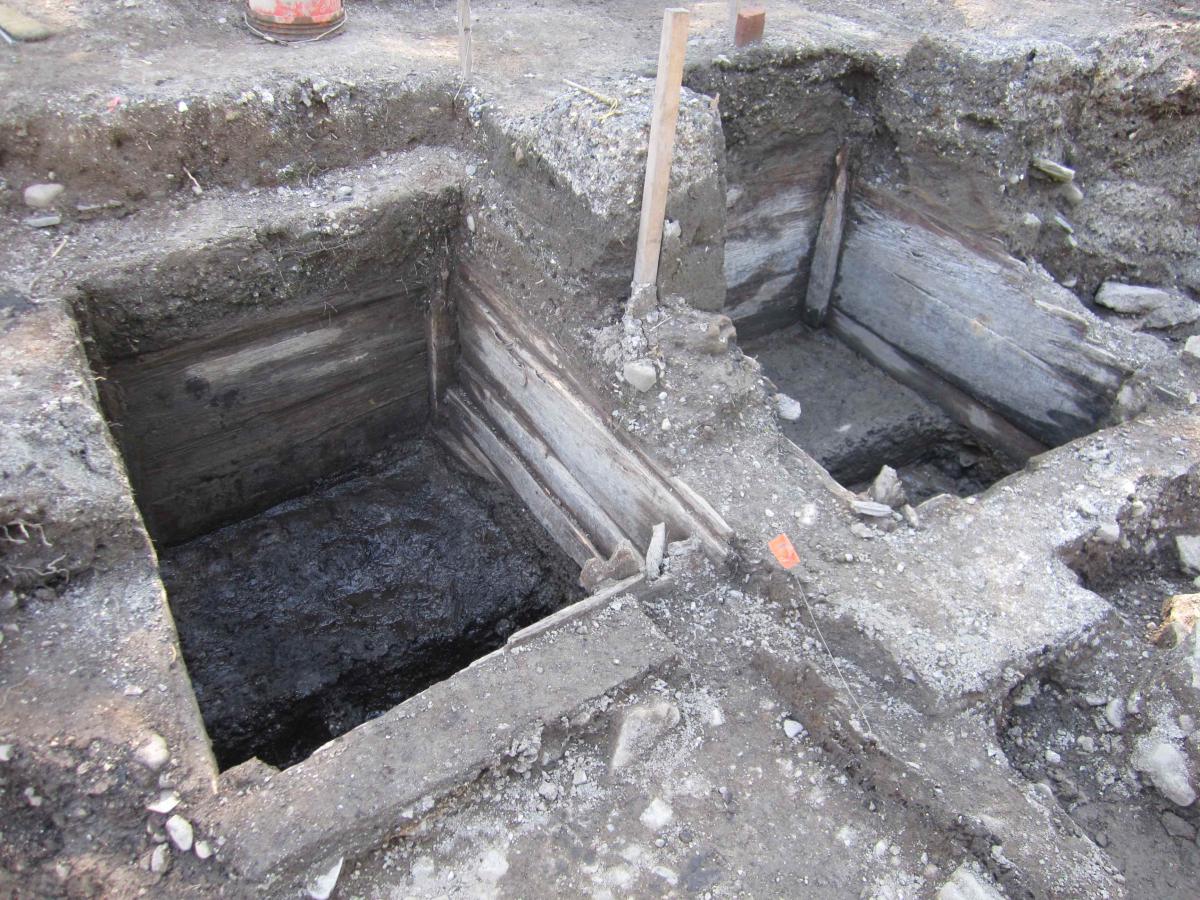
Chenango Canal #3 was located just west of the backyard and our excavations found sections of canal wall, a spillway, and a plank-lined sluice. Historic research has found that the structures represent both original construction and many modifications needed to keep the canal functioning in the harsh upstate New York climate. The canal was abandoned as a transportation route in 1878 yet not filled for another decade.
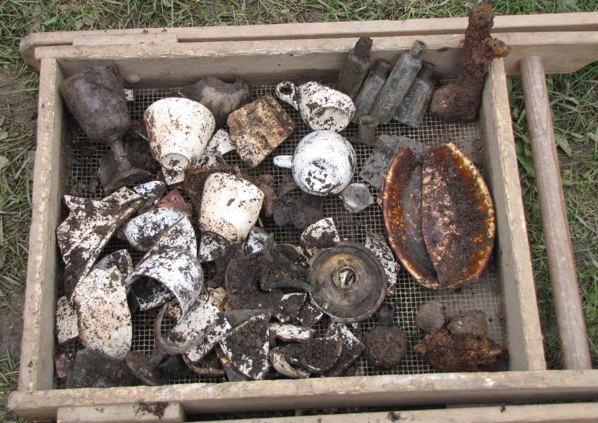
Through the years, the upstairs/downstairs duplex residences regularly changed ownership with tenant turnover even more rapid. The residents were of German, Irish, and English ancestry during the nineteenth century. After 1905, Polish families occupied these houses and most others in the neighborhood. Features and facilities related to the residences include several privies and early wastewater drains. The builders ingeniously positioned their privies to use the waterflow of the canal and the sluice to drain their privy vaults. Organic deposits in the privies provide information about the health and diet of the residents. In or around 1887, the privy vaults were abandoned and filled with trash and rubbish. The deposits of bottles, ceramics, and other objects belonged to families who had moved out of these houses just when the canal was being filled in and the city was installing sewer systems in the neighborhood.
Analysis of over 75,000 artifacts, features, and stratigraphy is currently on-going. Data recovered from 1026-1028 Lincoln Avenue Site has and will continue to contribute to our knowledge of household economics, health, sanitation infrastructure, urban landscape development, and the construction, use, and abandonment of the Chenango Canal.