

Subglacial Landforms and Processes
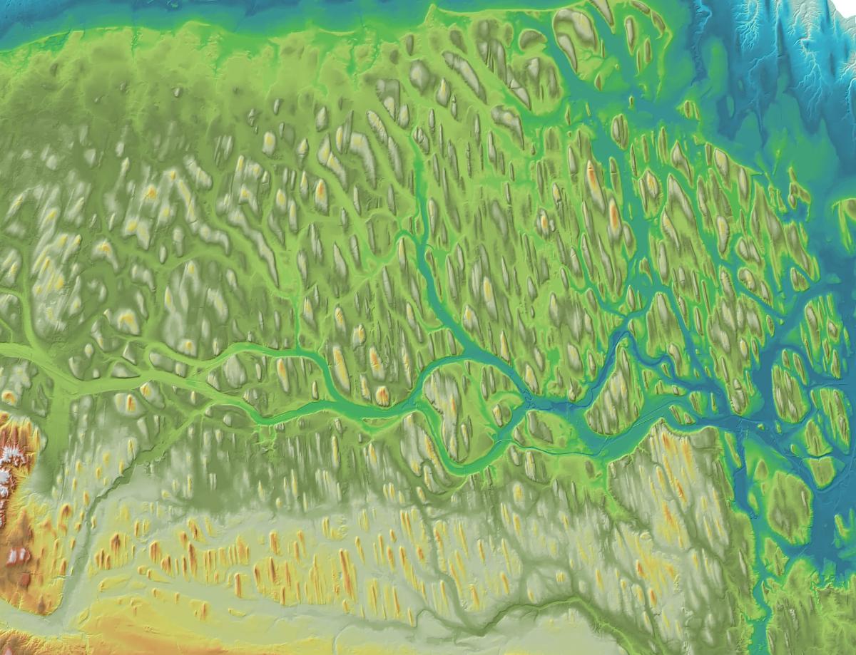
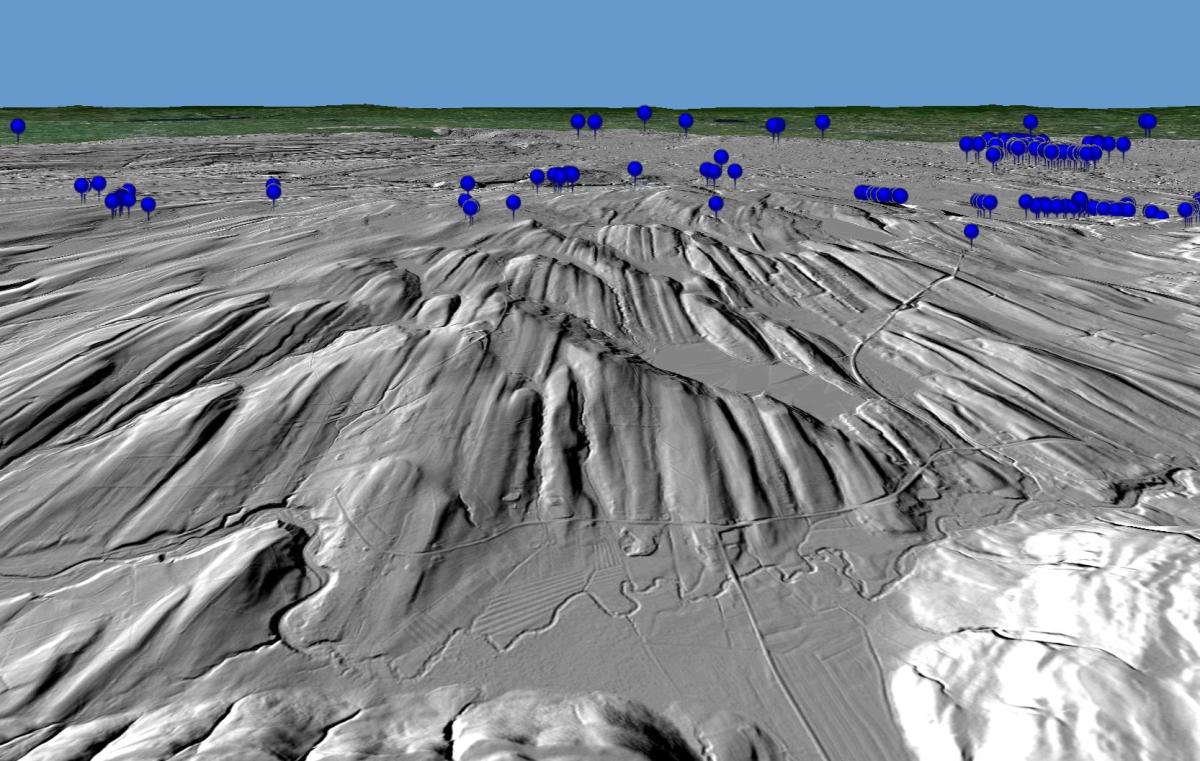
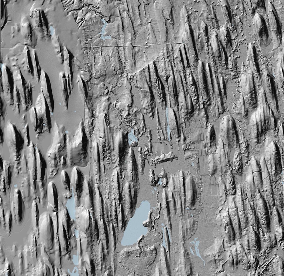
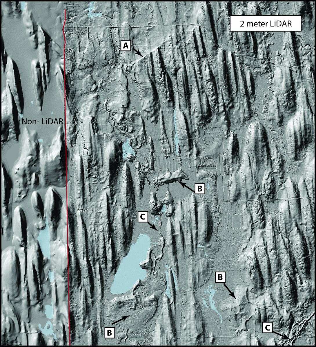
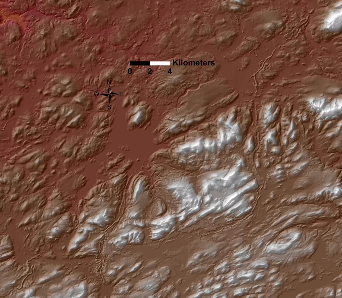
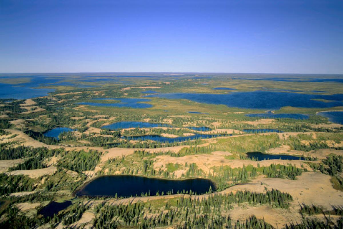
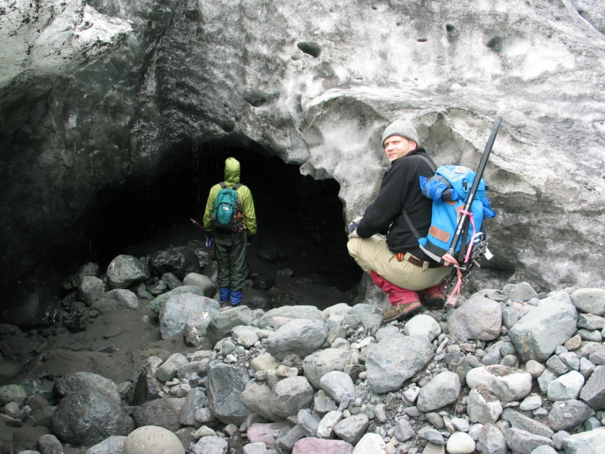
As the massive Ice Sheets more than 2,000 meters thick over road most of the Great Lakes region, the deforming ice and water underneath (subglacial) eroded and deposited sediment to create landforms. Some glacial landforms, such as drumlins and eskers, clearly indicate a landscape produced by subglacial processes. Other landforms, such as large channels known as tunnel channels or tunnel valleys, were produced subglacially by pressurized water flows directed toward the margin of the ice sheet. Because the water was pressurized by the weight and sloping profile of the glacier, these subglacial streams in many locations were flowing uphill. Some of the most interesting landscapes in New York, such as the Ontario Drumlin Field, are considered to be world-class examples of subglacial landscapes. Despite the fact that we can recognize many of these landforms, many questions remain about the glacial processes that formed them. My research here in New York and elsewhere in the Great Lakes region provides an opportunity to study and research these fascinating landforms in an attempt to better understand how they may have formed and the glacial conditions that created them.
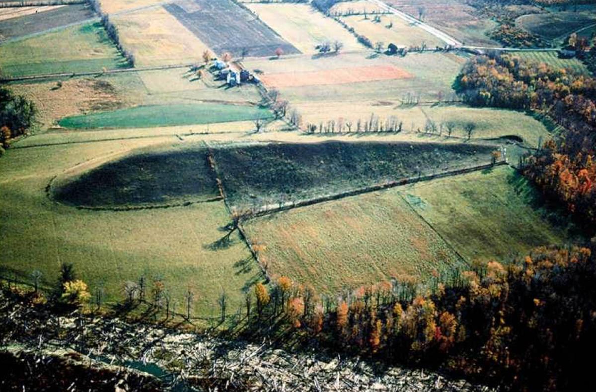
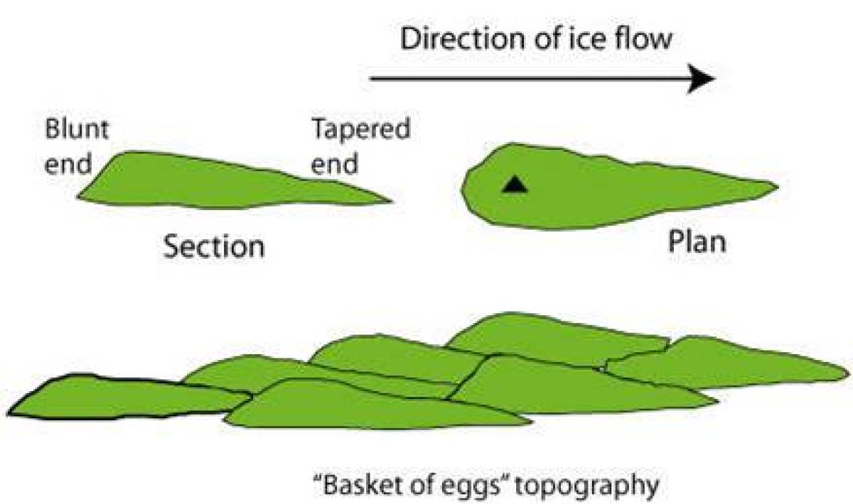
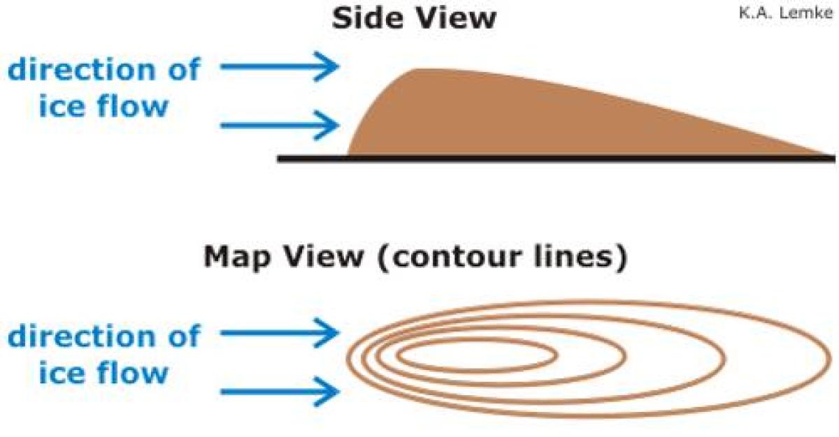
Drumlins
Eskers
Related publications
Hopkins, Nathan R., Evenson, Edward B., Kodama, Kenneth P. and Andrew Kozlowski, September, 2015. An Anisotropy of magnetic susceptibility (AMS) investigation of the till fabric of drumlins: support for an accretionary origin. Boreas, DOI: 10.1111/bor.12138
Kehew, Alan. E.; Kozlowski, A.L.; Brian C. Bird; Esch, J. M., May 2013, Contrasting Terrains of the Lake Michigan and Saginaw Lobes of the Laurentide Ice Sheet in southern Michigan. In Gillespie, Robert (ed.) Insights into the Michigan Basin: Salt deposits, Impact structure, Youngest Basin Bedrock, Glacial Geomorphology, Dune Complexes, and Coastal Bluff Stability. Geological Society of America Field Trip Guide 31 pp15-36,
Gentoso, M.J.; Evenson, E.B.; Kodama, K.P.; Iverson, N.R.; Alley, R.B.; Berti, C.; Kozlowski A.L. January 2012, Exploring Till Bed Kinematics using AMS Magnetic Fabrics and Pebble Fabrics: North Central, New York. Boreas, vol 41, pp.31-41
Kehew, Alan. E., Esch, J. M., Kozlowski, A. L. and Ewald, S. K. 2011, Glacial landsystems and dynamics of the Saginaw Lobe of the Laurentide Ice Sheet, Michigan , USA, Quaternary International, Vol. 24, no. 22, pp.1-11
Kehew, A.E., Kozlowski, A L., 2007 Tunnel Channels of the Saginaw Lobe, Michigan, USA
Special paper 46 of the Finland Geologic Survey, p. 69-79
Kehew, A.E., Lord, M.L., and Kozlowski, A.L. 2007 Glacifluvial landforms of erosion. In: Elias, S.A. (Ed.), Encyclopedia of Quaternary Science. Elsevier, p.818-830.
Kehew, Alan. E., Beukema, S. P., Bird, B. C. and Kozlowski, A. L. 2005, Fast flow/surge dynamics of the Lake Michigan Lobe: evidence from sediment-landform assemblages in southwestern Michigan, USA Quaternary Science Reviews, Vol. 24, no. 22, 2335-2353