

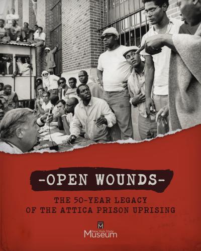
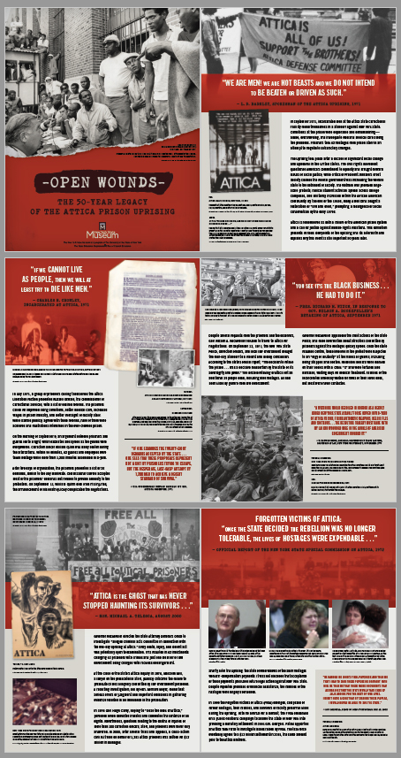
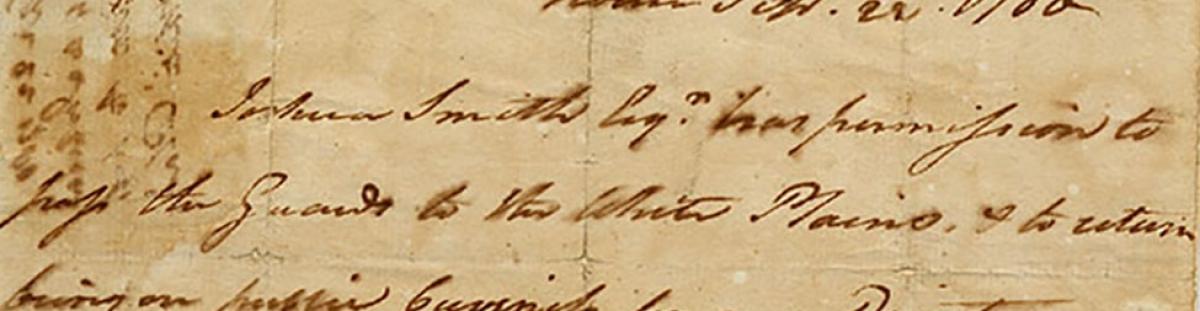
Open Wounds: The Fifty-Year Legacy of the Attica Prison Uprising
This exhibition seeks to present the various viewpoints of the September 1971 Attica prison uprising and its aftermath. It will also discuss the wider impacts of the event and create a dialogue as to why this story is important fifty years later.
The uprising, which left 43 people dead and hundreds wounded, played out against the backdrop of the racially charged late 1960s and early 1970s. The Attica Correctional Facility, located in Wyoming County, opened in 1931 and was originally intended to house incarcerated men from upstate. However, by the 1960s Attica became the overflow facility for New York City-area offenders, which led to racial tensions between the predominantly black prison population and white guards. The racial disparity coupled with overcrowding and inhumane conditions resulted in a tinderbox of explosive tension by the summer of 1971.
Teachers: CTLE: Every Prison is Attica
Panel Exhibition Files
Host this Panel Exhibition
The exhibition is intended as a space in which visitors can create dialogues and conversations about the complicated events as they unfolded at Attica in September 1971; the complex social and racial issues that permeated the events that unfolded (both in terms of the individuals involved and the actions of New York State authorities in the retaking and aftermath); and how the legacy of Attica continues to shape politics and policies today.
Is your organization interested in hosting the Open Wounds panel exhibtion?
- No Cost. High resolution files will be sent for venues to print and mount panels at own expense.
- Funding: Small organizations may apply for a Quick Grant from Humanities New York to off-set funding costs for printing the exhibition panels: https://humanitiesny.org/our-work/quick-grants/. Email grants@humanitiesny.org
- Size: Seven panels total, each 32 in wide x 40 in high. 25-30 linear feet (variable)
- Available: Exhibition panel files are ready to send via email
Contact: Office of New York State History, nysmhistory@nysed.gov
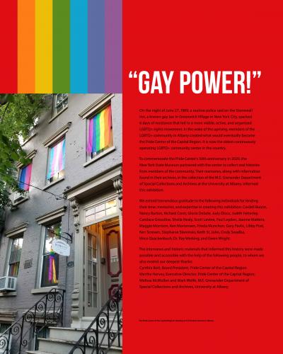
Pride Center of the Capital Region Panel Exhibition
The New York State Museum is pleased to announce a panel exhibition highlighting the 50-year history of the Pride Center of the Capital Region, the oldest continuously operating LGBTQ+ community center in the country. To commemorate the Pride Center’s anniversary in 2020, the New York State Museum partnered with the Center to collect oral histories from members of the community. The exhibition includes their memories, as well as images and information from the Pride Center archives housed in the M.E. Grenander Department of Special Collections and Archives at the University at Albany.

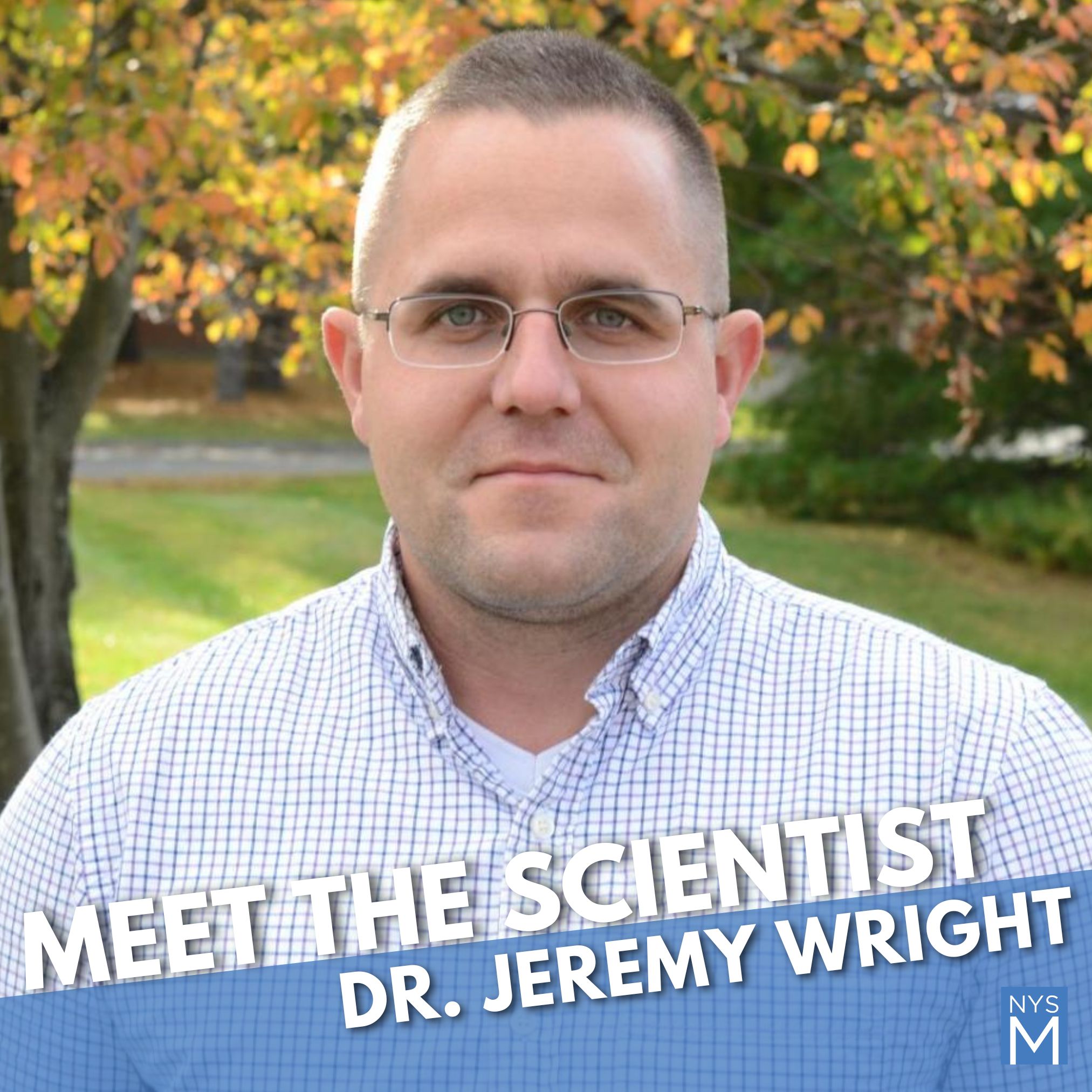
Dive into the world of fish with New York State Museum Curator of Ichthyology Dr. Jeremy Wright. Join us near Discovery Place to engage with Dr. Wright, ask your burning questions, and explore the evolution and ecological interactions of fishes. Don’t miss this unique opportunity to learn from an expert in the field.

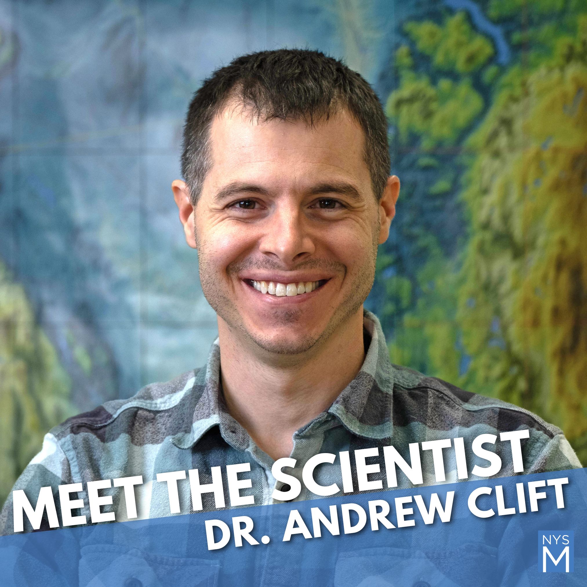
Join Dr. Andrew Clift, Curator of Bedrock Core at the New York State Museum, to explore what lies beneath our feet! Using rock cores, maps, and cool computer models, Dr. Clift uncovers the hidden layers of New York’s deep geologic past. Stop by the table, ask questions, and see some real rocks from New York’s underground!
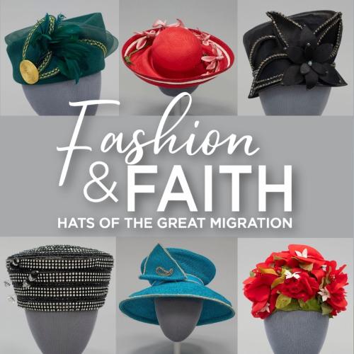

Join Dr. Jennifer Lemak, Chief Curator of History, for an engaging gallery talk on Fashion and Faith: Hats of the Great Migration. Explore how the hats worn in Black churches during the Great Migration were more than fashion—they were symbols of faith, resilience, and personal identity. Dr. Lemak will share the stories behind these extraordinary “crowns,” highlighting how they reflected the journeys, leadership, and creativity of women who navigated new lives in New York State while holding onto their heritage and hope for the future.
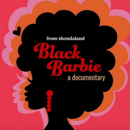
Join us for an educational screening of Black Barbie, a compelling documentary that explores the story of the first Black Barbie doll. Discover how three pioneering women at Mattel transformed the toy industry by creating a doll who reflected their own identities. This one-time screening provides an opportunity to explore representation, innovation, and cultural impact in toys and media.
Staff publications
2010
2009
Memory Keepers
When former Research and Collections Assistant Director and Curator of Ichthyology Dr. Robert Daniels retired in late 2012, he took with him over 30 years of specialist knowledge of the Museum’s fish collection, as well as key information about the Museum’s history and administrative activities. While it’s impossible to capture all of a person’s institutional knowledge, an ongoing oral history project aims to record the experiences of longtime staff members to compile a history of the State Museum. Museum anthropologists John Pasquini and Ralph Rataul conceived the research project in April 2006. – The untimely 2002 death of Dr. Robert Funk, who served as State Archaeologist from 1973 to 1993, had left a void in their professional lives. They both considered Funk “a great resource and a great friend” and knew he had possessed “a wealth of tales” about his time working at the Museum that had reflected the broader history of the institution.

This loss made Pasquini and Rataul realize there was a need to capture and preserve the first-person accounts, stories shared among colleagues, and personal remembrances that shape an individual’s institutional memory. “Some of this information can and does live on in the written and oral traditions that surround us everyday as friends and co-workers reminisce about the individuals in question, but that information is second-hand and is often altered through these recollections and time,” says Pasquini, co-director of the archaeology lab in the Cultural Resources Survey Program. “The Oral History Project collects these memories first-hand and records them for future generations.” So far, Pasquini and Rataul, a research and collections technician for Anthropology, have interviewed more than a dozen longtime employees and former NYSM staff members.
During the recorded interviews, topics range from the general background of the staff members and how they came to work at the Museum to details about how they did their job, who they reported to, what accomplishments they are most proud of, and how the Museum operated. Oral histories have the advantage of being from the “insider’s perspective,” says Rataul, who points out that neither he nor Pasquini or the majority of the current staff were Museum employees at the time many of the recalled events took place. “These insider perspectives, covering the last half century, provide a very real conception of coping and thriving during periods of massive facility and management change,” says Rataul. “Potential blueprints for how we, the current staff, might promote and manage pending changes within our time at this institution can be found in these interviews.” A key area of interest is past relocations of the collections, and many of the Museum’s senior staff participated in the last major move in the 1970s, when the NYSM relocated from the State Education Building to the Cultural Education Center. “We suspect the lessons learned during that effort would be applicable to any future relocation of the Research and Collections department,” say Pasquini and Rataul. The oral history initiative is one of several internally funded Research and Collections projects. Pasquini and Rataul were granted a percentage of time from their regular positions to work on this additional project.
Museum Renovation
The State Museum is proud to share a master plan for the renovation of the Museum's galleries. The master plan calls for 35,000 square feet of new exhibitions, a changeable wall system, and new interactive technology and media.
A full master plan of the renovation project, including artist renderings and floor plans, is AVAILABLE HERE
The master plan outlines the vision and goals for the new galleries and the overall approach for the renovation project. The goal of the renovation is to share New York State's natural, cultural and human history in an integrated, relevant, and memorable way.
The new galleries will be developed under a conceptual approach of "New York Stories" - with every exhibition telling the stories of the state in a diverse and compelling way. The new galleries will address the following themes:
- A State of Change: demonstrates New York State's geographic and geological change through natural and human impact.
- Politics and Prose: presents New York State as a place of debate, dialogue and documentation.
- Emergence of a State: defines New York State through its people, places and events.
- Culture, Community and Context: explores New York State's people, cities, and culture through topics such as art, music, architecture and beliefs.
- New York in 100 Objects: an exhibition of 100 objects, including objects borrowed from museums across the state, that represents the history of New York.


The master plan calls for 35,000 square feet of new exhibitions, a changeable wall system and new interactive technology and media. A full master plan of the renovation project, including artist renderings and floor plans. New York State Museum Gallery Renewal Master Plan
The new exhibitions will share New York State's natural, cultural and human history in an updated, integrated and memorable way.
With the master plan complete, the next step of the renovation process is the exhibition design phase. Check back here for updates on the project.
The State Museum moved to its current space in the Cultural Education Center in 1976. There has not been a major renovation of the gallery spaces since then. In addition, the renovation project presents the Museum with an opportunity to better explain the state's natural and human history. The new exhibitions will tell the stories of New York State's natural and human history that we've never been told before and will incorporate new research, media and technology. A chief goal of the Museum's mission is to serve the educational needs of New Yorkers - the renovated galleries and new exhibitions will offer a more integrated, updated and memorable educational experience for all visitors.
The Museum will remain open throughout the project, although certain galleries will be closed temporarily while undergoing renovation. Continue to check our website for the latest updates on the renovation timeline.
The renovation project is funded through a $14 million capital bond item.
The renovation project is expected to occur over a four-year timeline and will be completed in multiple phases.
Please see the renovation floor plan for details - the colored gallery spaces will be included in the renovation. These spaces include the current Adirondack Hall and New York Metropolis Hall. Some current galleries will be enhanced, including Native Peoples of New York Hall and the Main Lobby entrance. The grey gallery spaces on the floor plan are not included in the renovation, such as the World Trade Center exhibition, Fire Engine Hall and Discovery Place. The dark grey "Back Of House" spaces are preparation/storage spaces for Museum production and are non-public areas.
We are excited to create new galleries and exhibitions for our visitors to experience. However, while we are bringing in new exhibitions, we are keeping the best of our current exhibitions, including the World Trade Center exhibition, the A-Train, Sesame Street, the Cohoes Mastodon, Native Peoples of New York, and Discovery Place. We also plan to incorporate pieces of existing exhibitions into the new galleries in different ways - stay tuned!
We look forward to sharing detailed exhibition design plans after we have completed the design phase. We will begin the exhibition design phase of the renovation project this fall. Check back here for updates.
The Museum will provide regular project updates through the Museum's website, social media accounts, and email newsletter. Check back here for the most current information.
The Museum encourages the public to participate in the renovation project by emailing their suggestions and comments to museuminfo@nysed.gov.
The next step in the renovation project is the exhibition design phase. The Museum will begin the exhibition design phase soon.
Late Pleistocene Lifeways
New Yorkers today would barely recognize their state when it was first colonized by Native Americans about 13,000 years ago. As the Pleistocene era was ending, northward-retreating glaciers and catastrophic meltwater floods had scoured the state, the Atlantic coastline was retreating before rising sea levels, a vast inland sea flooded the St. Lawrence Valley and Champlain basin, and spruce parklands covered much of New York. Known to archaeologists as Paleoindians, these peoples probably immigrated into New York along river valleys from the west or south, perhaps drawn by resources of the Hudson Valley and the Champlain Sea.
Today, we are trying to understand the lifeways of these Paleoindian peoples on several fronts.
Perhaps most importantly, we are actively investigating Paleoindian sites and studying artifact collections. Documenting the locations of these discoveries tells us how they were using the New York region: mining toolstone at outcrops in the Hudson Valley, trekking the Ontario Lake Plain, and visiting Late Pleistocene dune fields on proglacial lake beds west of Albany.
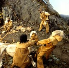
Ice Age Hunters
Life group interpretation of Paleoindian peoples at the West Athens Hill site, Greene County (NYSM Native Peoples Hall exhibit)
For chronological control, in the absence of radiocarbon dating, we devote special study to stone weapons tips (known as fluted points) as time-sensitive age indicators of Paleoindian sites. Other analyses of Paleoindian stone tool collections provide glimpses of life at their small campsites, and reveal adaptive qualities of their stone tool kit.
We are also building a state-wide comparative database on Paleoindian point finds and sites (see NYPID project), and encourage professional and avocational archaeologists to join us in this effort. In the long view, such databases will be one key to advancing our understanding of this unique Late Pleistocene life way.
Selected Publications
Lothrop, Jonathan C., and James Bradley
2012 Paleoindian Occupations in the Hudson Valley, New York. In: Late Pleistocene Archaeology and Ecology in the Far Northeast, edited by Claude Chapdelaine, pp. 9-47. Texas A&M University Press, College Station.
Lothrop, Jonathan C., Paige Newby, Arthur Spiess, and James Bradley
2011 Paleoindians and the Younger Dryas in the New England-Maritimes Region. Quaternary International 242 (2): 546-569.
The New York Paleoindian Database Project (NYPID)
As part of ongoing research on Native American adaptations during the Late Pleistocene and Early Holocene in New York, the NYSM has renewed its commitment to the statewide Paleoindian point survey. To all members of the NY State Archaeological Association and others interested in New York prehistory, please help us systematically record data on Paleoindian fluted and lanceolate projectile points for the NYPID Project.
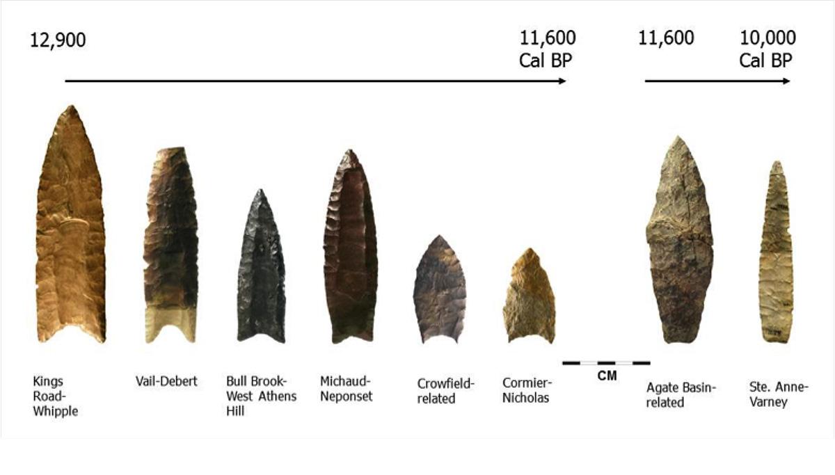
Chronological sequence of Paleoindian points for eastern New York and the New England-Maritimes, 13,000-10,000 years before present.
To help contribute to the NYPID Project, review the sections II and III below.
Section I: Background Information
NYPID -- it's not a state agency -- it's a research project!
Our goal is to compile information and digital photographs of artifacts left behind by the first peoples of New York. Beginning in the 1950s, New York State Museum archaeologists began systematically recording discoveries of Paleoindian points and sites, first, by Dr. William A. Ritchie, and later by Dr. Robert E Funk and Beth Wellman. Mapping of these early finds showed that fluted bifaces clustered in the Hudson and Susquehanna valleys, the Ontario Lake Plain, and other parts of New York, suggesting travel corridors and key resource areas for Paleoindian populations.
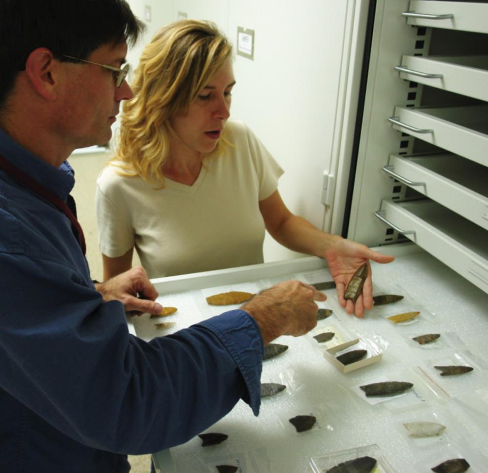
Examining Paleoindian points in the New York State Museum
Statewide Paleoindian point surveys are not new, but archaeologists are increasingly using these data as another tool for understanding life in the Late Pleistocene. The Paleoindian Database of the Americas (PIDBA) website (http://pidba.utk.edu(link is external)) shows how fluted point distributions can be examined at a continental scale to help address questions on the peopling of the New World. For many states, archaeologists have assembled comprehensive data sets of Paleoindian point finds. For New York, however, our data is woefully incomplete, handicapping our interpretations. In the last few years, we have made good progress, assembling the most extensive data sets for central and southeastern New York. With the help of professional and avocational archaeologists, we can continue to build the NYPID database, shedding new light on how and when the first New Yorkers colonized and settled the state.
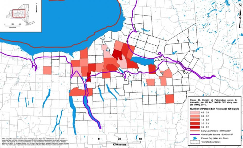
Distribution of Paleoindian points in central New York, showing greatest density on the former bed of proglacial Lake Iroquois.
Selected Publications
Lothrop, Jonathan C., Philip LaPorta, Joseph Diamond, Susan Winchell-Sweeney, and Meredith H. Younge In Review Paleoindian Occupations in Southeastern New York: Sites and Isolated Finds in the Wallkill/Rondout Valley. In: In the Eastern Fluted Point Tradition, Volume II, edited by Joseph A.M. Gingerich. University of Utah Press, Salt Lake City. Lothrop, Jonathan C., James W. Bradley, Susan Winchell-Sweeney, and Meredith H. Younge 2014 Paleoindian Occupations in Central New York. In: Glacial Geology of Cayuga County of the Eastern Finger Lakes: Lakes, Lore and Landforms, edited and compiled by Andrew Kozlowski and Brandon Graham. Guidebook for 77th Annual Reunion of the Northeastern Friends of the Pleistocene Field Conference, June 7-8, 2014, Auburn, New York, pp. 90-101. The New York State Geological Survey, New York State Museum and New York State Education Department, Albany. Lothrop, Jonathan C. 2009 The New York Paleoindian Database Project: a Call for Data. New York State Archaeological Association Newsletter 5(3): 6.
Section II: Recording Data for NYPID / Contact Information
NYPID -- it's not a state agency -- it's a research project!
Please contact us to record data on your Paleoindian point. We can meet you at a NY state archaeological Association chapter or annual meeting, or at your home to record and photograph the point(s). Contributors can also visit us in Albany at the New York State Museum (Anthropology Collections) to have their points recorded.
Contact information:
Jonathan C. Lothrop
New York State Museum
CEC Room 3049
Albany, NY 12230Section III: Where will the Data Go?
After we complete data forms and photography for each Paleoindian point, we enter the information on into an electronic database. Our ultimate goal is to make these data available to other researchers and interested archaeologists. To this end, we will soon begin to upload NYPID data assembled for individual regions to this NYPID web link, and also to the PIDBA site. (For site security, provenience will only be listed at the county level on these Web links.) All contributors will be acknowledged on the NYPID website, except those who wish to remain anonymous.
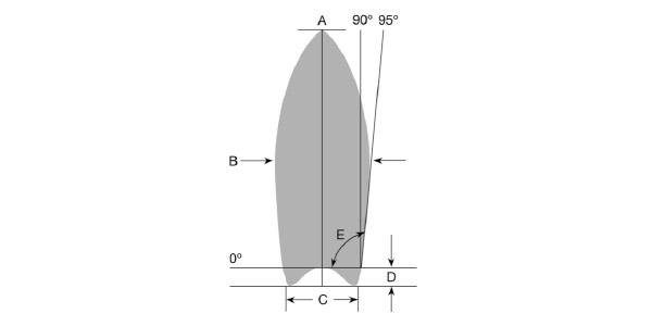
Schematic of measurements recorded for Paleoindian points, New York Paleoindian Database Project.
We encourage all members of the NY State Archaeological Association and interested persons to contribute to this effort. With your help, we can continue to build a database that is providing new insights on the first peoples of New York and their role in colonizing North America at the end of the Pleistocene.

Chazy Reef
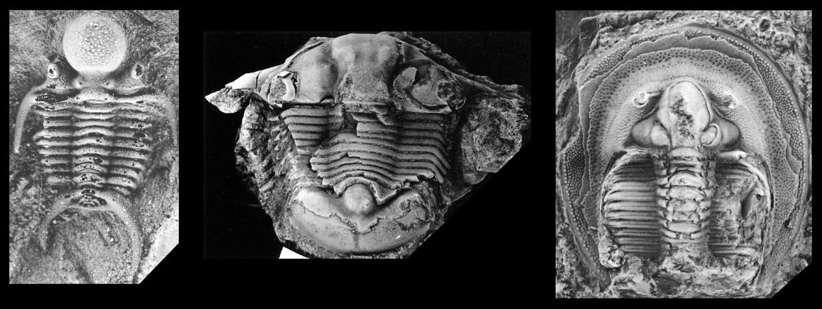
The Chazy Group consists of the Day Point, Crown Point, and Valcour formations and is exposed in areas along the northwestern edge of Lake Champlain and in a few islands within the lake itself. The Crown Point and Valcour formations contain abundant trilobites, which were documented by Shaw in 1968. I plan to study the ecologic relationships of the trilobites to the reefs that are preserved in the Valcour Formation and conduct some long-overdue revision of the phylogenies of some of the groups of trilobites.
Alluvial Geoarchaeology
Many archaeological sites are buried by alluvium in floodplain and terrace settings. Finding and studying these sites can provide new insights into how river systems evolved throughout the Holocene.
This topic has long been a staple of Geoarchaeology, given the close relationships between peoples and rivers. Compelled to work at the minute scales of archaeological excavations, geoarchaeologist routinely find that subsurface stratigraphy in alluvial settings is much more complex than surface conditions can reveal. This is as true in small valleys as in large valleys. A great area to study alluvial deposits in detail has been in the Sny Bottom portion of the Mississippi River in western Illinois, near Hannibal, Missouri. Based on more than two hundred core holes, geoarchaeological studies at several mitigated sites, and a number of radiocarbon dates obtained by recovering uncarbonized plant macrofossil assemblages, the Sny Bottom record is interpreted to reflect the effects of very large (extra-historical) Upper Mississippi River floods on the Holocene evolution of this anastomosed floodplain reach. This study highlights the importance of alluvial terrace veneer facies and provides examples of how archaeological surfaces can be quickly buried even in the absence of buried soils, or paleosols.

The Museum Lab has documented a number of alluvial settings in New York State, primarily in the Mohawk and Hudson River valleys. One ongoing research question of broad applicability addresses the conditions under which paleosols (old soil surfaces, now buried) form in alluvial settings. Archaeological data demonstrate that buried archaeological sites in floodplain settings are very common, but not all of these sites are associated with buried soil horizons. How long does it take for the various soil horizons to form? What happens to soil A horizons when they are buried? When and where are the buried soils expressed?
Using radiocarbon-dated alluvial plant macrofossil assemblages from basal river bar deposits, obtained by coring, in combination with known ages of the stacked soils exposed by excavation, these sections initially show very rapid rates of sedimentation that gradually decrease as the floodplain accretes upward in an episodic manner. The stacked buried soil A horizons are only expressed under limited conditions of modest sedimentation rates and in relatively thick sections. In general, coring and dating show that they cannot be traced laterally very far, further revealing great subsurface stratigraphic complexity that can be difficult if not impossible to appreciate from just a few exposures.

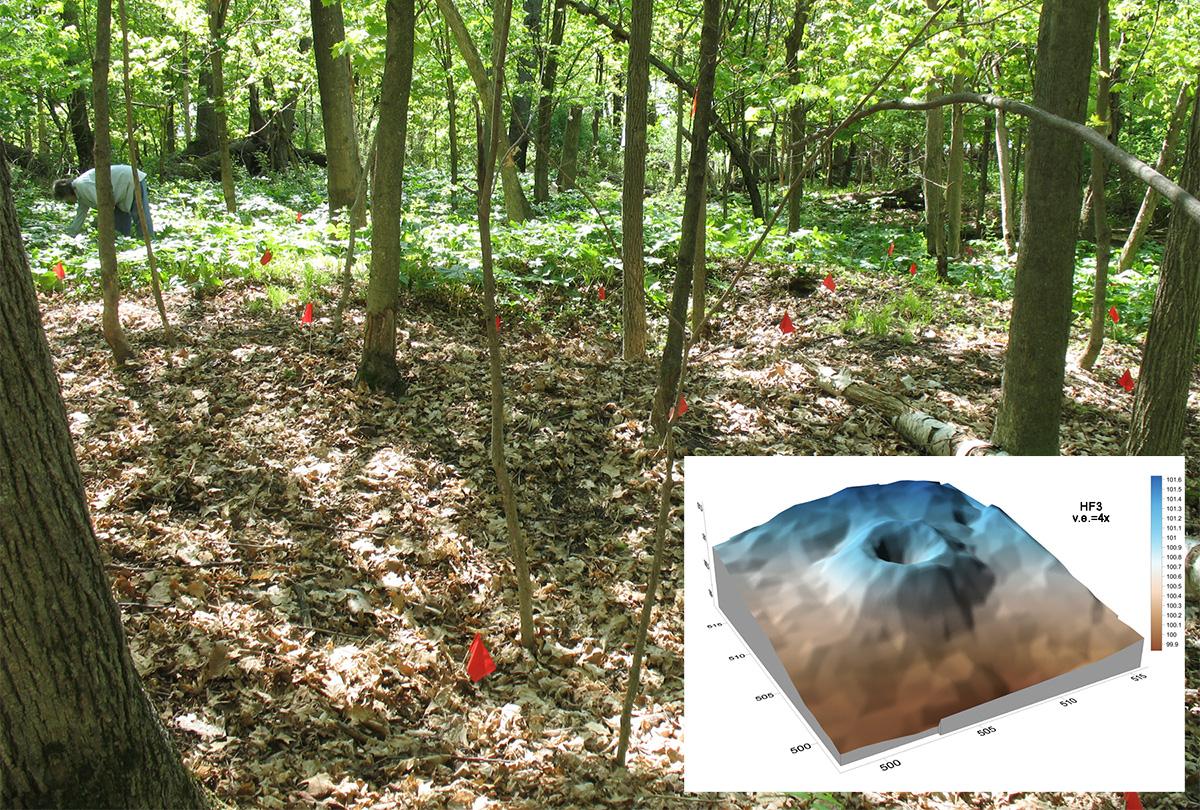
Annular Mounds at Perch Lake
First recorded in the mid-1850s, the unusual mounds at Perch Lake in Jefferson County, New York have long eluded satisfactory archaeological explanation. With funding from the National Science Foundation, we have been exploring some of the geoarchaeological and archaeobotanical aspects of these fascinating features.
The mounds at Perch Lake are annular or ring-shaped features made of earth and stones. Recent walkover survey in the 4 x 10 km area surrounding the Perch Lake basin documents 70 mounds, making this by far the largest mound group in New York. The mounds are small and subtle, but consistently complete circles (or slight ovals). Detailed topographic surveys show that they rarely exceed a meter in height. Outer diameters average about 11 m, and the ring crests defining a central depression have an average diameter of about 5 m. There are no ditches or borrow pits associated with these mounds, and there are no other mound forms in the Perch Lake area.
First reported by Franklin Hough in an 1851 Regents Report, the Perch Lake mounds soon became the subject of much speculation and numerous excavations. They figured prominently during the formation of the Jefferson County Historical Society in 1886, attracting the attention of William M. Beauchamp, one of the pioneers of New York archaeology. In 1901 Beauchamp made several direct field observations at Perch Lake that culminated in his 1905 NYSM monograph, the last comprehensive survey of the mounds prior to the present study. Beauchamp concluded that the annular rings were the remains of ancient lodge sites, but many since have questioned this interpretation.
Over the years numerous explanations for the mounds have been offered by archaeologists. The accompanying diagram organizes these diverse interpretive strains using a schema that helps to illustrate how the Method of Multiple Alternative Hypotheses can be used in a reiterative way to work towards better explanation. P on the left is the overarching phenomenon of the Perch Lake mounds; on the right, proposed explanations are placed into three broad but not necessarily exclusive categories. R signals rejection of the hypothesis on the basis of archaeological evidence.
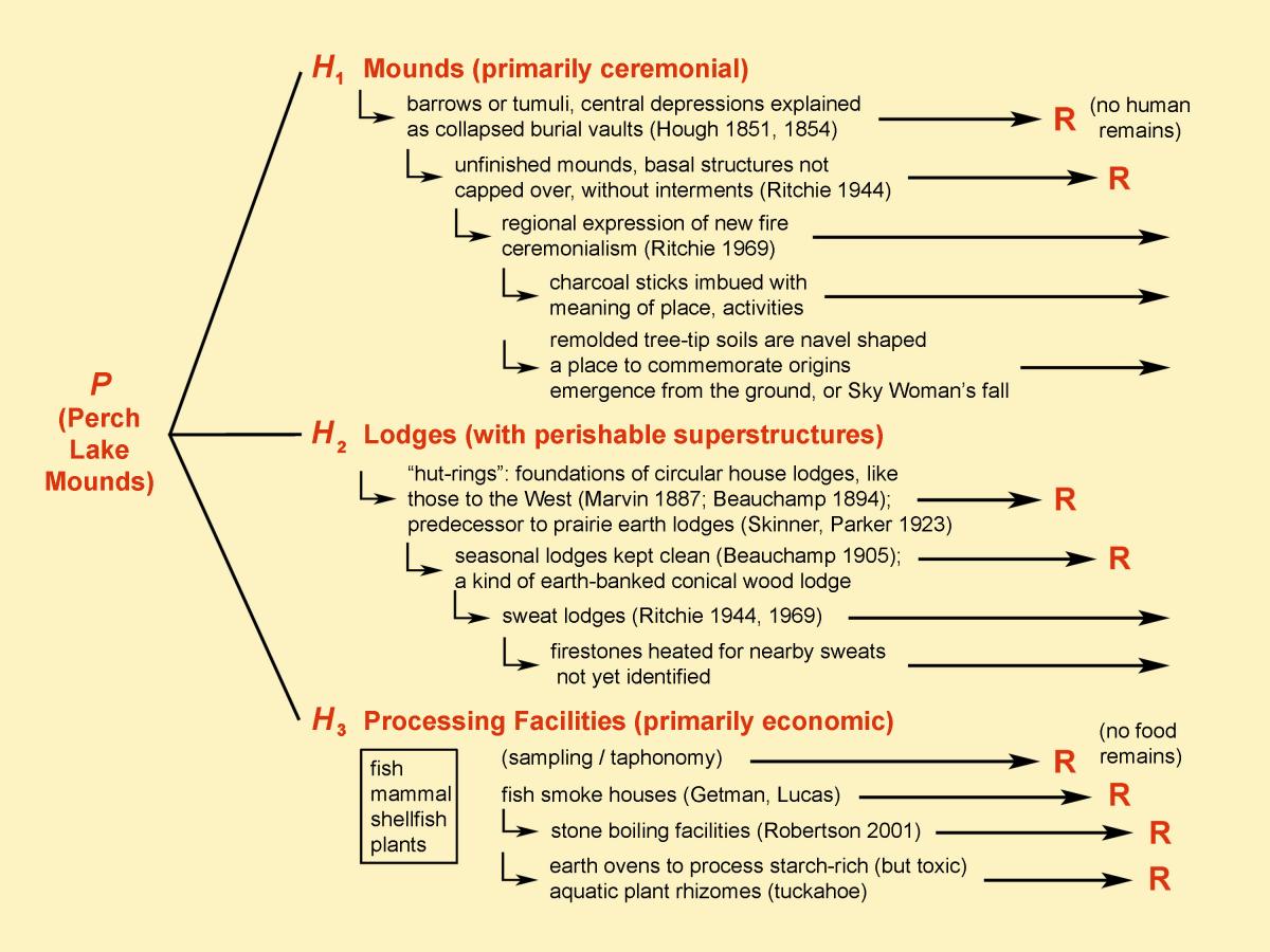
The mounds are not burial mounds or mortuary sites, as no human remains have ever been found in them. They contain much charcoal and burned rock but few other artifacts. They lack plant or animal remains expected if they were food-processing sites or habitation structures. In the present study, we are focused on conducting a field census of the mounds for preservation purposes and on gathering basic descriptive data that better documents some of the morphometric and geophysical attributes of the mounds.
Prior to this study no one had made any real attempt to look for food remains to address the suite of economic hypotheses, or to study in detail the internal structure and history of a mound. To do this, we conducted limited test excavations by working off of reopened historical excavations in two mounds on the rocky High Banks that form eastern shore of Perch Lake. No food remains were found in the newly excavated samples despite a large and intensive archaeobotanical flotation effort in the field and in the laboratory, so we reject the series of economic hypotheses, including our own favored one. This is no small gain, however, as it places exploration and refinement of the other hypotheses on firmer ground.
Stratigraphic studies show that the mounds are planned, carefully-made geometric structures of earth and stone, internally complex but with sharply delineated outer margins. A Perch Lake mound was first a made earthen structure that later became the site of many subsequent burn episodes, in which much charcoal was produced when fires were extinguished under soil or stones. Few intact burn surfaces are preserved, as the soil and stones were subsequently reorganized in an act of mound building that would leave the mound in its very distinctive form. The two tested mounds were found to have been made at the sites of tree-tip, where pit-and-knoll disturbed soils were remolded into the ring-shaped form. Near-surface soil horizons in the area that would become the mound were also used for the earthen fraction of the rings, and their excavation may have served as the initial marking out of the mound space that would be maintained with subsequent use. Sixty seven new high resolution radiocarbon dates place construction and near continuous ritual use of these mounds minimally between 50 BC and AD 1425.
Archaeology Staff Receive University at Albany's President's Award
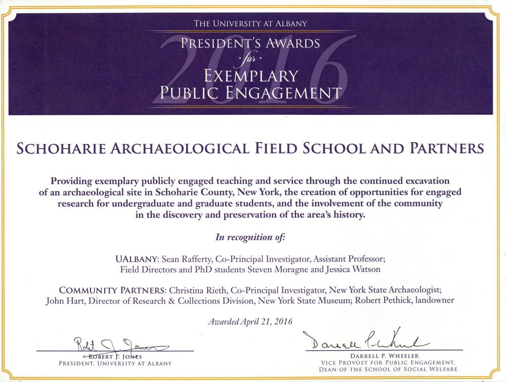
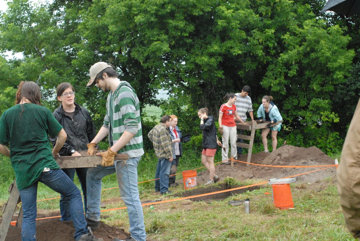
New York State Museum Archaeology staff recently received the University at Albany’s President’s Award for Exemplary Public Engagement in recognition of the joint Museum-University archaeological field school at the Pethick Site in Schohaire County, New York. New York State Archaeologist, Christina Rieth, and John Hart, Director of Research & Collections, along with colleagues from the University at Albany Anthropology Department, were recognized for "providing exemplary publicly engaged teaching and service through the continued excavation of [the Pethick Site], the creation of opportunities for engaged research for undergraduate and graduate students, and the involvement of the community in the discovery and preservation of the area's history." Awardees included Jessica Watson, a University at Albany Ph.D. student who is a NYS Museum Ph.D. fellow and Steve Moragne, a University at Albany Ph.D. student who works for the Museum’s Cultural Resource Survey Program. Both have served as field directors for several years.


The 12-year collaboration has provided UAlbany students first-hand experience with Archaeological fieldwork, site management, and research project development. In turn, the Museum has been able to document and house rare artifacts, laboratory notes and data that will be held in trust for the People of the State of New York for future exhibition and research. Additionally, the field school has also had a focus on public engagement and education through public open-houses and week-long teacher workshops.
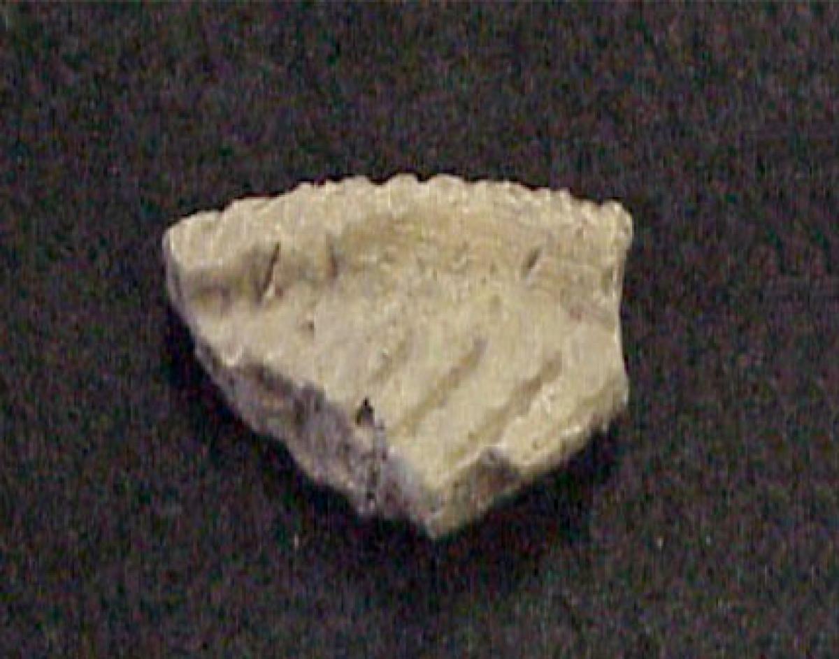
Dating back over 6,000 years, the Pethick Site, has revealed evidence of four major cultural occupations: (1) 4,000-3,000 B.C.; (2) 1000 B.C.-A.D. 300; (3) A.D. 1300-1400; and (4) the mid-19th century. From the original hunter-gatherers who left behind evidence of stone tools to villagers who constructed permanent homes and crafted pottery, smoking pipes and bone awls, the 350,000+ artifacts they left behind serve to document and paint a picture of the unique lives of those who, over the span thousands of years, once called the Pethick site, “home”.
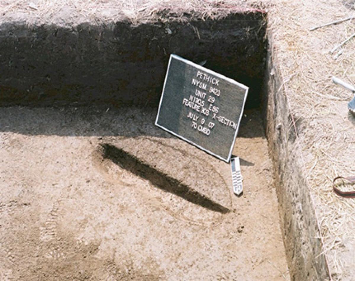
Pethick Site: Archaeological Excavations in Schoharie, NY
The Pethick site is located in the Town of Schoharie, Schoharie County, New York. The site has produced more than 350,000 artifacts associated with four major cultural occupations. The earliest occupation dates between 4,000-3,000 B.C. and consists of the remains of a small camp occupied by hunter-gatherers who used the site during forays into the valley. Artifacts recovered from this occupation include small projectile points, debris from the manufacture of stone tools, food remains (including nutshell, seeds, and white-tailed deer) as well as net weights used to catch fish from the Schoharie Creek.
The second occupation dates between 1000 B.C. and A.D. 300 and has produced evidence of a more lengthy occupation of the site for a season or two. Artifacts recovered from this occupation point to the use of the site as a long term camp with several post molds suggesting one or more temporary structures may have been present. Pottery decorated with cord marked designs, projectile points, and pieces of stone (or steatite) bowls have been recovered. Other stone tools include drills, bifaces, scrapers, and hammerstones. The recovery of non-local stone materials suggests that these groups interacted with other groups in southern and central New York, New England, and other parts of the Mid-Atlantic Region.

The final occupation dates to the mid-19th century and is associated with the occupation of the site by local farmers. Evidence of a small cabin has been identified and offers a view into the lives of farmers at the site. Historic pottery, kaolin smoking pipe fragments, architectural debris, and other farming tools have been recovered.
A number of publications have been produced documenting the excavations at the Pethick site. These include the following:
Rieth, C.B., Rafferty, S., and Saputo, D. 2007. A Trace Element Analysis of Ceramics from the Pethick Site, Schoharie County, New York. North American Archaeologist 28(1):59-80.
Rafferty, S., Wood, C., and Rieth, C.B. 2007. Archaeometric Analysis of Lithic outcrops from Eastern New York. North American Archaeologist 28(2):167-186.
Rafferty, S., Rieth, C.B., and Moragne, S. 2014. Prehistoric Occupations at the Pethick Site, Schoharie County, New York. Archaeology of Eastern North America 42:177-199.
Mussel Surveys in the Upper Hudson River
Of the 315 miles that characterize New York’s Hudson River, only the lower 153 miles, comprising the Estuary has been studied in great detail in regard to mollusc communities. Museum scientists are conducting detailed surveys in the Upper portions of the river to better characterize freshwater mussel and snail communities north of the dam at Troy, NY.
Project Manager
Evaluation of Polychlorinated Biphenyls (PCBs) in Mussels Collected from the Upper Hudson River
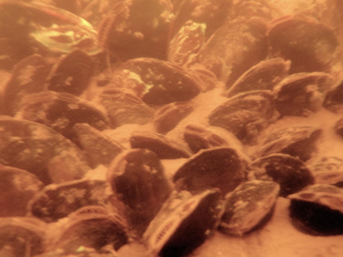
Mussels are stationary organisms that filter particles from the water; chemical concentrations in their tissues can be an indicator of the presence of local contamination. An intensive remediation project that removed over 2.7 million cubic yards of sediment to reduce poly-chlorinated biphenyl (PCB) contamination was completed in the Upper Hudson River (from Fort Edward to Troy, NY) from 2009 through 2015. We plan to analyze PCBs within mussel tissues that we collected from a series of five dam-defined river pools in 2013 and 2015. The uppermost pool serves as a reference site, upstream of PCB contamination, and is followed by four pools from the source of original contamination (Fort Edward) and progressing downstream. Future mussel collections and monitoring efforts will allow us to monitor and assess long-term trends in the mussel community and in PCB levels that may be present in mussel tissues post-remediation. Since PCBs are known to bioaccumulate in organisms, particularly in lipids, and mussels are at the bottom tier of the food chain, this study has broader implications in monitoring environmental health following large-scale remediation projects.
This image depicts a parade celebrating the passage of the 15th Amendment surrounded by portraits and vignettes of African Americans excising their newly won liberties—land ownership, education, political involvement, religious freedom, employment, and military participation.
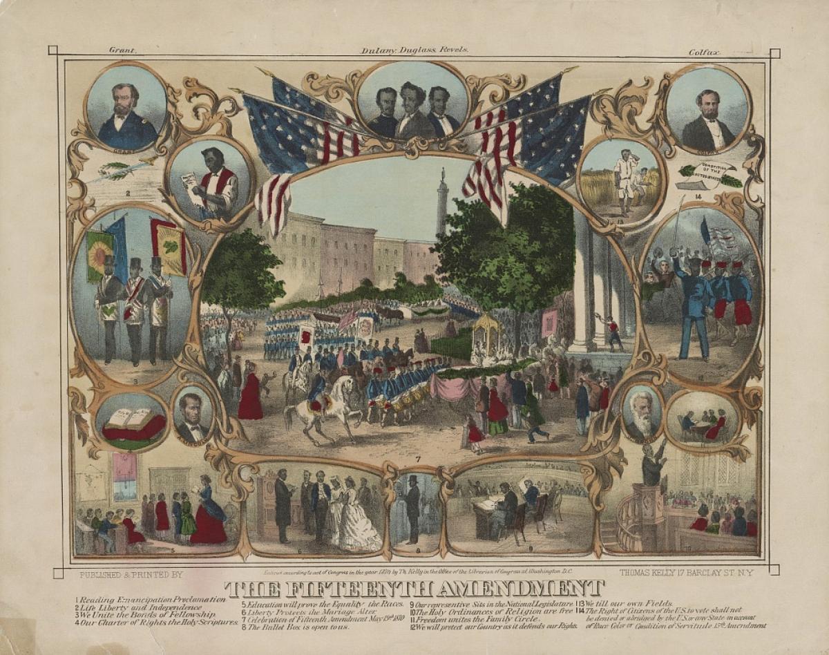
Engaging Question: What did the artist think the ratification of the 15th Amendment would provide for African Americans?
Using the graphic organizer "Broadside Analysis" created by the New York State Archives have students predict what they think the Broadside is saying and then go through and analyze each part of the image using the prompts to help answer the question “What did the artist think the ratification of the 15th Amendment would provide for African Americans?”
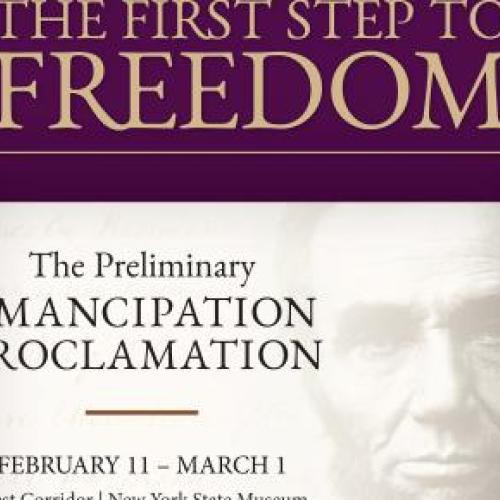
Be sure to visit the NYSM from February 11 to March 1, 2020, to view an original draft of the Preliminary Emancipation Proclamation written in Lincoln’s own hand.
Activity 1
This image depicts, at center, a parade celebrating the passage of the 15th Amendment surrounded by portraits and vignettes of African Americans exercising their newly won liberties—land ownership, education, political involvement, religious freedom, employment, and military participation.
(Click on image below to view full screen.)
Engaging Question: What did the artist think the ratification of the 15th Amendment would provide for African Americans?
Using Broadside Analysis, the graphic organizer created by the New York State Archives, have students predict what they think the broadside is saying and then go through and analyze each part of the image using the prompts to help answer the question, “What did the artist think the ratification of the 15th Amendment would provide for African Americans?”
[[{"fid":"4900","view_mode":"default","fields":{"format":"default","field_title[und][0][value]":"Graphic Organizer: Broadsides"},"type":"media","field_deltas":{"1":{"format":"default","field_title[und][0][value]":"Graphic Organizer: Broadsides"}},"link_text":"graphic-organizers-broadsides.pdf","attributes":{"class":"media-element file-default","data-delta":"1"}}]]
Graphic Organizer: Broadsides (78.56 KB)

Be sure to visit the NYSM from February 11 to March 1, 2020, to view an original draft of the Preliminary Emancipation Proclamation written in Lincoln’s own hand.
Activity 2
These two engravings compare former Confederates applying for pardons, which would re-instate their rights to vote and hold public office, and a wounded African American Union soldier who lost his leg during combat and does not have the right to vote.
(Click on image below to view full screen.)
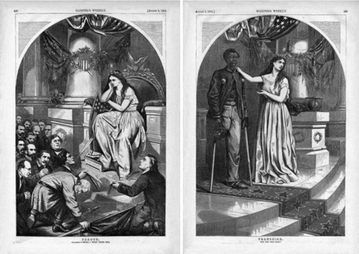
Engaging Question: After the American Civil War, could African Americans vote?
Using Political Cartoon Analysis, the graphic organizer created by the New York State Archives, have students describe what they think the engravings are meant to convey and then analyze both images, using the prompts to help answer the question, “After the American Civil War, could African Americans vote?”
[[{"fid":"4902","view_mode":"default","fields":{"format":"default","field_title[und][0][value]":"Graphic Organizer: Political Cartoon Analysis"},"type":"media","field_deltas":{"1":{"format":"default","field_title[und][0][value]":"Graphic Organizer: Political Cartoon Analysis"}},"link_text":"graphic-organizers-politicalanalysis.pdf","attributes":{"class":"media-element file-default","data-delta":"1"}}]]

Be sure to visit the NYSM from February 11 to March 1, 2020, to view an original draft of the Preliminary Emancipation Proclamation written in Lincoln’s own hand.
Activity 3
This cartoon reflects the political situation in the South after Reconstruction. While Radical Republicans wanted to expand liberties for newly freed African Americans, Democrats and former Confederates wanted to limit these rights. By the 1870s overall public opinion began to turn against Republican policies in the South. Northerners, many of who never had a commitment to racial equality, grew tired of the endless turmoil of Southern politics. By 1876 the Democratic Party, strongly Southern and made up of many ex-Confederates, had a majority in the House of Representatives. Most of these officials wanted to eliminate the racial progress achieved during Reconstruction. Even the Supreme Court narrowed the scope of the 14th and 15th Amendments. In 1877 Pres. Rutherford B. Hayes withdrew the last of the federal troops from the South, and Reconstruction was officially over. But state and local policies known as Jim Crow Laws began, legalizing discrimination against African Americans in all facets of public life. Jim Crow Laws, upheld primarily in the South but also present in the North, were enforced for nearly a century.
(Click on image below to view full screen.)
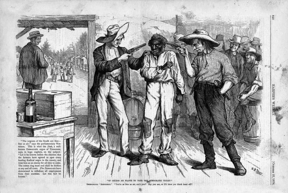
Engaging Question: Did the 15th Amendment give all African American men the ability to vote?
Using Political Cartoon Analysis, the graphic organizer created by the New York State Archives, have students describe what they think the political cartoon is saying and then analyze the image using the prompts to help answer the question, “Did the 15th Amendment give all African American men the ability to vote?”

Be sure to visit the NYSM from February 11 to March 1, 2020, to view an original draft of the Preliminary Emancipation Proclamation written in Lincoln’s own hand.
Activity 4
On February 3, 1870, the 15th Amendment to the U.S. Constitution was ratified, granting African American men the right to vote. Despite this Constitutional victory, many states maintained strict voter-eligibility laws, including literacy tests and poll taxes. In reality, African American men and women would not freely exercise their right to vote until Voting Rights Act of 1965.
(Click on image below to view full screen.)
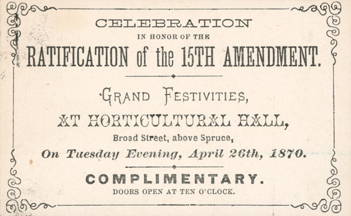
Engaging Question: What information can an object provide about the people, events, or time period in which it was made?
Using Artifact Analysis, the graphic organizer created by the New York State Archives, have students document the physical qualities and original purpose of the ticket. Students will then analyze the object to answer the question, “What information can an object provide about the people, events, or time period when it was made?"
Mission:
The New York State COVID-19 Documentation Initiative is a committee made up of staff members from the State Archives, Library and Museum, as well as the Office of Cultural Education (OCE) Preservation Officer, who will be coordinating the documentation of the state’s response to the COVID-19 pandemic. The Initiative will focus on the following areas in conducting its work:
To contact the New York State Documentation Initiative please email: ocecovid@nysed.gov
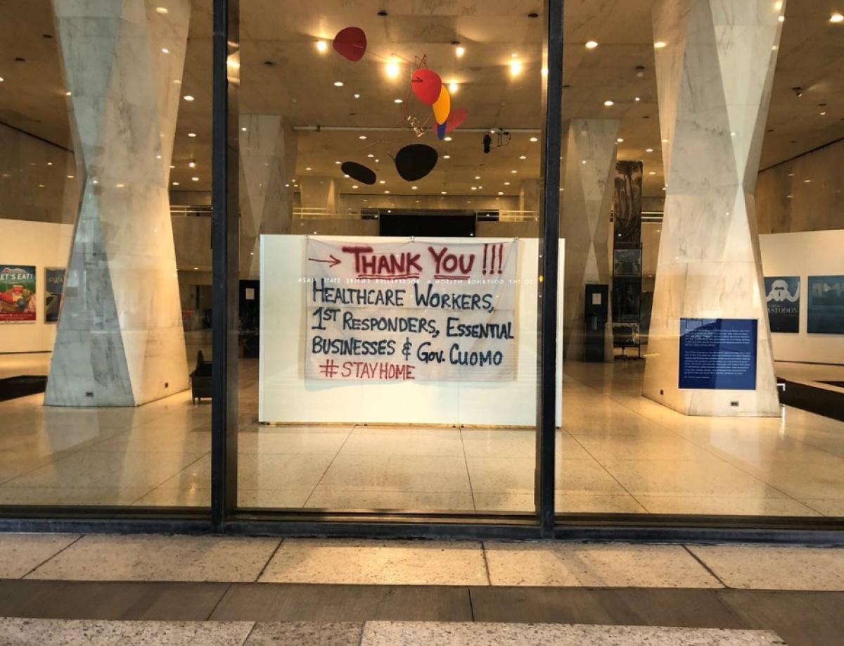
This banner, which hung at 9 Madison Place in Albany, New York, went up on March 22, 2020—the first day “New York on Pause” went into effect. Meagan Fitzgerald created the banner because, “I was overwhelmed with gratefulness for all of those working on the front lines and with the Governor for keeping a sense of calm during a highly anxious period.”
New York State Archives
Recognizing the unprecedented nature of the COVID-19 pandemic, staff at the New York State Archives are working to ensure that the statewide response to the crisis is comprehensively documented and preserved. The State Archives continues to provide guidance to local governments and state agencies and is developing a list of records that may document the pandemic response for state agencies and local governments to retain. We are also developing practical guidance for governments providing access to public records. In addition, we are providing support to non-governmental repositories. To help these institutions navigate this period of uncertainty, the Documentary Heritage and Preservation Services for New York COVID –19 Information Aggregate provides access to newly developed on-demand learning opportunities, information on funding for cultural institutions, and the latest updates from local, state, federal, and international leaders in the field.
We are available to support all activities of all repositories in New York as they respond to the challenges we face. If you have questions, concerns or would like to share information about how your institution is responding to the pandemic please contact us at: recmgmt@nysed.gov or dhs@nysed.gov
New York State Library
In response to the global pandemic, New York State Library's Manuscripts and Special Collections unit (MSC) has launched the COVID-19 Personal History Initiative. In the first phase of this project, MSC is promoting a journal or diary writing campaign by encouraging all New Yorkers to record their experiences during this scary and challenging period of time. Future phases of the project will include seeking online submissions of media related to how New Yorkers are experiencing the pandemic and an oral history component.
In addition, the State Library is collecting materials with a particular focus on how libraries across the state are responding to the COVID-19 pandemic. A component of our effort focuses on collecting stories, internet resources, videos, and news releases highlighting innovative services and delivery programs that continue to engage patrons during closures. For more information, contact P.J. Nastasi at: peter.nastasi@nysed.gov
New York State Museum
The COVID-19 pandemic has affected all aspects of daily life in every part of New York State. The State Museum is working to document and collect materials related to the pandemic and its effects on state and local government, institutions, and everyday individuals, with special focus given to communities whose histories are traditionally underrepresented. We are looking to collect objects, stories, and photographs to help document this pandemic.
This banner, which hung at 9 Madison Place in Albany, New York, went up on March 22, 2020—the first day “New York on Pause” went into effect. Meagan Fitzgerald created the banner because, “I was overwhelmed with gratefulness for all of those working on the front lines and with the Governor for keeping a sense of calm during a highly anxious period.”
If you have a COVID-19 related artifact or image that you would like to donate to the New York State Museum, please contact Dr. Jennifer Lemak, Chief Curator of History, at jennifer.lemak@nysed.gov
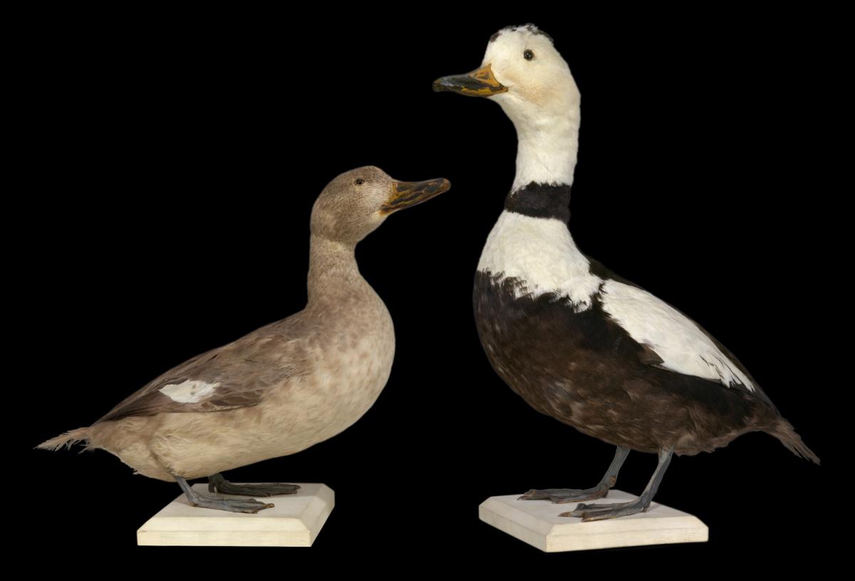
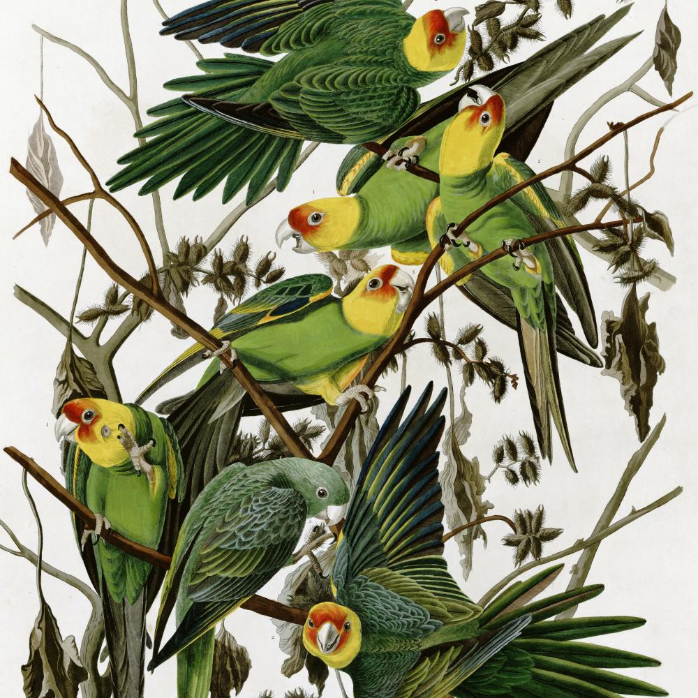
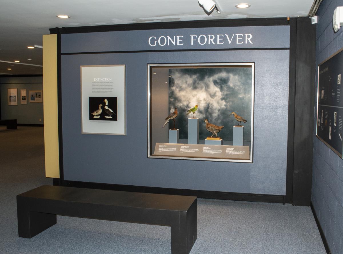
Extinction
For some species, the conservation laws that protect wild bird populations came too late. Habitat loss and overhunting for food or feathers resulted in the extinction of these birds that were once native to New York. Their loss reminds us that humans are capable of exterminating even widespread and abundant species.
The New York State Museum ornithology collection includes specimens of several North American species and subspecies that have become extinct in the last 150 years.
Recovery
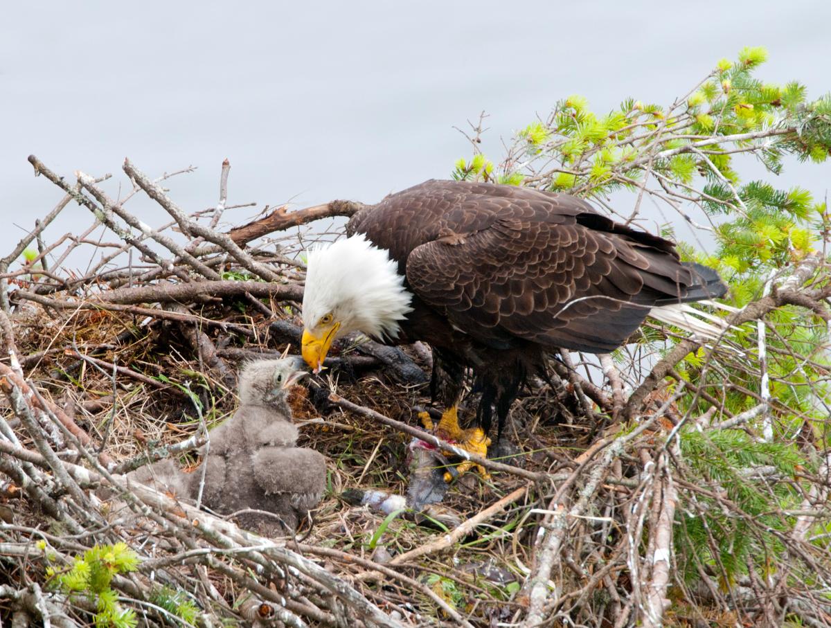
Widespread agricultural use of the pesticide DDT in the mid-20th century caused raptors and fish-eating species at the top of the food chain to produce eggs with very thin eggshells that broke when the parents tried to incubate them. The banning of DDT in 1972, along with first-of-their-kind restoration efforts by the New York State Department of Environmental Conservation and the Cornell Lab of Ornithology in the 1970s and 1980s, enabled these species to make a comeback from the brink of extinction.
Timeline: Extinction Events & Conservation Efforts
1791
In one of the first efforts to save a species from extinction, a bill entitled “An Act for the preservation of heath-hen and other game” is introduced in the New York State Legislature.
Mid-19th Century
- Carolina Parakeets are gone from New York.
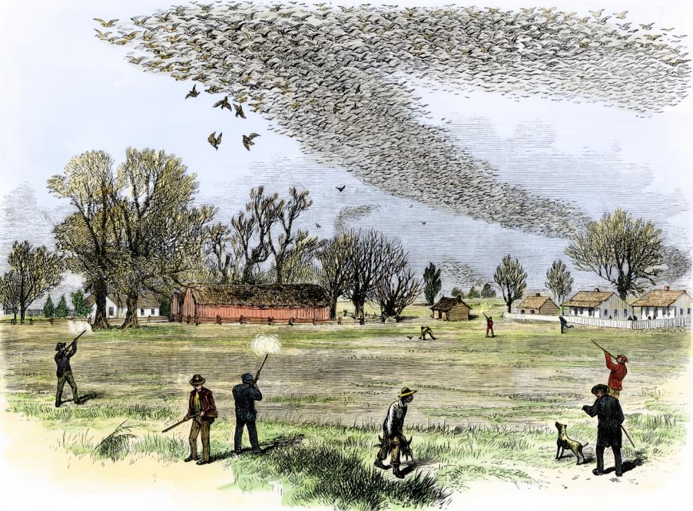
- Commercial market for Passenger Pigeons booms; adults and squabs harvested by the millions.
1878
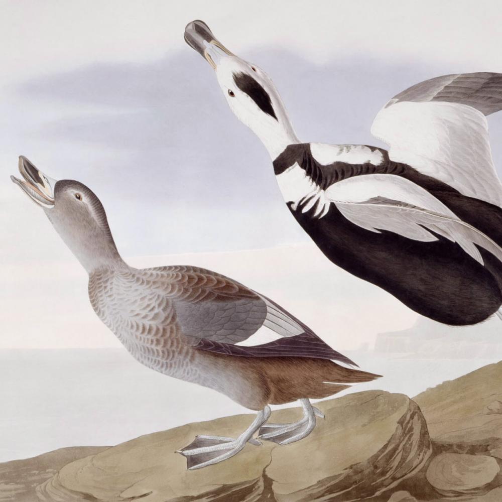
Last known sighting of Labrador Duck occurs, in Elmira, New York.
1890s
Unregulated hunting for feathers to supply the Victorian fashion industry causes widespread declines of wild bird populations.
1900
Last remaining wild Passenger Pigeon is shot in Ohio.
1903

President Theodore Roosevelt issues executive order establishing Pelican Island National Wildlife Refuge in Florida as the first federal migratory bird refuge.
1905
The National Audubon Society is incorporated.
1914
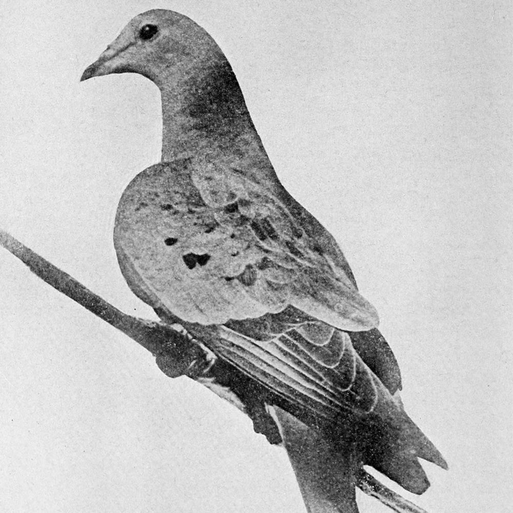
“Martha,” the last Passenger Pigeon, dies in captivity at the Cincinnati Zoo.
1918
Migratory Bird Treaty Act passes, protecting all non-game bird species in the United States.
1921
Carolina Parakeet becomes extinct.
1932
- Nearly 100 years after it disappeared from New York, the Heath Hen goes extinct when “Booming Ben,” the last of his species, dies on Martha’s Vineyard.
- The last Eskimo Curlew is seen in New York.
1940s-50s

Widespread use of DDT causes eggshell thinning in raptors and fish-eating birds. Populations of Bald Eagle, Peregrine Falcon, and Osprey plummet across the country, and these species become rare in New York.
1961
Peregrine Falcons no longer breed in New York.
1962

- Bald and Golden Eagle Protection Act is passed.
- Rachel Carson’s Silent Spring is published, highlighting the decline of wild bird populations and the overuse of pesticides.
1963
The last confirmed sighting of an Eskimo Curlew occurs in Barbados.
1967-1968
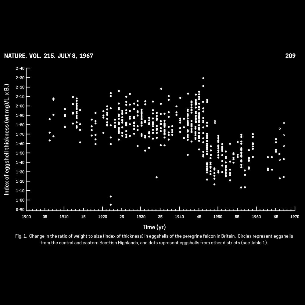
Scientists studying egg specimens from NYSM and other museums link DDT and eggshell thinning in raptors.
1970

New York State Department of Environmental Conservation is formed.
1971
New York State bans the agricultural pesticide DDT.
1972
The federal government passes the Clean Water Act and bans DDT in all states.
1973
- Passage of the federal Endangered Species Act.
- Tom Cade (Cornell Lab of Ornithology) initiates the Peregrine Falcon Restoration Program.
1975
Scientists release 16 captive-bred Peregrine Falcons at sites across the eastern U.S. Six survive the year and return to their release sites to breed.
1976
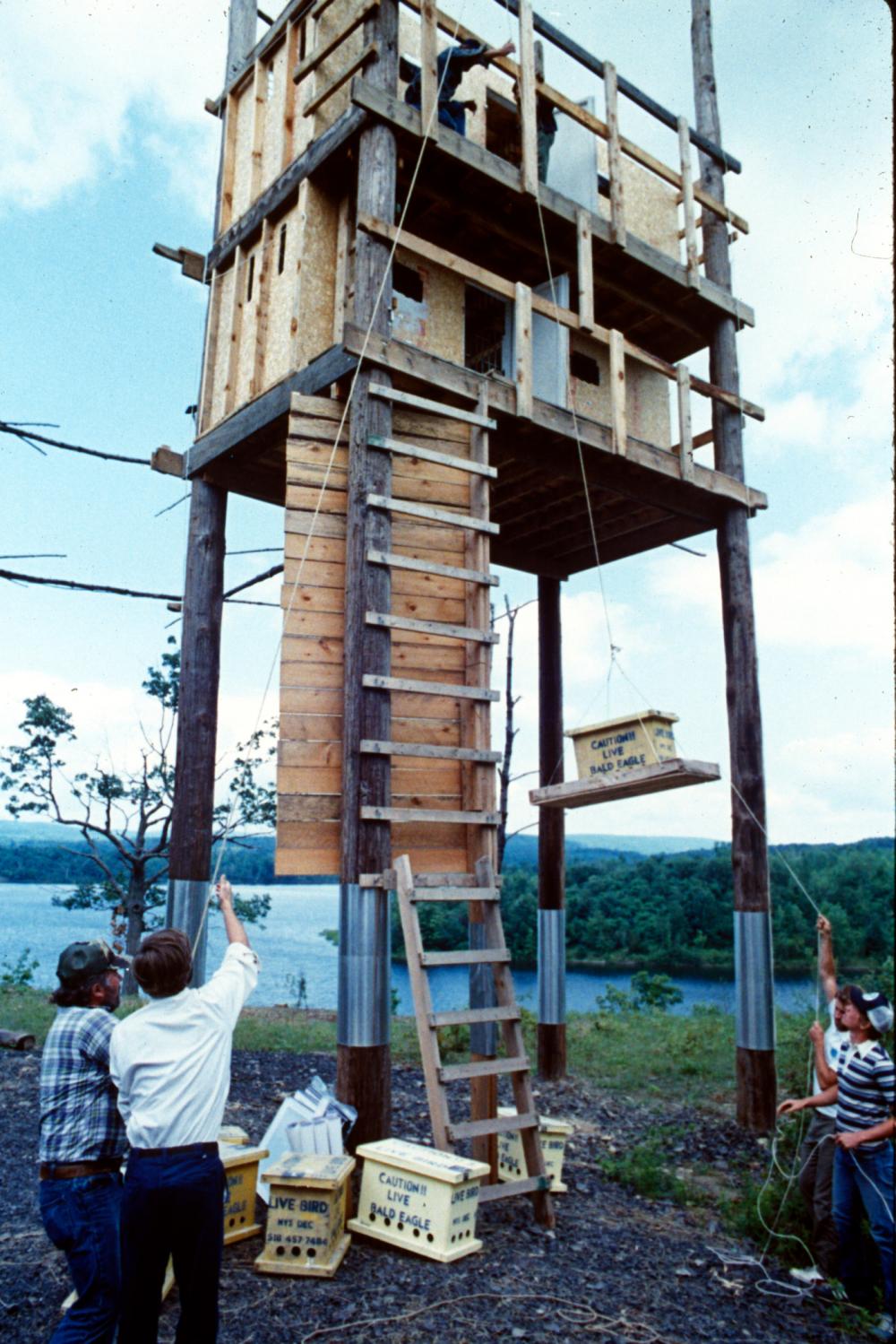
Only one pair of Bald Eagles remains in New York State. Peter Nye and Mike Allen (NYSDEC) launch the Bald Eagle Restoration Program.
1983
Peregrine Falcons nest in New York State for the first time in more than 20 years, on two bridges near New York City.
1985
Peregrine Falcons return to breeding sites in the Adirondacks.
1999
Peregrine Falcon removed from the U.S. Endangered Species list.
2007
Bald Eagles removed from the U.S. Endangered Species list.
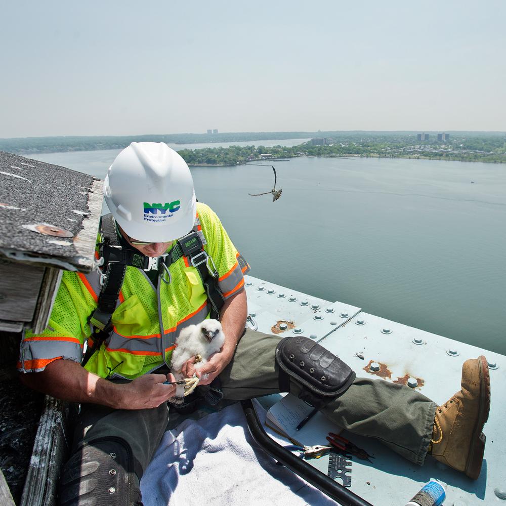
2019
Populations of Bald Eagle, Peregrine Falcon, and Osprey continue to grow. These species, once rare or extirpated from New York, breed throughout the state.
")
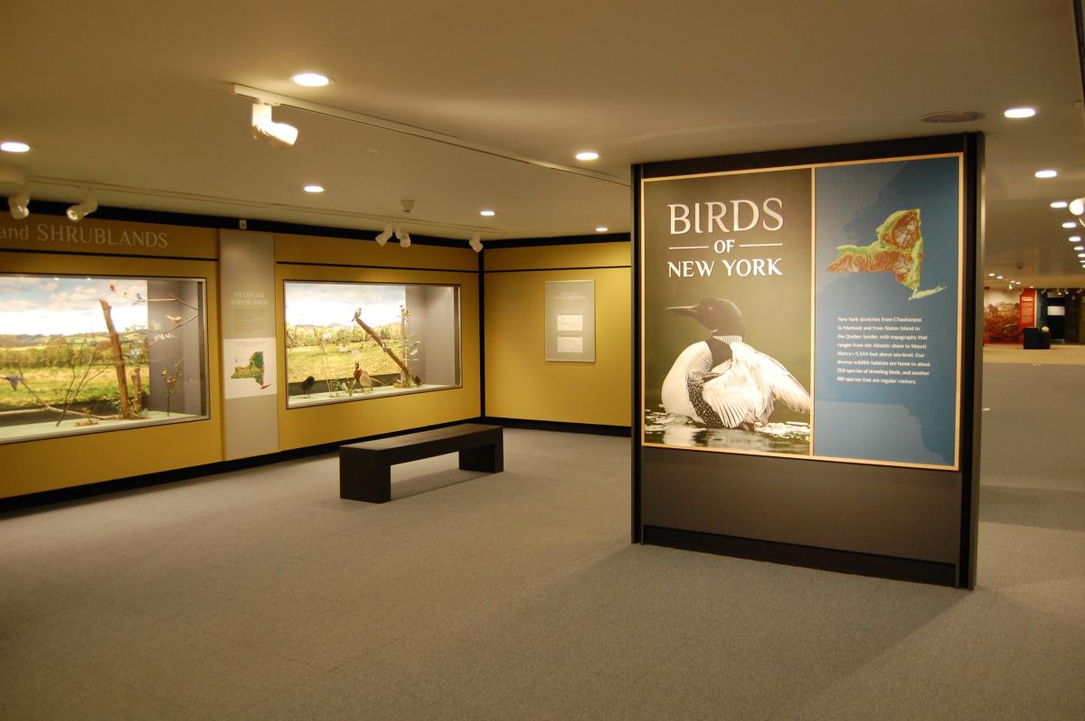
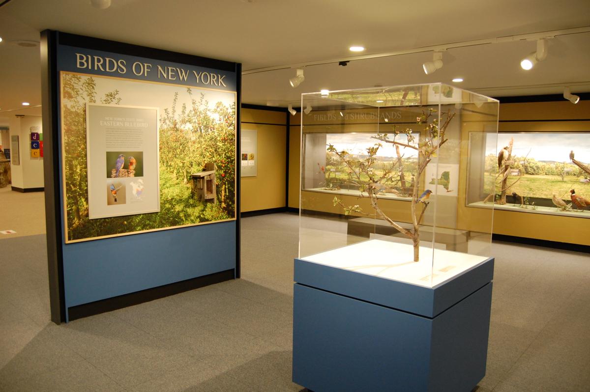
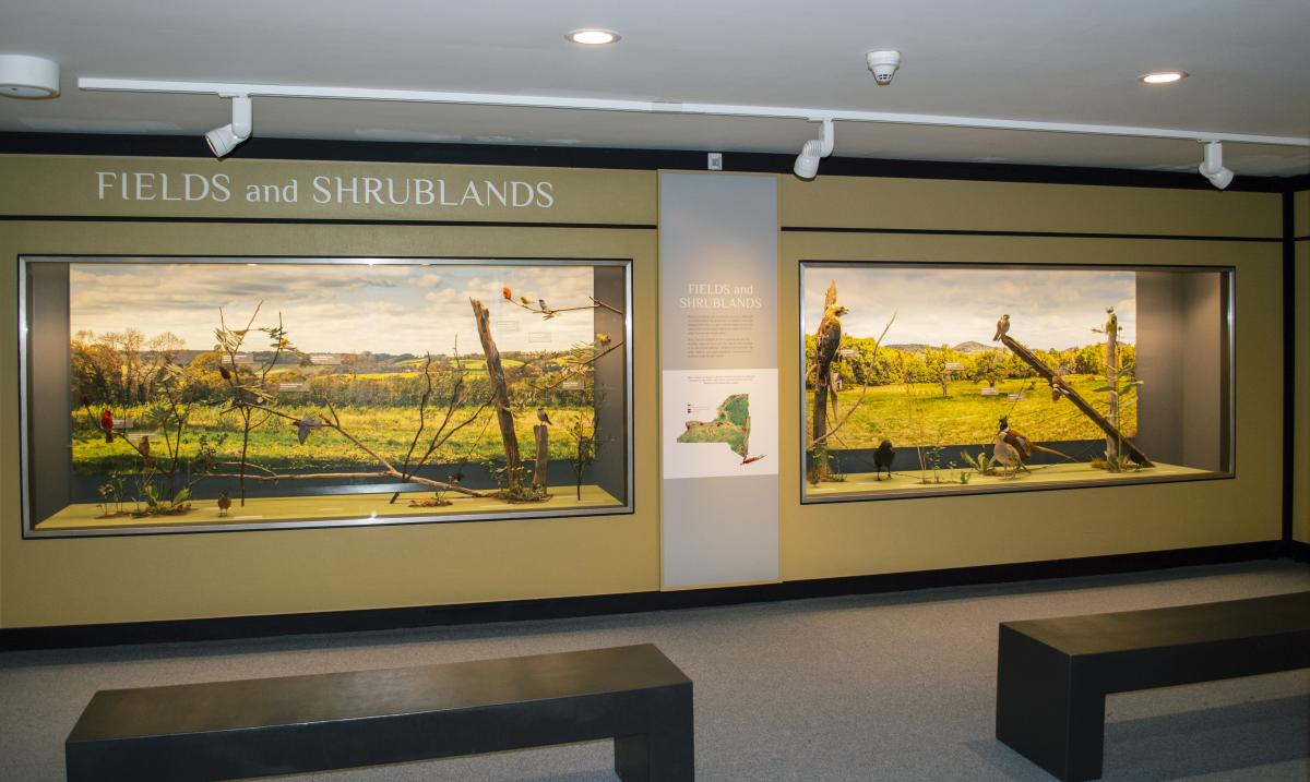
Fields and Shrublands
Natural grasslands and shrublands are rare in New York. As people altered the landscape to establish farms and villages, birds that use open habitats began to flourish. Today these birds largely depend on agricultural and other human-maintained areas.
Birds that are adapted to live in grasslands and the shrubby edges of forests are the species most familiar to us. Farms and suburban neighborhoods provide the fields, thickets, and open woodlands favored by many nesting songbirds and raptors.
")


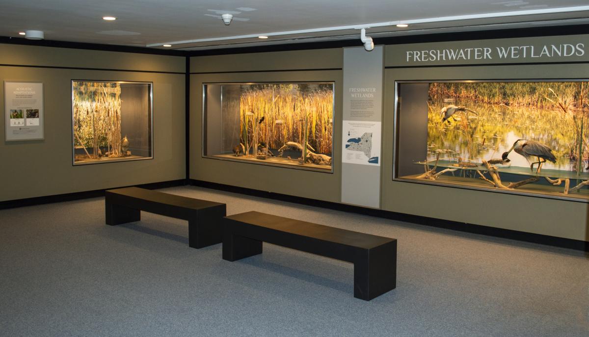
Tidal Bays and Marshes
Saltwater wetlands are very productive habitats for birds. They act as nesting sites for dozens of species of breeding birds, and are important staging areas for migrating landbirds. In winter, huge flocks of waterfowl that breed in the arctic call New York’s tidal bays and marshes home. Tidal bays and marshes are among our most vulnerable wildlife habitats, because they occur in the most densely populated parts of the state.
, right, and Double-Crested Cormorant (Phalacrocorax auritus), left")

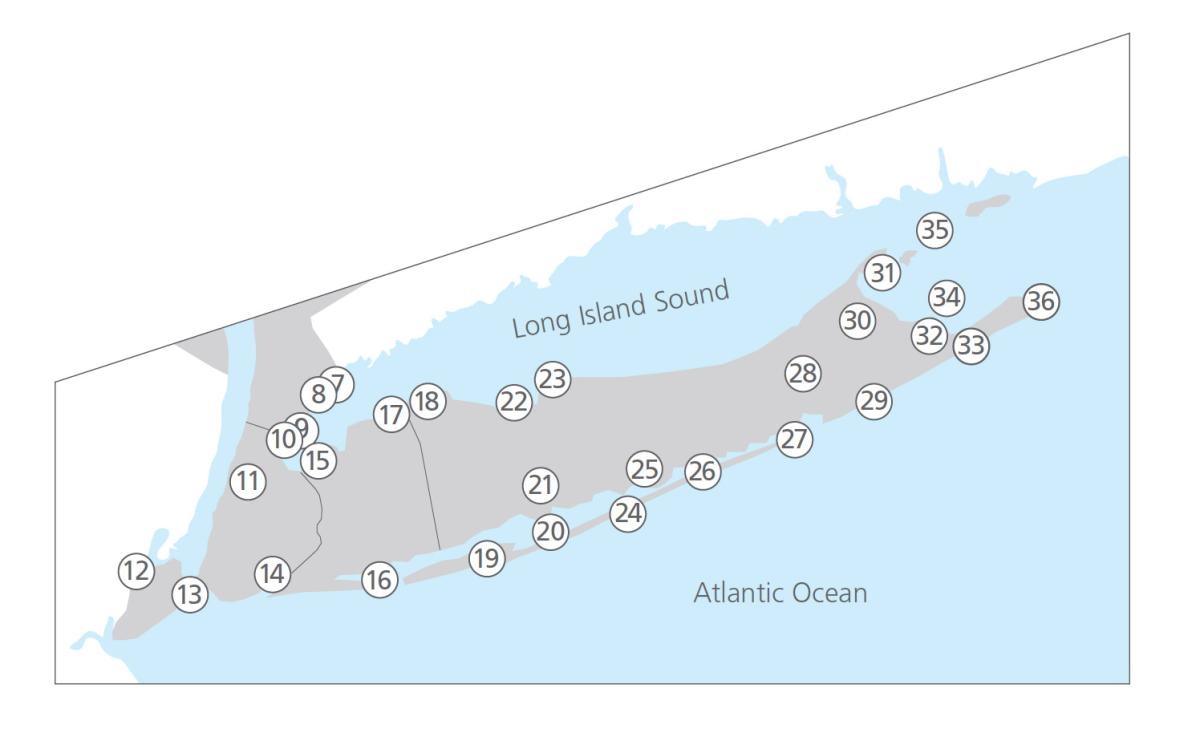
Thirty-six of Audubon New York’s Important Bird Areas are found in tidal bays, marshes and estuaries.
The Hudson River Estuary is a mix of fresh and salty waters. It experiences daily tides all the way to the first barrier on the river channel—the Federal Dam at Troy, some 154 miles upriver from New York City.
- Schodack Island State Park
- Stockport Flats
- Tivoli Bays
- Constitution Marsh Sanctuary
- Doodletown and Iona Island
- Lower Hudson River
Tidal bays and saltwater marshes are found along New York’s Atlantic coast and Long Island Sound.
| 7. Edith G. Read Wildlife Sanctuary 8. Marshlands Conservancy 9. Huckleberry Island 10. Pelham Bay Park 11. North Brother/South Brother Islands 12. Harbor Herons Complex 13. Hoffman and Swinburne Island Complex 14. Jamaica Bay Complex 15. Little Neck Bay to Hempstead Harbor 16. West Hempstead Bay/Jones Beach West 17. Oyster Bay Area 18. Huntington and Northport Bays 19. Captree Island Vicinity 20. Great South Bay 21. Connetquot Estuary 22. Nissequogue River Watershed/Smithtown Bay | 23. Crane Neck to Misery Point 24. Fire Island 25. Carmen’s River Estuary 26. Moriches Bay 27. Shinnecock Bay 28. Peconic Bays and Flanders Bay 29. Mecox Sagaponack Coastal Dunes 30. Northwest Harbor/Shelter Island Complex 31. Orient Point/Plum Island 32. Accabonac Harbor 33. Napeague Harbor and Beach 34. Gardiner’s Island 35. Great Gull Island 36. Montauk Point |
")
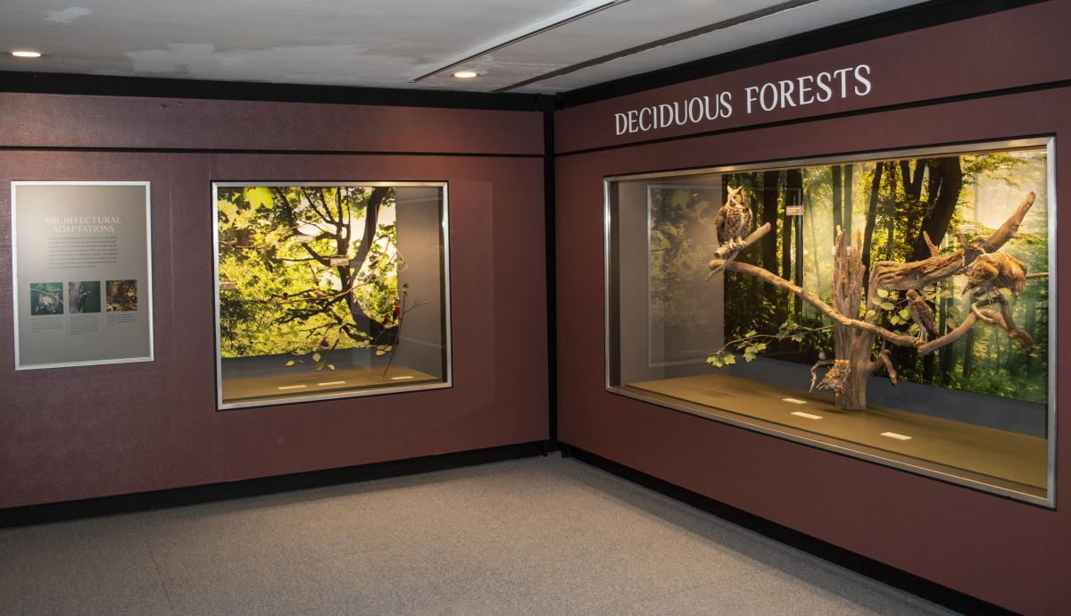
Deciduous Forests
Deciduous forests are New York’s most widespread habitat, covering about 45 percent of the land. Allegheny oak forests, maple and birch northern hardwoods, and coastal beech forests are all dominated by broad-leaved trees that shed and regrow their foliage annually, but each has its own distinctive community of resident and migratory bird species.
Almost all of New York’s cultivated land and pastures (covering another 22 percent of the state), was deciduous forest before it was cleared for agricultural use. Extensive reforestation of abandoned farmland and the establishment of forest preserves and managed “working forests” has increased the amount of forested land in New York since the 19th century.
 and female (right) Baltimore Oriole (Icterus galbula)")
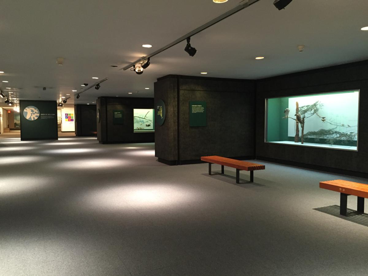
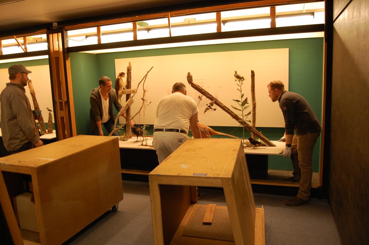
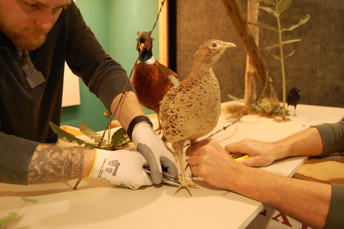
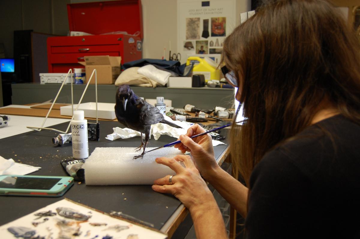
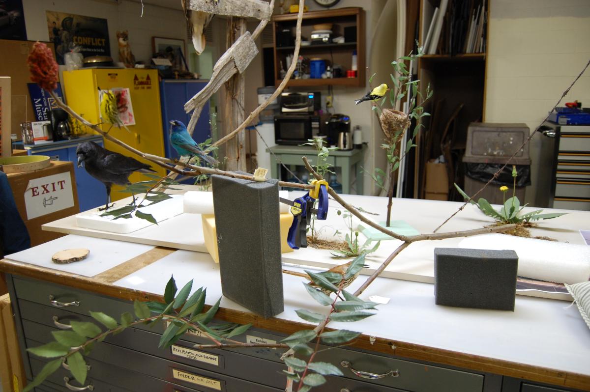
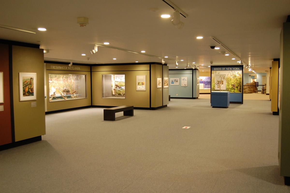
Welcome to the Newly Renovated "Birds of New York"
From Chautauqua to Montauk and from the Atlantic shore to the peak of Mount Marcy, New York’s diverse wildlife habitats are home to 250 species of breeding birds, and another 100 species that are regular visitors. Birds of New York offers visitors a close-up view of 140 taxidermy bird specimens displayed in dioramas that highlight the major wildlife habitats found in the state of New York.
The restored habitat dioramas feature 27 new taxidermy mounts and are completely reinterpreted with new maps, descriptions of amazing bird adaptations, and recordings of bird song. A new section of the exhibit tells the story of bird species that we have lost forever to extinction. Here you can see specimens of the Passenger Pigeon, Carolina Parakeet, Heath Hen, and Eskimo Curlew from our research collection, on display for the first time. You can also learn how heroic efforts by scientists and conservationists saved the Bald Eagle, Osprey, and Peregrine Falcon, bringing these species back from the brink of extinction.

Virtual Tour
Join NYSM Curator of Ornithology, Dr. Jeremy Kirchman, in our Birds of New York exhibit hall for a guided tour of the newly renovated dioramas depicting the major bird habitats of New York State.
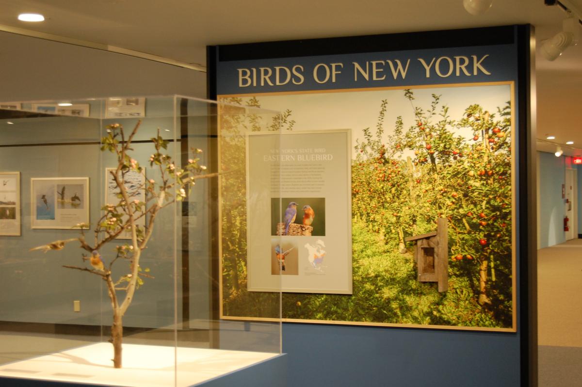
New York's State Bird: Eastern Bluebird
Eastern Bluebirds (Sialia sialis) are small thrushes that nest in tree cavities in open habitats such as meadows, fields, and forest openings. Competition from non-native European Starlings and House Sparrows, which also nest in cavities, led to a steep decline in the bluebird population. Conservationists responded in the 1970s, forming the North American Bluebird Society, which led an effort to erect wooden nest boxes. Today, Eastern Bluebirds are commonly seen in pastures, agricultural fields, and suburban parks, where they nest in boxes provided by concerned citizens and conservation organizations.
: male, left, and female, right")

Gallery Renovation of Birds of New York
The gallery renovation project, completed in 2020, ushered Birds of New York into a new era, with upgraded lighting, realistic backgrounds, and taxidermy bird mounts that have been cleaned or replaced. See how the entire hall has been completely re-interpreted with new maps, photos, and updated information about bird ecology and evolution and conservation
Original Gallery (1976-2014)

Gallery Renovation Process (2015-2020)
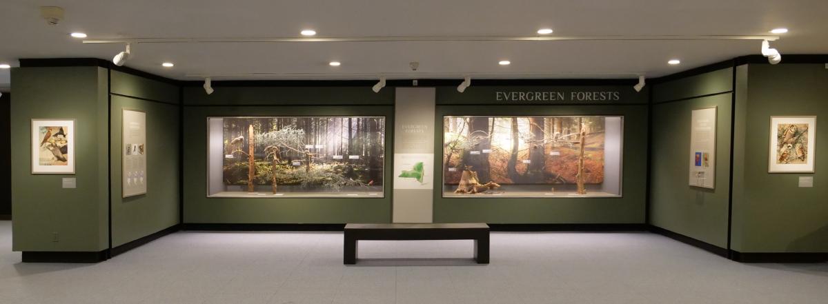
Evergreen Forests
New York’s evergreen forests are dominated by cone-bearing trees such as spruce, balsam fir, hemlock, tamarack, and white pine. These cold, wet habitats are found in New York at high elevations: the Adirondack Mountains, Tug Hill Plateau, Taconic Highlands, Appalachian Plateau, and the Catskill Peaks.
Several bird species that live in evergreen forests breed in New York only in the Adirondacks and Catskills above 3,000 feet elevation. Since 1894 the public land in these forest preserves has been protected by the New York State Constitution, which declares that they “shall be forever kept as wild forest lands.”
")
What is a Boreal Forest?
After a few thousand years, the tundra slowly turned to boreal forest, or taiga. The climate warmed slightly, and confiers grew into rich forests. Spruce, larch, and fir trees are the dominant plants in this forest, although smaller herbaceous plants, mosses, and grasses can be found. Lakes and other smaller water bodies are also abundant in the boreal forest. Today, boreal forest is the largest biome in the world. These forests make up 29% of all forest cover. Boreal forests are still found in the Adirondack Mountains.
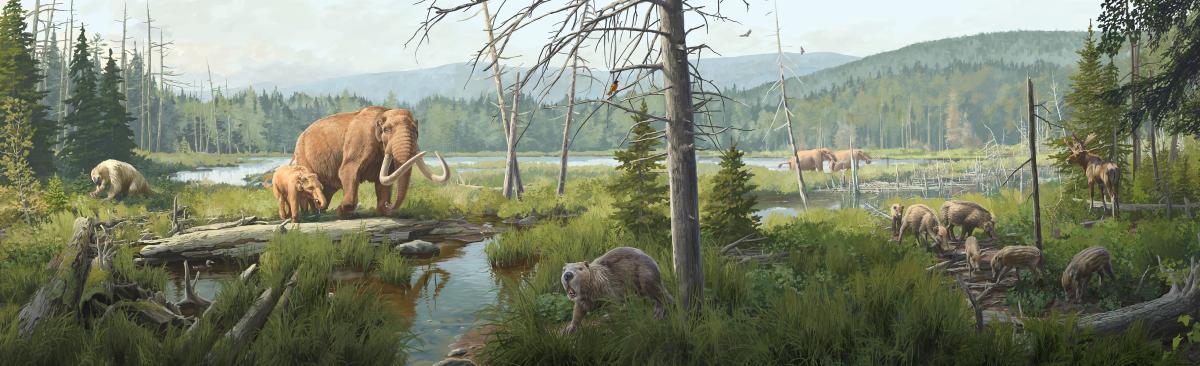
Animals of the Boreal Forest
Fossils of boreal mammal species are the most abundant in the Ice Age collections of the State Museum. American mastodon fossils are found in sites across the state as well as species like giant ground sloth, peccary, stag-moose, giant beaver, and even California condor. These fossils show that the boreal forest was very diverse.
Giant Beaver
Castoroides ohioensis
One of the largest rodents that ever lived, this extinct beaver grew to 8 feet (2.4 m) long and weighed as much as 275 pounds (125 kg)—about the size of a modern black bear. Like modern beavers, this extinct beaver had long incisor teeth. But they were not sharp and could not have cut down trees.

 and Modern Beaver Skull (left)")
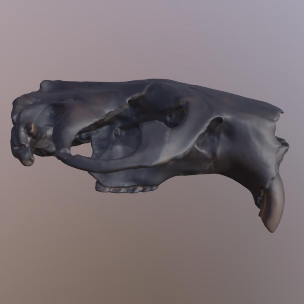
VIEW 3D SCAN
Giant Beaver Skull
https://sketchfab.com/3d-models/giant-beaver-skull-vcu-3d-3639-9abbbda9edb4458fa39e71a437602ebe
Flat-headed Peccary
Platygonus compressus
A distant relative of pigs, this extinct peccary grew up to 3 feet (0.91 m) long. With long legs, it was probably a fast runner. Today, three species of peccaries live in the southwestern United States and tropical America. This peccary’s canine teeth point straight up and down. In pigs, the canines are at an angle.

")

VIEW 3D SCAN
Peccary Skull
https://sketchfab.com/3d-models/extinct-peccary-skull-vcu-3d-3628-ee8ba23602ae48aba372693944b53221
Jefferson’s Ground Sloth
Megalonyx jeffersonii
Unlike modern sloths, this extinct sloth lived mainly on the ground. It reached high into trees to eat twigs and branches.

")
")

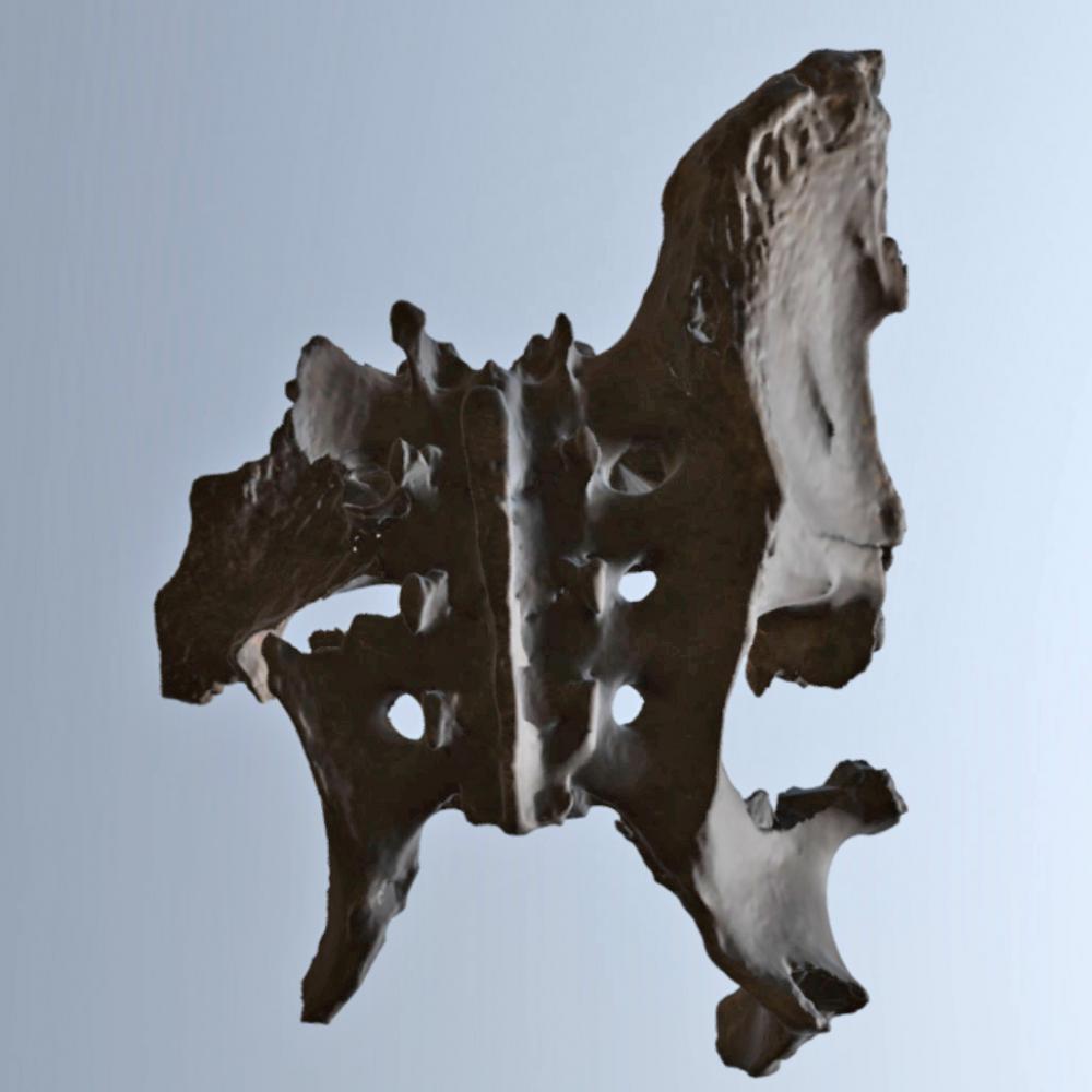
Stag-moose
Cervalces scotti
Only a little bit larger than moose, the stag-moose lived in New York until approximately 11,700 years ago. The stag-moose reached 8 feet (2.5 m) in height and a weight of 1,562 pounds (708.5 kg). Its antlers could reach 6 feet in length. Like modern moose, the stag-moose lived in the Pleistocene’s wetlands, forests, and woodlands.

")
")

")
")
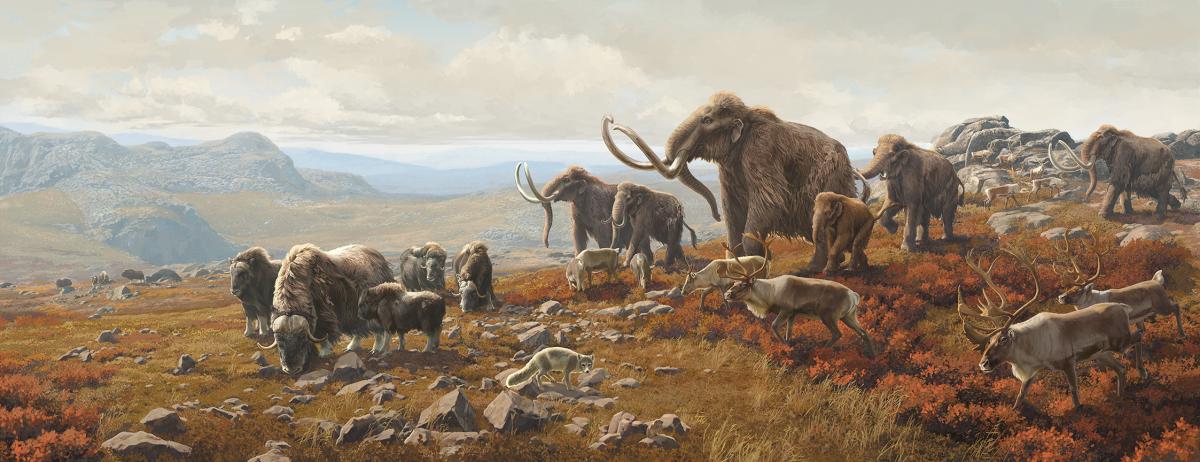
What is a Tundra?
When glaciers retreat, the first habitat to appear is the tundra. A tundra is a cold, windy, treeless environment with little rain and a short growing season. The plants that grow in this harsh environment are unusually small such as: alpine bilberry, sibbaldia, and purple mountain saxifrage. They have adapted to conserve water and survive in the cold and wind. By enriching the soil, tundra plants play an important role in preparing the landscape for trees and other organisms. Although many tundra plant species disappeared as New York’s climate warmed, a few hang on in steep gorges and high Adirondack peaks. Alpine tundra may be the State’s most endangered ecosystem. These rare plants are nearly gone from New York.
After Glaciers Retreat Plants and Animals Colonize
.

As temperatures fall and rise, glaciers advance and retreat. During times of retreat, different habitats appear and disappear in a predictable cycle. It always follows the same basic pattern. As the plant communities change, so do the kinds and numbers of animals associated with them. About 13,000 years ago, the last Ice Age ended. By 11,000 years ago, many animals were extinct while others were just gone from New York. Many large North American mammals went extinct shortly after the end of the last glacial maximum, the ice sheets’ greatest expansion. The event is known as the Pleistocene Extinction. Since then, there have been far fewer large mammals in North America.
Animals of the Tundra
Likely because of the harsh environment, very few fossil species from the tundra environment were preserved. So far, New York's Ice Age tundra species include only caribou, mammoth, and musk oxen. From tundra habitats in other states we know species like Arctic fox and lemmings also lived in this habitat.
Columbian Mammoth skull and tusk
Mammuthus columbi
About 35,000 years ago, in the Late Pleistocene, woolly mammoths dispersed into North America. While mammoths do not appear to have been as abundant in New York as mastodons, scientists have found fossils of the Columbian mammoth and the woolly mammoth.


VIEW 3D SCANS:
Columbian Mammoth Skull
https://sketchfab.com/3d-models/randolph-mammoth-skull-vcu-3d-3629-9d47cf145ab042308bfab130870e7b68
Columbian Mammoth Tusk
https://sketchfab.com/3d-models/randolph-mammoth-tuskvcu-3d-3630-be99f0ca3a3f48d3bc9ee5f4059a7055
Caribou
Rangifer tarandus
Caribou are still found in the tundra and boreal forests of North America. Some of their diet consists of lichens, a symbiotic organism consisting of an algae and fungus. Caribou are the only mammal known to be able to break down lichen as food. Their hollow-hair fur provides warmth for living in cold climates as well as to help them stay afloat while swimming.

")
Musk Oxen
Ovibos moschatus
Musk oxen survive year-round in extremely cold environments. They lived in New York 15,000 years ago. By the end of the last Ice Age 11,700 years ago, none of these animals were here. Adapted to climates and habitats that are no longer present in New York, they remain in other parts of North America.

")
The Champlain Sea
At one time, a sea covered parts of New York, Vermont, Quebec, and Ontario. This Champlain Sea lasted from about 13,100 years ago until 9,000 years ago.
When mile-high glaciers covered New York, the enormous weight created depressions in the land. When the last glacier melted, water from the Atlantic Ocean filled the depression it made, creating the sea. Oceanic creatures lived in this sea until the land rebounded and the sea retreated.

Animals of the Champlain Sea
Today, beluga whales and seals live in the sea around the Arctic Circle. However, these bones were found on land in New York where the Champlain Sea was once located. Evidence of other animals living in the Champlain Sea include whales, fish, clams, and the ringed seal and the harbor seal included here.
Beluga Whale
Delphinapterus leucas
Beluga whales are adapted for living in cold water and are currently found in the Arctic Ocean. They lack a dorsal fin that could hit floating ice blocks and have a thick layer of insulating fat.

")
Harbor Seal
Phoca vitulina
Harbor seals do not migrate and like areas of water that are free from ice. They prefer familiar resting places on land. This would suggest that, initially, the Champlain Sea did not have much ice when it formed.

")
Ringed Seal
Pusa hispida
Much different from harbor seals, ringed seals favor resting on ice floes. They have adapted to remaining in contact with ice most of the year. The age of this ringed seal implies the Champlain Sea developed at least some land-attached ice several hundred years after it was created.

 Jaw (right), about 12,500 years ago (NYSM VP 14334)")
Revolutionary Research
Online Resources For Historians and Researchers
The links below provide resources for further information on historical topics of interest to historians, and researchers.
Online Resources For Historians and Researchers
Stockbridge-Munsee Community Band of Mohican Indians
American Indian Community House
Center for Brooklyn History: Indigenous Peoples of Long Island and New York City
Center for Native Peoples and the Environment
Ganondagan State Historic Site
National Museum of the American Indian New York
New York State Library: Selected Native American Websites
South Central Regional Library Council: History Unbound: First Nations of New York
Daughters of the American Revolution: Long Island and NYC Revolutionary War Resources
Empire State Society of the Sons of the American Revolution: New York Revolutionary War Tax Lists
Fort Stanwix National Monument: History and Culture
Fort Ticonderoga: Online Collections
Gilder Lehrman Institute of American History: History Resources
Hudson River Valley Institute at Marist College
Hudson River Valley National Heritage Area: the American Revolution in the Hudson River Valley
Institute for Thomas Paine Studies at Iona College
New-York Historical Society: Colonists, Citizens, Constitution: Creating the American Republic
New York State Archives Colonial and Revolutionary Governments
New York State Library: American Revolutionary War, 1775-1783
New York State Military Museum and Veterans Research Center: New York in the Revolutionary War
New York Public Library: New York and the American Revolution
Saratoga Battlefield National Historical Park: History & Culture
Resources Related to Revolutionary Ideals
Columbia University: Columbia University and Slavery
Fordham University: Researching Slavery in New York
Frederick Douglass Family Initiatives
Harriet Tubman National Historical Park: History and Culture
Niagara Falls Underground Railroad Heritage Center
New-York Historical Society: Slavery in New York
Northeast Slavery Records Index
New York City Landmarks Preservation Commission: New York City and the Path to Freedom
NYS Office of Parks, Recreation and Historic Preservation: Underground Railroad
College of Staten Island—CUNY: Internet Sources for the Women’s Suffrage Movement
Humanities NY: Women’s Suffrage Centennial, 1920-2020
Long Island Library Resources Council: Recognizing Women’s Right to Vote in New York State
National Park Service: New York and the 19th Amendment
New York Public Library: Women’s Right to Vote: A Resource Guide
New York State Library: Women’s Suffrage
New York State Museum: Votes for Women
New York State Women’s Suffrage Commission
WNED—PBS: Discovering New York Suffrage Stories
Women’s Rights Alliance of New York State
Women’s Rights National Historical Park: History and Culture
Madeline Davis Gay, Lesbian, Bisexual, and Transgender Archives, Buffalo State University
New York City LGBT Historic Sites Project
New York State Museum: LGBTQ+History
Rochester, New York Voices of LGBT History, University of Rochester
The Empty Closet: Gay Alliance of the Genesee Valley, University of Rochester
Erie Canalway National Heritage Corridor: Social Reform and Innovation
Gilder Lehrman Institute of American History: Reform Movements of the Progressive Era
Library of Congress: Progressive Era to New Era 1900-1929
Museum of the City of New York: Activist New York
Museum of the City of New York: Triangle Shirtwaist Factory Fire
Niagara Falls History Museum: the Niagara Movement
The Tenement Museum: Digital Exhibits
Castle Garden: America’s First Immigration Center
CUNY Academic Commons: Immigrant NYC
Irish American Heritage Museum
Lehman College: History of New York City and State: NYC Immigration
Museum of the City of New York: Raise Your Voice
Museum of the Chinese in America
National Archives: New York Passenger Lists, 1820-1957
New York Genealogical and Biographical Society: Helpful Facts About Immigration to New York
New York Public Library: A Brief Passage in U.S. Immigration History
New York State Archives: Immigration Records
New York State Library: Tracing Your Immigrant Ancestors
PBS: American Experience: Immigration to New York, 1900-2000
Schomburg Center for Research in Black Culture
Kanien’keha:ka (Mohawk) Haudenosaunee (Iroquois) Village Model
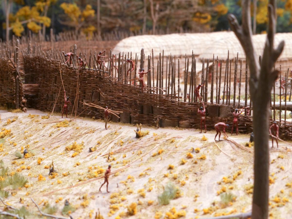
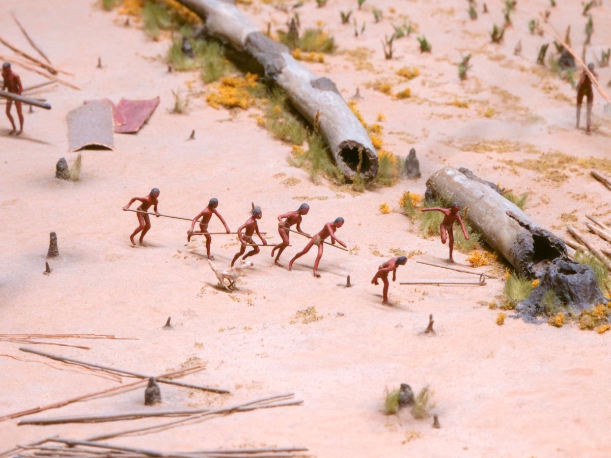
Four hundred years ago, Mohawk Haudenosaunee villages were usually located on the tops of steep-sided hills. The steep slopes formed natural defenses for the village; a palisade or "stockade" was commonly built along the edge of the hill for added protection. The entrance to the village was through a narrow space formed by overlapping ends of the stockade wall. This "tunnel" could be defended from intruders. Some villages had two or three rows of palisades around them.
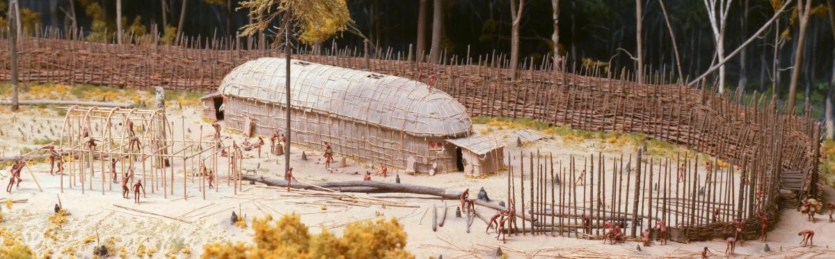
The Haudenosaunee used a style of farming, known today as "slash-and-burn" or "swidden," which requires a community to move the location of its village from time to time. As the soils of the fields became exhausted, and firewood in the neighborhood became scarce, the people had to venture farther afield for these essentials of life. After a while, the distances traveled for both became too inconvenient and difficult. For these reasons, and because the longhouses and palisades needed more and more repair, the community would decide to create a new village a few miles away.
The larger the population of a village, the more quickly the nearby resources such as firewood and fertile fields become exhausted. A small village might be able to maintain itself in one location for 20 to 30 years, but a large village might need to move in ten years. The move itself and the decision to move were not made quickly. They were the result of months, if not years of planning.
Perparing the Site

Perhaps a year or two before the move, the villagers identified a new location in the surrounding forest. The forest would be cleared to create the site for the village and for the fields. Rather than everyone from the "old" village moving to the "new" village at the same time, the move probably took place over a period of months, perhaps a year. Families from the old village moved to the new village as longhouses were completed and as fields came under cultivation. A few people may have chosen to stay in the old village, at least for a while.
The village was located on the hilltop for defense and good drainage. The Haudenosaunee cut a clearing in the forest to create a space for the village and the surrounding fields. Soil fertility determined the location of the surrounding fields. A water supply, either a spring or stream, was located nearby.
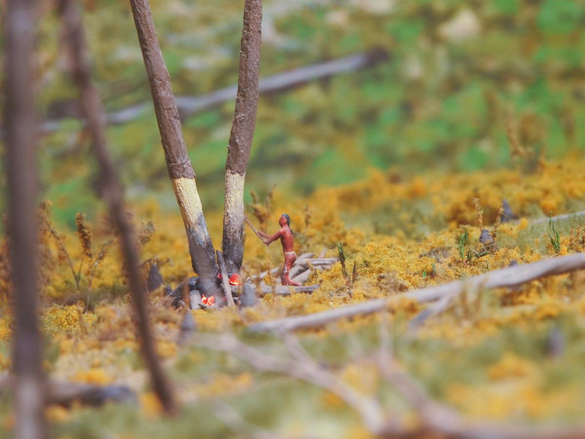
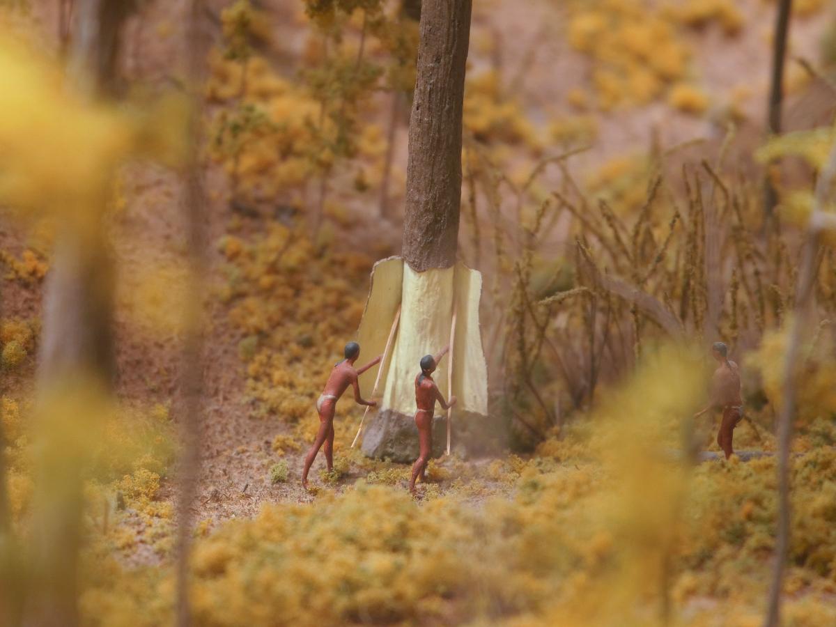
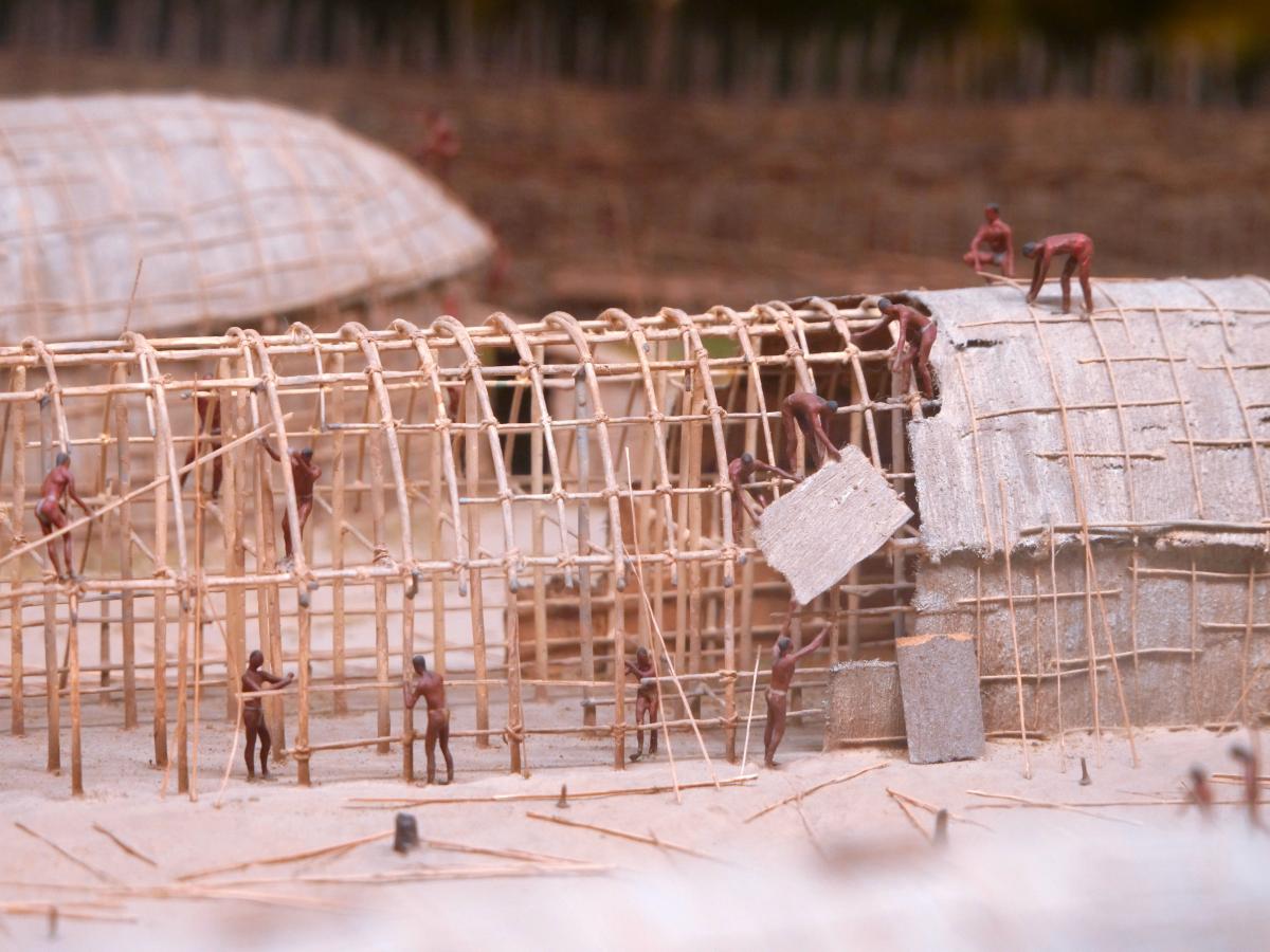
Putting up the longhouse was relatively easy and quick, and accomplished by a "longhouse-raising-bee," drawing upon the help of all who would live in it, and perhaps neighboring families.
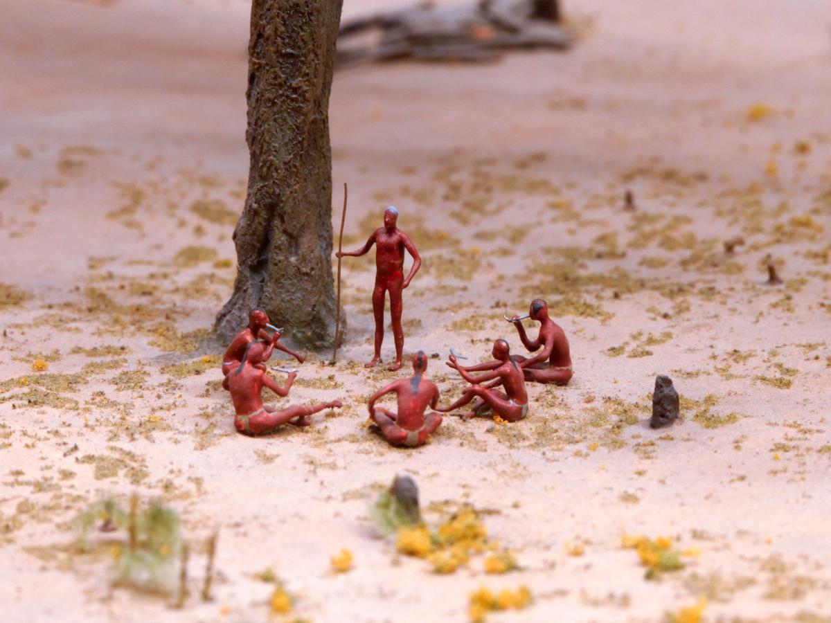
Family

The symbol of the extended family's clan was frequently painted on the outside end of the longhouse to identify its residents. Among the Mohawks, this would either be a turtle, wolf, or bear. The one shown here, painted in red, is a stylized "Bear." It indicated that this was a longhouse of the Bear Clan, whose female residents were "sisters" who worked and lived together. Adjacent longhouses might be the homes of extended families belonging to the same clan, or they might be home to families of another clan.
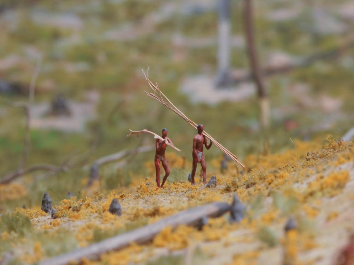
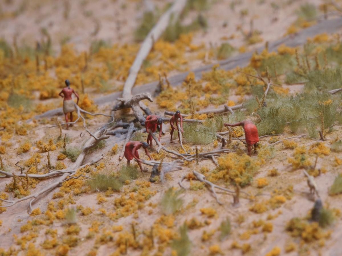
Clearing Fields for Farming

The new field, cleared by slash-and-burn from a patch of the forest, was littered with charred tree stumps and large, partially burnt tree trunks. Freshly cleared fields were very fertile. The sites for the fields were chosen because of the high lime content of their soils, indicated by the kinds of plants, shrubs, and trees growing on them. Although some soil nutrients were lost when the clearing was burnt over in spring to rid it of weeds, brush, and unwanted fallen tree trunks and stumps, the same fires produced wood ash, rich in potassium, which helped to fertilize the soil. Although most trees were cleared, some very large trees, stripped of their bark, dead, and partially burnt, remained. Aware of the dangers of falling limbs, workers in the field avoided these whenever possible, especially during high winds.
Haudenosaunee women worked in the fields in the spring, planting corn, beans, and squash seeds. These were frequently planted together, spacing them amid the charred forest litter. Once the corn plants grew "knee-high" in June, they had to be "hilled" by hoeing soil up around their bases, otherwise, the wind or a hard rain would knock the plants over because of their shallow roots. Eventually, tall cornstalks served to support climbing beans. The large and broad leaves of squash and pumpkin plants spread out below and shaded the soil, helping to hold moisture in and preventing weeds from growing.
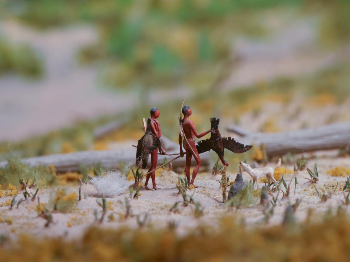
Hunting, Gathering, & Farming
Foods raised by the Haudenosaunee women included corn, beans, and squash; other plant foods were gathered from the surrounding forest and included in-season roots and tubers, greens, berries, and other fruits and nuts. Hunting activities were "men's work" in which younger brothers and older sons assisted. Fish, waterfowl, deer, and other mammals were caught, trapped, and hunted throughout the year and were the major sources of protein. Animal skins provided clothing and robes. Dogs were not so much family "pets," as watchdogs and the companions of hunters. Originally, they were the only domesticated animals kept by the Haudenosaunee and their ancestors.
Food was continually being prepared and cooked. There were no set mealtimes. Family members helped themselves from the pot whenever they were hungry.
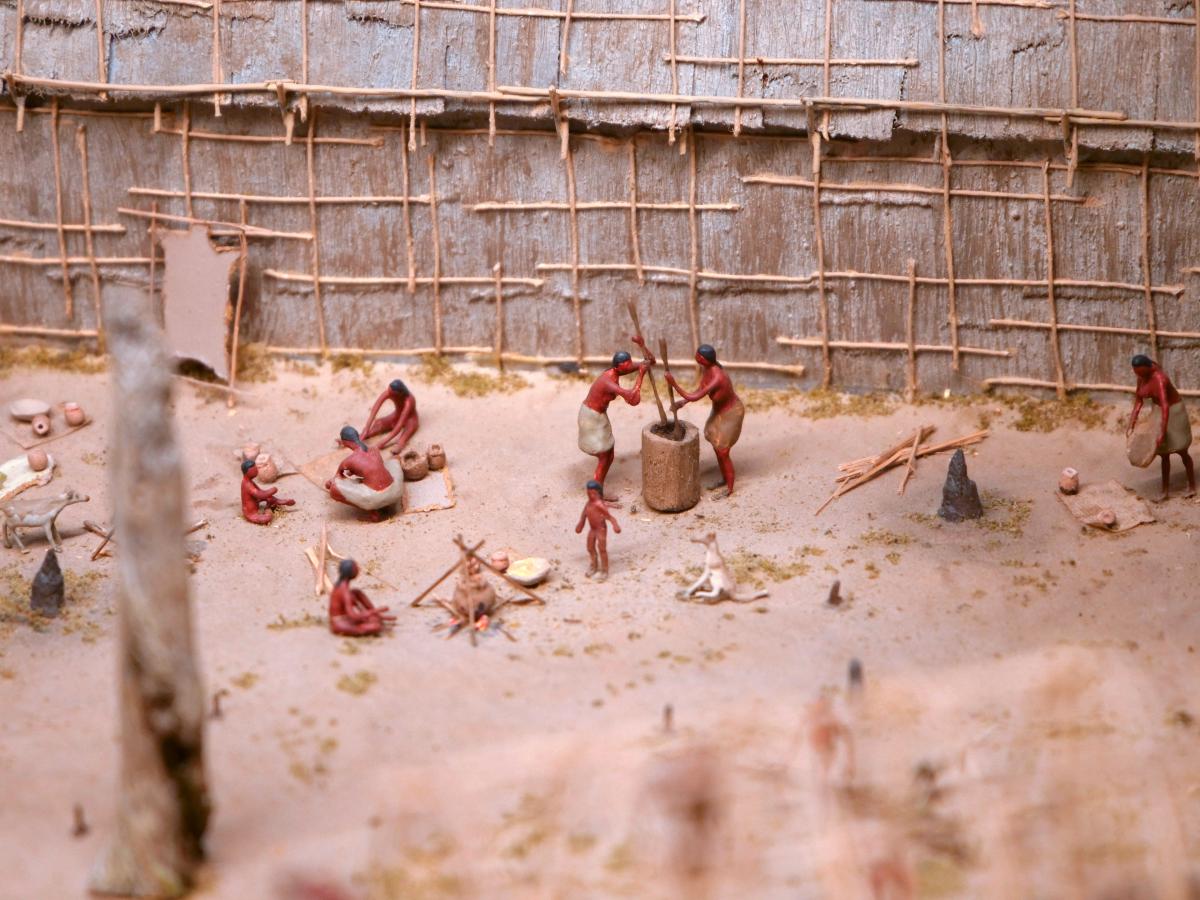
Pottery

The girls learned various skills and crafts, such as pottery-making, from their "mothers," "aunts," and "grandmothers." Today, on the basis of distinctions in techniques and decorations, archeologists can often distinguish the pottery made in one longhouse from that made in another longhouse nearby. Relying on these same distinctions, archeologists can also trace the movements of families and communities from one village location to another.
Games & Leisure Activities
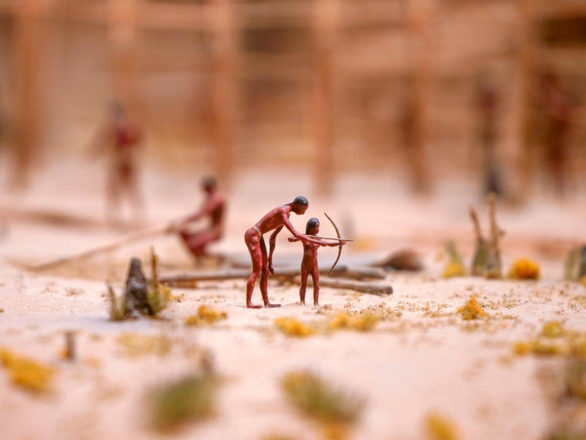
But it was not all work and no play. Amusements and recreation were also important parts of Haudenosaunee village life 400 years ago. Stories, riddles, and jokes would be told, even as you worked, especially, in the cold of winter, when the weather confined everyone in their longhouses. Games of chance, for instance, those using circular dice made from deer antlers, would be played. Children role-played and or just had a "good time."
Most children's toys and games involved role-playing: that is, girls doing things that their "mothers" and older "sisters" would do; boys doing what their " fathers," "uncles" and older "brothers" would do. Boys role-played as hunters and warriors using small bows and arrows, testing their skills by shooting at targets or small animals and birds. Lacrosse, known to the Haudenosaunee as "The Little Brother of War," also drew upon and tested skills that would become important to boys in adulthood. The boys also played the "hoop and javelin" game, in which they took turns trying to throw a javelin or spear through a small hoop rolled along the ground by another.
Girls played with cornhusk dolls, which prepared them for their important roles of life-givers and "nurturers." Field hockey or shinney may have evolved from games played by girls in the cornfields using their wooden hoes as "hockey" sticks, and any available rounded object, such as a stone or nut, as the ball.


Spiller Newspaper Paperweight Collection
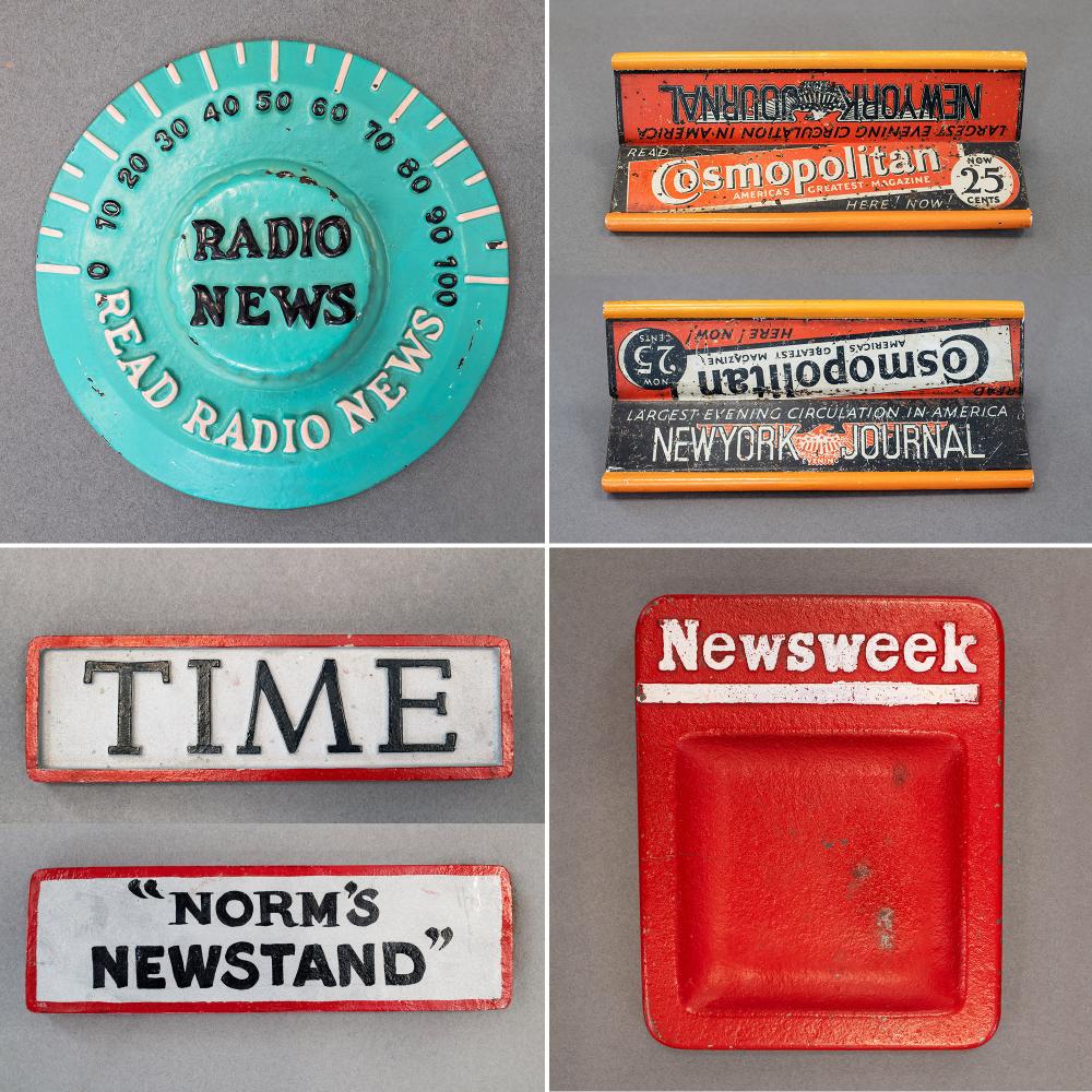
Mortimer Spiller was born in 1922 to Russian immigrants who settled in LeRoy, New York. Spiller’s college training in business and advertising was interrupted by service in World War II. After the war, he was eager to complete his education and put his degree into practice. In 1947, while conducting sidewalk surveys in the windy skyscraper canyons of New York City, he noticed the practical need for weights to hold down newspapers in the city’s newsstands.
Spiller saw a unique opportunity. In the confined space of a newsstand, every square inch counted as potential placement for products or advertising. While a simple rock could hold the papers down, a custom-made weight could enhance the marketing of any newspaper or magazine. Spiller was soon making and selling weights to major publishers for use at newsstands around the country. His first order was for 10,000 weights for Newsweek. The company went on to produce over 100,000 different weights into the 1980s from a foundry in Batavia, New York, for such companies as Newsweek, Look, and the New York Times.
In 2011, the Spiller family donated its collection of newspaper weights to the New York State Museum. The collection includes samples of Spiller products as well as products made by other manufacturers.
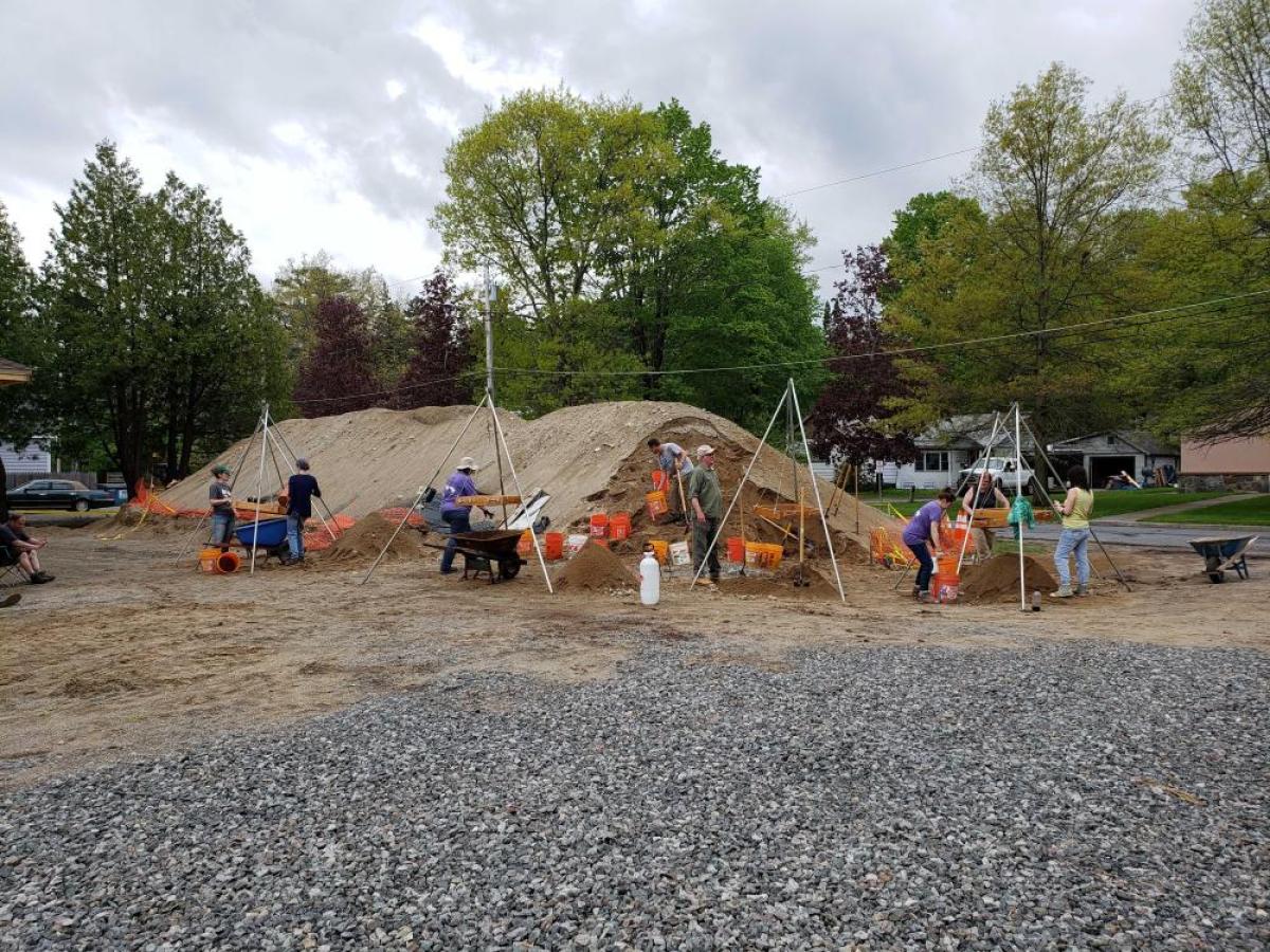
Hallowing This Ground: The Courtland Street Burials and Lake George Battlefield Park
On February 7, 2019, a housing development excavation destroyed numerous unmarked military graves on Courtland Street in Lake George village. Following reports of exposed human remains, Lisa Anderson, curator of bioarchaeology at the New York State Museum, and archaeologist Charles Vandrei of the Department of Environmental Conservation began a multiyear effort to recover and analyze these Revolutionary War remains in advance of their planned reinterment at Lake George Battlefield Park.
Immediately following the 2019 discovery, Anderson and Vandrei investigated the construction site. What they found was evidence for dozens of burials, some partially intact, but most consisting of shattered skeletal fragments held in a house-sized spoil pile left by the construction crew. Over the next 15 months, they oversaw a team of volunteers who progressively excavated and screened the pile to recover human remains from the disturbed burials.
Initially thought to represent graves from the mid-18th century French and Indian War, the discovery of a regimental button from the First Pennsylvania Battalion placed this cemetery at the time of the American Revolution. The cemetery is believed to be associated with the General Hospital established at Fort George in 1776 to treat the sick and wounded brought from Crown Point and Ticonderoga. They were sent by the thousands, many suffering from smallpox and other diseases that could not be treated with the simple herbs and medical practices available at the time.
The painstaking sorting and inventory of the human remains by Anderson and NYSM bioarchaeologists Julie Weatherwax and Alexandra DeCarlo revealed the graves of at least 44 individuals that were destroyed. Many were young men and boys in their teens who had enlisted as young as 16 years old. Two were children, probably members of families travelling with the troops. There also may have been women, enslaved, and Indigenous individuals but the remains are too fragmented to identify. The recovered remains represent a fraction of those who died and were buried in Lake George in the summer of 1776.
Since the discovery of the Courtland Street burials, consultation with local, state, and federal officials and with the support of Senator Charles Schumer’s office led to a plan to ultimately reinter the remains of these Revolutionary War soldiers at the Lake George Battlefield Park. On Friday, June 14, 2024, a ceremony was held to consecrate the ground where these remains will be buried.
At the conclusion of the ceremony, Lisa Anderson remarked, “If anything good has come of this, it's the recognition of their place in the American Revolution right here in Lake George, and we are here to honor them. It's the recognition of the dedication of so many of you to do the right thing, and we are here to honor you. And it's the hope that this project may have played a small role in getting a new law passed to protect other unmarked burial sites like this." Anderson further expressed, "As our work continues, piece by piece, we hope to be able to tell more of their story—who they were, how they lived and maybe how they died."
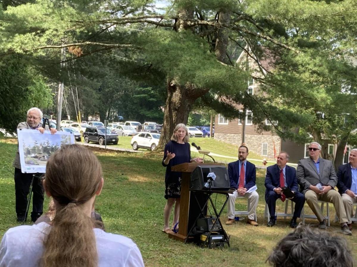
Additional Resources
Bioarchaeology at the Courtland Street Burying Ground (NYSM, 2019)
https://www.nysm.nysed.gov/research-collections/archaeology/bioarchaeology/news/bioarchaeology-courtland-street-burying-ground
NYS Museum piecing together remains of Revolutionary War soldiers recovered in Lake George (WRGB, May 2023)
https://cbs6albany.com/community/positively-upstate/nys-museum-piecing-together-remains-of-revolutionary-war-soldiers-recovered-in-lake-george-excavation-2019-townhome
Lake George remains likely first protected under new law (WTEN, Nov 2023)
https://www.news10.com/news/lake-george-remains-likely-first-protected-under-new-law/
New York State Unmarked Burial Site Protection Act
https://www.nysm.nysed.gov/unmarked-burial-site-protection-act
Freshwater Wetlands
New York has over 70,000 miles of rivers and streams and more than 7,600 lakes, ponds, and reservoirs. This open water and New York’s extensive freshwater wetlands (marshes, bogs, swamps, and wet meadows) provide important nesting habitat for breeding birds, and stopover areas for migrating birds. In the past 400 years, over half of the historically known freshwater wetlands have been lost due to draining and filling. Protecting remaining habitats is an important priority for wildlife conservation organizations.
Acoustic Adaptations
Marsh birds are seldom seen, but easily heard! Many bird species that breed in freshwater marshes have streaked, brown plumage that helps conceal them in the dense vegetation. They prefer to stay hidden from sight, but make their presence known to other members of their species with complex and LOUD vocalizations.
")
")
Waterbird Migration
Many bird species that live in wetlands need open water to feed. During New York’s long and cold winters, only the largest and fastest-moving water bodies do not freeze. Most fish-eating birds, like herons, loons, and kingfishers, must migrate south to areas with open water. Some individuals survive the winter months in the remaining open water on the Great Lakes, the Finger Lakes, or along the Atlantic Coast.
")
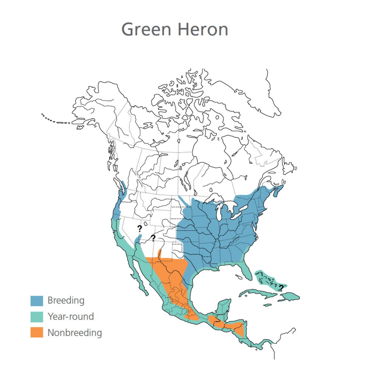

, left, and Lincoln's sparrow (Melospiza lincolnii), top right")

Dispossession of Indigenous Lands Map
Generalized Locations of Indigenous Territories and 21st-Century Indigenous Nations
This map provides an overview of territorial boundaries and locations of present-day Indigenous Nations and communities whose ancestral lands lie within what is now New York. The territorial boundaries depicted are not intended to be definitive. They were derived from multiple sources, including secondary and conglomerate maps available in the public domain. State Museum staff obtained locations of present-day Indigenous Nations through county, state, and federal land records and digital Geographic Information Systems (GIS) files. For New York State cities, the population numbers were obtained from the 2022 US Census Bureau QuickFacts population estimates. The population figures specifically reflect the count of individuals who identify as “American Indian and Alaska Native alone.” For Canadian cities, the population numbers are sourced from the 2016 Census of Population compiled by Statistics Canada.
View/Download Dispossession Map (PDF)
View the PDF version of this map to zoom in, save, and/or print the document.
Dispossession of Indigenous Lands Map (25.94 MB)
Present Day Locations of Indigenous Nations
(Indicated in Orange on the Map)
- Kahnawake Indian Reserve No.14 (Mohawk, Canada)
- Kanesatake Lands (Mohawk, Canada)
- Saint Regis Mohawk Indian Territory (Mohawk, New York)
- Oneida Nation Indian Territory (Oneida, New York)
- Onondaga Nation Indian Territory (Onondaga, New York)
- Oil Springs Indian Territory (Seneca, New York)
- Tonawanda Indian Territory (Seneca, New York)
- Tuscarora Nation Indian Territory (Tuscarora, New York)
- Cattaraugus Indian Territory (Cattaraugus, New York)
- Allegany Indian Territory (Seneca, New York)
- Six Nations Indian Reserve No. 40 (Haudenosaunee, Canada)
- Oneida Indian Reserve No. 41 (Oneida, Canada)
- Wahta Mohawk Territory (Mohawk, Canada)
- Tyendinaga Mohawk Territory (Mohawk, Canada)
- Shinnecock Indian Territory (Shinnecock, New York)
- Poospatuck Indian Territory (Poospatuck, New York)
- Kanatsiohareke (Mohawk, New York)
- Ganienkeh (Mohawk, New York)
- Seneca-Cayuga (Seneca and Cayuga, Oklahoma)
- Delaware Nation (Lenape, Oklahoma)
- Delaware Tribe of Indians (Lenape, Oklahoma)
- Stockbridge-Munsee Community (Mohican, Wisconsin)
- Oneida (Oneida, Wisconsin)
- Brothertown Nation (Montauk, Wisconsin)

Additional Resources
Visit these sites to learn more about the Indigenous Nations whose ancestral lands lie within what is now New York:
Haudenosaunee Confederacy:
https://www.haudenosauneeconfederacy.com/confederacys-creation/
Abenaki-Wabanaki:
https://wabanakialliance.com/who-we-are/
Stockbridge-Munsee Mohican Nation:
https://www.mohican.com/brief-history/
Delaware Nation-Anadarko:
https://www.delawarenation-nsn.gov/
Delaware Tribe of Indians-Bartlesville, OK:
http://delawaretribe.org/
Munsee Delaware Nation at Moraviantown-Canada:
https://www.facebook.com/people/Munsee-Delaware-Nation/100066265130726/
Shinnecock Nation:
https://www.shinnecock-nsn.gov/
Unkechaug Nation:
https://nativelongisland.com/
Seneca-Cayuga Nation (Oklahoma):
https://sctribe.com/
Brotherton Nation:
https://brothertownindians.org/
Delaware Nation (Oklahoma):
https://www.delawarenation-nsn.gov/
Delaware Tribe of Indians (Oklahoma):
https://delawaretribe.org/
Tyendinaga, Mohawks of the Bay of Quinte:
https://mbq-tmt.org/
New York State Museum Earthquake Center
Delve into the intriguing world of earthquakes, and discover how New York, despite its location far from tectonic plate boundaries, experiences its own seismic activity.
Earthquakes in New York?
Yes, earthquakes do occur on a regular basis in New York.
Most people think of places like California when they hear the word "earthquake", but earthquake activity is normal in the eastern United States. Thousands of earthquakes have been recorded in New York and nearby areas over the past century. The major difference between East Coast and West Coast quakes is the frequency of damage-causing events. Most New York quakes cause little or no damage, while West Coast quakes are often much more destructive.
What Are Earthquakes?
Earthquakes usually occur from movement between the tectonic plates that make up the Earth's crust, with about 90% happening at plate boundaries. Plates tear apart, collide, and slide past each other along faults, causing earthquakes. Areas known for frequent seismic activity like California, the southwest Pacific, Japan, and Iceland are located on these boundaries.
New York isn't on a tectonic plate boundary. Geologists think earthquakes happen here because of movements in old, weak areas of the Earth's crust. They also suggest that these earthquakes may be due to mantle movements pushing the crust up, as is happening in the Adirondacks, or the crust is rebounding since the last Ice Age's glacial ice melted.
Above or Below?
We often feel earthquakes on the surface, but they originate below us at a point called the hypocenter. The closer the hypocenter is to the surface, the more strongly the earthquake can be felt. Very strong quakes with deep hypocenters might not be felt at all, while weaker quakes near the surface can cause significant damage.
The epicenter is the point directly above the hypocenter on the surface and is used to mark the earthquake’s location on a map.

New York Quakes
The Richter Scale measures earthquakes by the energy they release. Earthquakes under magnitude 3 are recorded by scientific instruments but usually not felt, while those of magnitude 8 or higher can cause significant damage over large areas.
Most New York earthquakes are well under magnitude 5. However, notable earthquakes above 5 have occurred in Attica (1929), New York City (1884 and 1937), and Plattsburgh (2002). While rare, damaging earthquakes can occur in New York. The northern part of the state and the New York City region are slightly more at risk.

New York's Biggest Earthquake
On September 4, 1944, a 5.8 magnitude earthquake rocked St Lawrence County. Centered between Massena, New York, and Cornwall, Ontario, Canada, the quake caused $2 million in damage. Massena saw significant damage to chimneys, plumbing and house foundations. In nearby Hogansburg the ground cracked in many places. Numerous wells across St. Lawrence County went dry.
The quake was felt across 450,000 square kilometers, into New England, Delaware, Maryland, New Jersey, Pennsylvania, Michigan, and Ohio.
Monitoring and Measuring Earthquakes
Seismic waves are vibrations from earthquakes or other events that travel through the Earth. These vibrations are recorded by scientific instruments called seismographs. Sensitive seismographs can detect strong earthquakes from around the world. The time, location, and magnitude of an earthquake can be seen on the recorded data.
The seismograph records data as a wavy line called a seismogram. The seismogram shows data in one-hour sections over a full day. When there is little or no seismic activity, the wavy line is almost flat. As seismic activity increases, the waves become taller and closer together. The taller the waves, the stronger the seismic activity.
View an ongoing record of seismic energy detected by a seismograph at the U.S. Geologic Survey’s seismic station in Troy, NY. The timestamps on the seismogram are in a standardized global format, Coordinated Universal Time (UTC), which is four hours ahead of local Eastern Standard Time.
New York State Museum Geologists Discuss Earthquakes!
Geological Specimens on View

Calc-silicate schist
Lake George, NY
Under certain conditions, rocks bend and fold rather than break. Folded rocks are bent or curved due to forces such as tectonic stress, creating wave-like structures. Some folds are small, as here; others are landscape size.
NYSM 2817, Geology-Minerals Collection
Slickensides
Slickensides are polished, striated rock surfaces that are a result of friction along a fault.
NYSM 19418 & 19451, Geology-Minerals Collection


Faults
These rocks show faults. Faults are fractures in Earth’s crust where blocks of rock have moved relative to each other. Some faults are very large, like the San Andreas Fault in California, while others are very small.
NYSM S1721 & S1722, Sedimentary Rocks Collection


What is a Glacier?

Glaciers are fused snow flakes and crystalized ice that form into huge masses. As snow falls, it compacts and deforms under its own weight. This "plastic" ice will move as a response to gravity.
Just like pancake batter spreads on a skillet, so too does the snow and ice as it accumulates in one spot. As snow piles up at the ice cap and transforms into ice, it will eventually spread out until constrained by topography.
Glaciers at Work
Glaciers move under their own weight in response to gravity. In the process, they erode, transport, and deposit rocks and other sediments.
Snow accumulates, compresses, and glaciers form. Erosion occurs as the glacier crushes, grinds, and plucks up rocks and sediment. Boulders and sediment of all sizes, is transported by ice. Meltwater flowing in tunnels under the glacier sorts and moves sediments.
Till forms as unsorted sediments accumulate under the glacier as it moves over the landscape. Outwash deposits accumulate as meltwater dumps coarse materials in front of the glacier. Meltwater then transports fine grained silt and clay to distant lakes basins.

Glacial and Biological Specimens Recovered near Great Gully Gorge, NY

Spruce Log
Great Gully Gorge
~50,000 years old
This log was recovered from the same exposure to the buried peat showing that a spruce forest was growing on the surface during an interglacial period around approximately 50,000 years ago. This sample and other fragments of wood (31,000 years old) buried between glacial till deposits provides the strong scientific evidence of multiple glacial cycles in New York. Previously, it was presumed that the most recent glacial advance destroyed all evidence of past glaciations. This log and peat was too old to radiocarbon date, so scientists used Optically Stimulated Luminescence (OSL) to date the sediment above and below to determine the approximate age.
Glacial Cycles
Glaciers have advanced and retreated across New York many times. Glacial till, the unsorted sediments directly deposited by a glacier, occur as an abundant surface deposit on the landscape. It was generally believed that with each new cycle, the glacier erased the evidence of previous glacial cycles.
However, Museum scientists recently found evidence of at least six glacial cycles at the Great Gully Gorge, near Union Springs, NY, on the eastern shore of Cayuga Lake. By studying and dating the stacked sedimentary units along with collecting drill cores scientist are able to construct a timeline of geological events in the Finger Lakes.

Optically Stimulated Luminescence (OSL)
Where Radiocarbon Dating requires organic material to provide ages and dates, Optically Stimulated Luminescence (OSL) dating does not. OSL is able to use sand-sized pieces of the mineral quartz to estimate when sand grains were buried or last exposed to sunlight. This method is useful to date geologic sediments transported by air (sand dunes) or water (stream and lake deposits), or archaeologic ceramics from 200 years old to 300,000 years old. Museum scientists used OSL to date the sand layers from which the buried peat and spruce log were recovered. This provides dated evidence of at least six glacial cycles.
Lunar New Year: Gong Hay Fat Choy! (Happiness and Fortune to All!) Refresh Chinatown, Tuck High Co. Store
On View Through March 2, 2025
In celebration of the 2025 Lunar New Year, the New York State Museum is thrilled to announce exciting updates to the ongoing exhibition of the Tuck High Co. Chinatown Store, including refreshed graphics and the addition of contemporary artworks and artifacts. Additionally, we invite you to immerse yourself in a special temporary exhibit which shines a spotlight on the rich traditions of Lunar New Year celebrations.
Lunar New Year and the Spring Festival are celebrated in Asian countries and countries around the world where immigrants have settled—including in many communities across New York State! Come learn about how Lunar New Year is traditionally celebrated while exploring the historic Chinatown store, Tuck High Co. Uncover the rich history of this iconic establishment and discover how three generations of the Lee family served their local community while operating the store. Also on permanent exhibit are goods from two other bygone establishments, Sun Goon Shing Co. and Quong Yee Wo & Co.

Featured Artifacts and Artwork

Greeting card
Quong Yee Wo Store collection, Chinatown, Manhattan
New York State Museum H-1980.149
During Lunar New Year, it is tradition for adults to gift money to children in red envelopes. This red card was produced by the Quong Yee Wo Store as a gift to customers.
Togetherness Tray, version 2
Tiffany Saw for Wing on Wo & Co., 2024
Porcelain
New York State Museum H-2024.84.2
A Tray of Togetherness is used to offer treats and abundance to guests in Chinese homes for the new year. Traditionally round, representing fullness and bounty, it holds six or eight compartments for luck or good fortune.
Tiffany Saw is inspired by traditional Chinese and Burmese pottery. Her work combines American and Chinese wheel throwing techniques with porcelain carving she studied in Jingdezhen, China.
The Togetherness Tray will be on view in the galleries in the windows of the Tuck High store exhibition through March 2nd.
Ginger Jar, from the series Passages (those that carried us), 2024
Vivian Chiu
assembled crate wood
New York State Museum H-2024.84.1
Artist Vivian Chiu created the vessels in her series Passages (those that carried us) with historic wood crates gifted to her by Wing on Wo & Co., the oldest operating store in Manhattan’s Chinatown.
Chiu describes: “Each crate is meticulously deconstructed, cut into hundreds of individually faceted pieces, and reassembled to resemble the ceramic vessels they once held...the crates' stampings and markings [serve] as tangible traces of their journey from Asia to the United States, symbolically mirroring the migration shared by both the Lum Family at W.O.W. and myself. “
Related Information
The Tuck High Co. Chinatown Store
Take a step back in time and visit the historic Tuck High Co. store nestled in the NYSM's New York Metropolis Hall. Originally owned and operated by three generations of the Lee family in Chinatown, NYC, the Tuck High Co. store was the oldest continuously operating business in Manhattan’s Chinatown at the time of its closure in 1980. To preserve its significance, the Lee family transferred many of the store's original contents including counters, a cash register, lamps, tools, and receipts to the museum.
Stay in the Know: Sign Up for the New York State Museum’s Public Program Newsletter!
Looking for exciting, hands-on activities for kids? The New York State Museum offers a wide range of engaging programs designed for young learners to explore history, science, art, and culture. Whether your child is interested in stories, scientific discoveries, or creative art projects, there’s always something fun and educational happening at the Museum.
By signing up for our monthly Public Program Newsletter, you'll be the first to know about all our upcoming family-friendly events and children’s activities. From school break week programs to year-round adventures, we make learning an exciting experience for all ages.
Don’t miss out on the fun—sign up today to get the latest updates and start planning your next Museum visit!
From the Collections: Shakers and the New York State Museum
2024 marks the 250th anniversary of the Shakers coming to colonial America. The Shakers were a small sect of Quakers that started in Manchester, England in 1747. They were formally known as the United Society of Believers in Christ’s First and Second Appearing. Because of the zealous fervor associated with their ritual dance, they were known as the “Shaking Quakers” or “Shakers.”
After migrating to New York in 1774, the Shakers became a communal Christian religious society that flourished in the late 18th and 19th centuries. Principles of their faith included celibacy, equality of the sexes, oral confessions of sins, pacifism, and withdrawal into their communities from the outside world.
The first American Shaker settlement was in Niskayuna (later called Watervliet), Albany County, NY. The second settlement was established in New Lebanon, Columbia County, where the first meeting house was constructed in 1784. Other Shaker communities were founded in Massachusetts, Connecticut, New Hampshire, Maine, Ohio, Kentucky, and Indiana. At the movement’s height, its total population reached about 6,000 in 19 separate communities.
To mark this anniversary, the New York State Museum will post an artifact from its Shaker Collection each month.
DECEMBER
As we close out the 250th anniversary of the Shakers coming to America in 1774, it is important to note the efforts of the Shakers themselves to preserve their own heritage at the New York State Museum.
When the Groveland community (Livingston County) closed in 1892, Eldress Ella Winship and Sister Jennie Wells moved to the Watervliet community, bringing the community’s possessions with them. Eldress Anna Case documented Watervliet’s history and artifacts, and in 1927, these women began collaborating with the New York State Museum (NYSM) to preserve their community's unique heritage. By 1938, only three Shaker women remained at Watervliet, leading to its closure and their relocation to Mt. Lebanon, which itself closed in 1947. Thanks to these women, many Shaker artifacts in the NYSM’s History Collection have a well-documented provenance.

Charles Adams, c.1930
Dr. Charles C. Adams (1874–1955) was the director of the New York State Museum between 1926 and 1943. Shortly after his arrival, Adams collaborated with the diminishing Shaker community at Watervliet to document the Shaker’s culture.
New York State Museum Collection

Eldress Anna Case, c.1920
Anna Case of Watervliet was instrumental in documenting the material from her community until her death in 1938.
New York State Museum Collection

Jennie Wells and Ella Winship, c.1917
When the Groveland community (Livingston County) closed in 1892, Eldress Ella Winship and Sister Jennie Wells both moved to the Watervliet community. Both women documented most of the material from the Groveland community that was transferred to Watervliet, and eventually to the Museum.
New York State Museum Collection

Eldress Ella Winship at spinning wheel, Sister Esther Relyea, and Sister Jennie Wells at loom, North family, Watervliet, c. 1910.
New York State Museum Collection

Stone Bridge, South Family at Watervliet Community, c.1910
Each Shaker community was organized into various families with their own buildings. The leading family in each community was located closest to the meetinghouse and was always known as the “Church Family.” Subsequent families took the name of their geographic location within the community, for example the “North Family” or the “South Family.”
New York State Museum Collection
NOVEMBER
Shaker Meeting Houses are simple, functional structures that reflect the Shakers' values of humility, equality, and communal living. Designed with open interiors to accommodate their distinctive worship practices, these buildings are characterized by their plain, rectangular shapes and lack of ornamentation. They stand as significant examples of early American religious architecture and a testament to the ingenuity and craftsmanship of the Shaker communities.
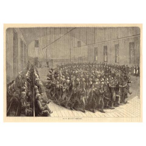
New York State -The Shakers of New Lebanon-Religious exercises in the Meeting house, 1873
This scene takes place inside the unique building that is the Mount Lebanon Meeting house. It depicts a circular dance where brethren and sisters are in separate circles, but are dancing together: clapping, singing and stomping during their worship service. "Observers from the World" line the built-in benches along the walls. Shakers welcomed guests to their meetings, hoping that they would gain converts.
(Image courtesy of the Library of Congress)

Meetinghouse bench, c.1800
Benches like this one lined the walls of Shaker meetinghouses. This bench was used at the Watervliet community.
23” H x 125” W x 13” D
NYSM H-1929.1.12

OCTOBER
The production and sale of “fancy goods” by Shaker women was an important source of income for Shaker communities in the early 20th century. Doll clothing and dolls dressed in Shaker-made clothing were popular items in shops in several Shaker communities. The doll clothing made by Shaker women mimicked their own outfits, including a cloak, bonnet, dress, and even underwear! These two examples, which came into the NYSM’s collections almost fifty years apart, were both made by Sister Mary Frances Dahm.
The first doll wearing a red cloak and purple dress, was recently acquired by the NYSM in 2024. It was made by Dahm for Shelia Bergin Plowinske, a young woman who lived with her family on the Shaker’s South Family Farm at Watervliet and who remained friendly with the remaining sisters after the Watervliet community shut down and they moved to Mount Lebanon. The second doll, pictured below seated in front of its packaging, was acquired in 1975 directly from Mary and her sister, Grace.
Mary Dahm, and her biological siblings Grace and Raymond, were brought to the Watervliet Shaker community after the death of their mother. When Watervliet closed, Mary and Grace moved to Mount Lebanon and then to Hancock, Massachusetts, as each community shut down. Recognizing the needs of the aging Shaker population around her, Mary sought out nurse’s training and served the community in that role for the rest of her life.
SEPTEMBER
Cloaks and Pen Wipes
As Shaker communities dwindled at the end of the 19th century, and agriculture and furniture-making were in decline, Shaker communities needed to find new sources of income. As a result, many communities in the Northeast opened stores that sold household “fancy goods” made by the Shaker sisters.
The design and making of hooded cloaks was one such successful enterprise for the Shakers. Using imported wool, cloaks of the same design worn by Shaker women, patented by Elders Emma J. Neale, were sold to women in the outside world.
In the interest of not being wasteful, the Shakers used wool scraps from cloak-making to make pen wipes, an important desktop accessory for dip and fountain pen use. The Shakers added scraps to small ceramic dolls, as seen in the photograph from Mt. Lebanon by William Winter. Shaker store records also list “kittie” and “water lily” designs.
AUGUST
In the Kitchen with the Shakers
In the early years of the Shaker Society, followers ate a meager diet as they struggled to attain sound economic footing. However, by the 1830s, as the communities grew in numbers and resources, the Shakers generally ate very well. Journals of the period record a rich diet of meats and fish prepared various ways, seasonal fruits and vegetables served fresh and preserved, and treats like doughnuts, cakes, and pies. Although the Shakers officially banned alcoholic beverages, including hard cider, beer and wine, documents indicate that the Shakers still purchased and consumed these products in quantity.
JULY

Double Cheese Press, c.1860
This device has a dual or double press for squeezing water from curds to make cheese. It was manufactured at the Hancock Shaker Village where dairy production was a major industry.
Cheese Basket, c. 1860
Baskets like this, made of woven splint, were used to strain water from whey curds that became cheese.
JUNE
Did you know that the Shakers were instrumental in bringing home gardens to life in the United States? Before they established themselves as high-quality furniture makers, their first major business involved garden seeds! The Shaker garden seed industry began in the late 18th century. Most farms at this time produced vegetables on a large scale and farmers would purchase seeds in bulk. The Shakers were the first to put their seeds into small packages, called papers, so that the average person could plant a small kitchen garden. Shakers placed the seed packets into wooden boxes with colorful advertising on the lid, brought the boxes to small country stores in the spring and collected money from the proprietor in the fall.

MAY
Shaker women were active in many aspects of community life that were not open to women in other communities—they were able to preach, were valued in community decision-making, and participated in a variety of work and industries. Shaker women were also vital in preserving their communities’ history, donating many items to the museum’s collections.
A new addition to the exhibition “From the Collections: Women Who Lead,” this mold was used for shaping bonnets worn by Shaker women. It was donated to the NYSM by Eldress Emma Neale, of Mount Lebanon. Shaker women's active role in the production of products for use by the Shakers and for sale to the secular world made them adept at choosing important tools, raw materials, and finished goods to donate to the museum, allowing us to tell the story of these industries.

APRIL
The Era of Manifestations
In the mid-19th century, the Shakers experienced a religious revival called the Era of Manifestations, or "Mother’s Work." With the gradual decline of Believers who had known Mother Ann Lee personally, new Believers sought to reconnect with the original messages of Shakerism.
From 1837 to the mid-1850s, this period saw a great deal of excitement and religious fervor in the communities. Meetings were closed to the “World’s People” as Shakers had visions, spoke in tongues, and communicated with spirits. Believers in each community were divinely inspired to consecrate the highest piece of land as a “feast ground” and install a “fountain stone.” The feast was a spiritual one, and the “fountain” offered the water of life for the Believers.
This fountain stone is the only surviving example of a fountain stone from a Shaker feast ground. It was installed in 1847 at the community at Groveland in Western New York. The carved inscription states in part, “Here have I opened a living fountain of holy and eternal waters.”
MARCH
Shaker Women's Legacy: Preserving History in New York State
The NYSM’s extensive collection of artifacts documenting Shaker communities in New York State would not exist without the foresight of Shaker women. Facing a shrinking population and closure of some Shaker communities in the early 20th century, Shaker women reached out and worked closely with the director and curatorial staff of the NYSM from 1927 through the 1940s. These women included Eldress Ella Winship, Eldress Rosetta Stephens, Sister Lillian Barlow, Eldress Emma Neal, and Sister Sadie Neale of Mt. Lebanon, NY, Eldress Anna Case and Sister Jennie Wells of Watervliet, NY, Sister Alice Smith of Hancock, MA, and Sister Aida Elam of Canterbury, NH. They were forced to make careful decisions, balancing the importance of preserving Shaker history through donations, while also keeping in mind the financial health of the remaining communities by offering some artifacts for sale. Thanks to their work, we can continue to study the influence and contributions of the Shakers throughout New York and beyond!
FEBRUARY
How the Shakers Championed Equality in Early America
The Shakers were revolutionary in their attitudes toward equality. To the Shakers, all are equal in the eyes of God, and therefore all are to be treated with respect. The Shakers accepted converts of any race or ethnicity to their communities as equal members. African Americans joined and held equal status with their white brethren inside the confines of the village.
Sister Phoebe Lane was born in Cornwall, NY, in 1785. Her father, Prime, joined the Shakers at Watervliet in 1802 accompanied by his daughters, Phoebe and Betty. When Prime rejected the Shakers, his daughters decided to remain. Because slavery was still legal in New York State, Prime sued the Society claiming his daughters as property. The New York State Supreme Court ultimately ruled that the women were free to act for themselves. Phoebe remained with the Watervliet Community for 74 years until she died in 1881.
JANUARY
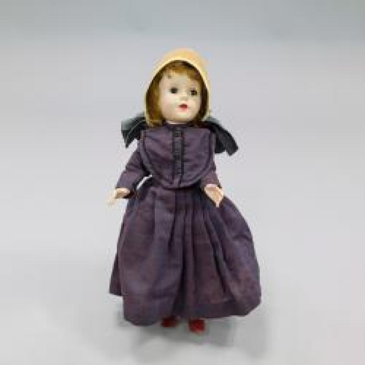
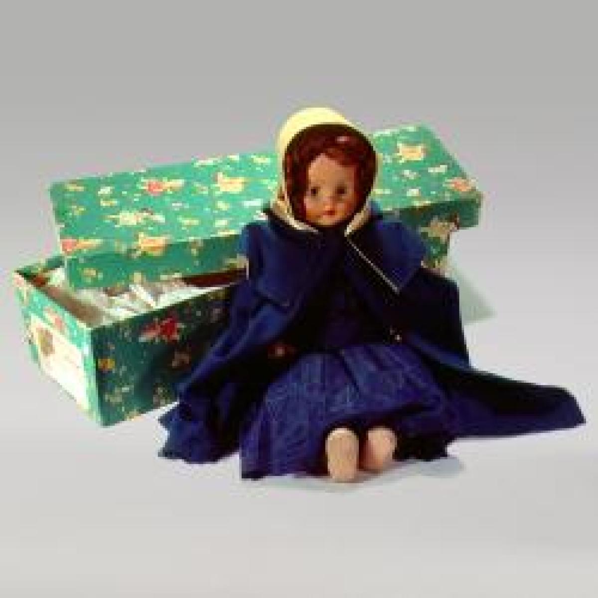
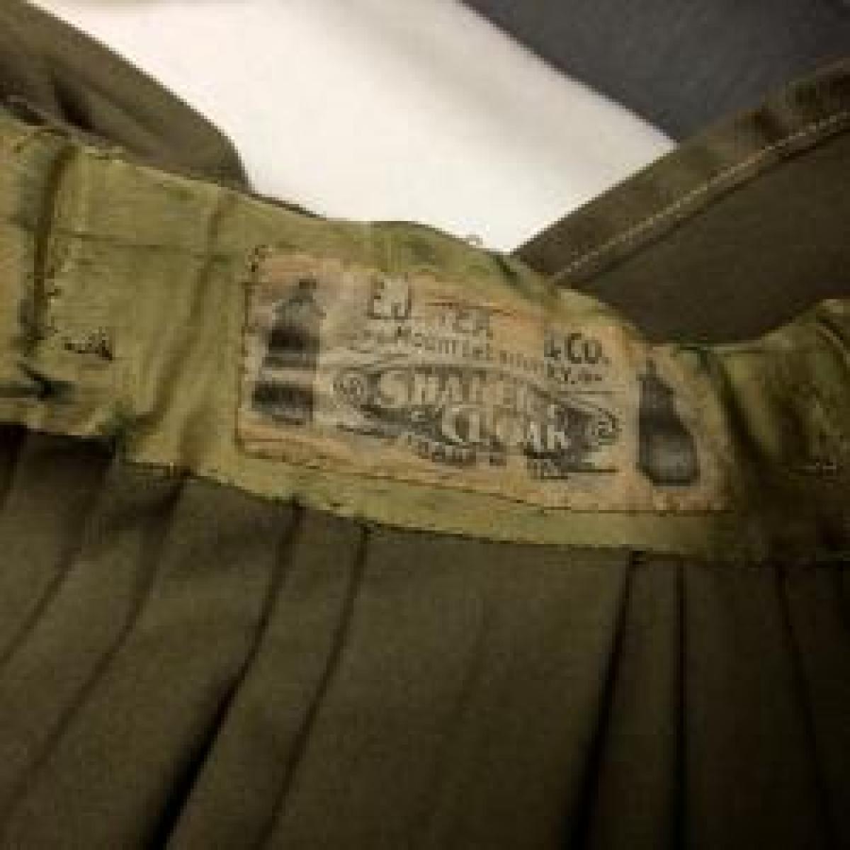

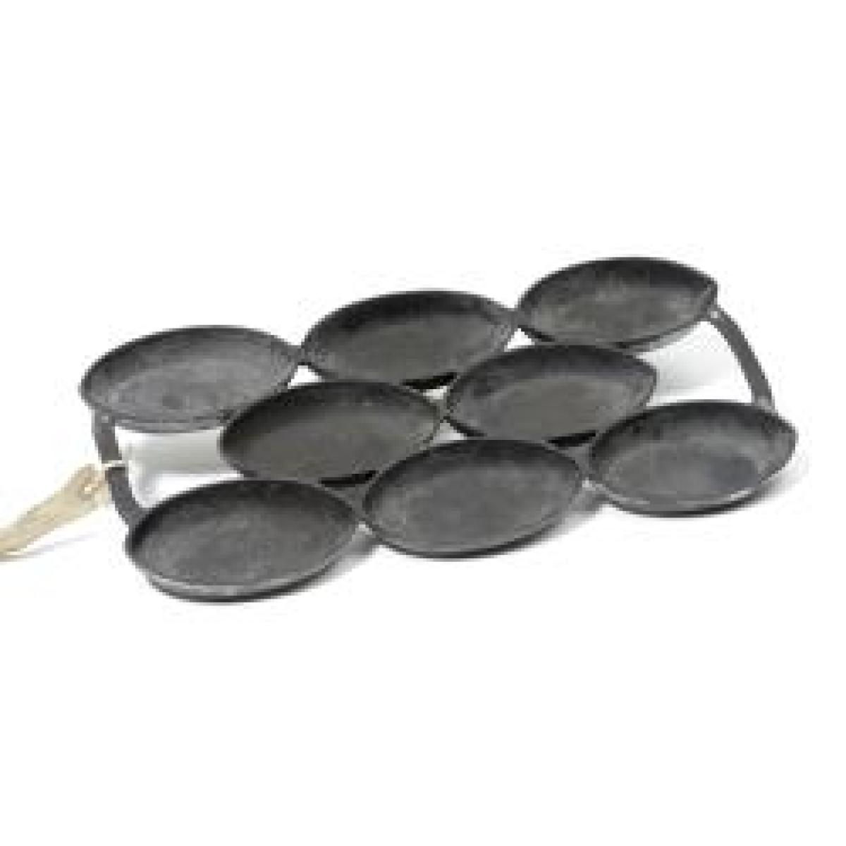

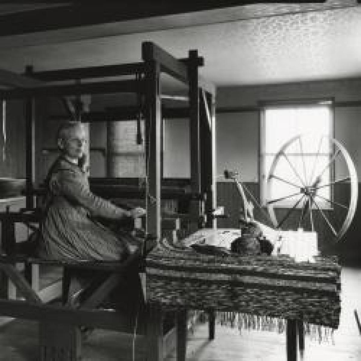
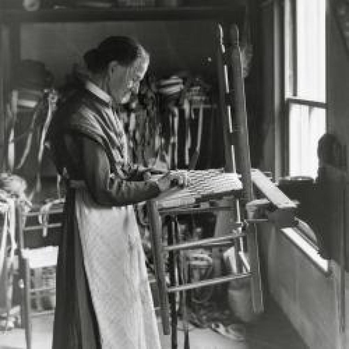
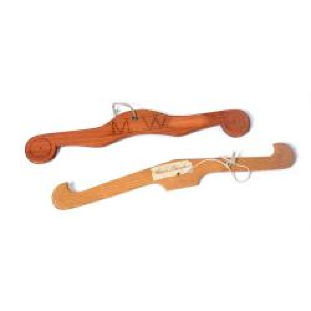
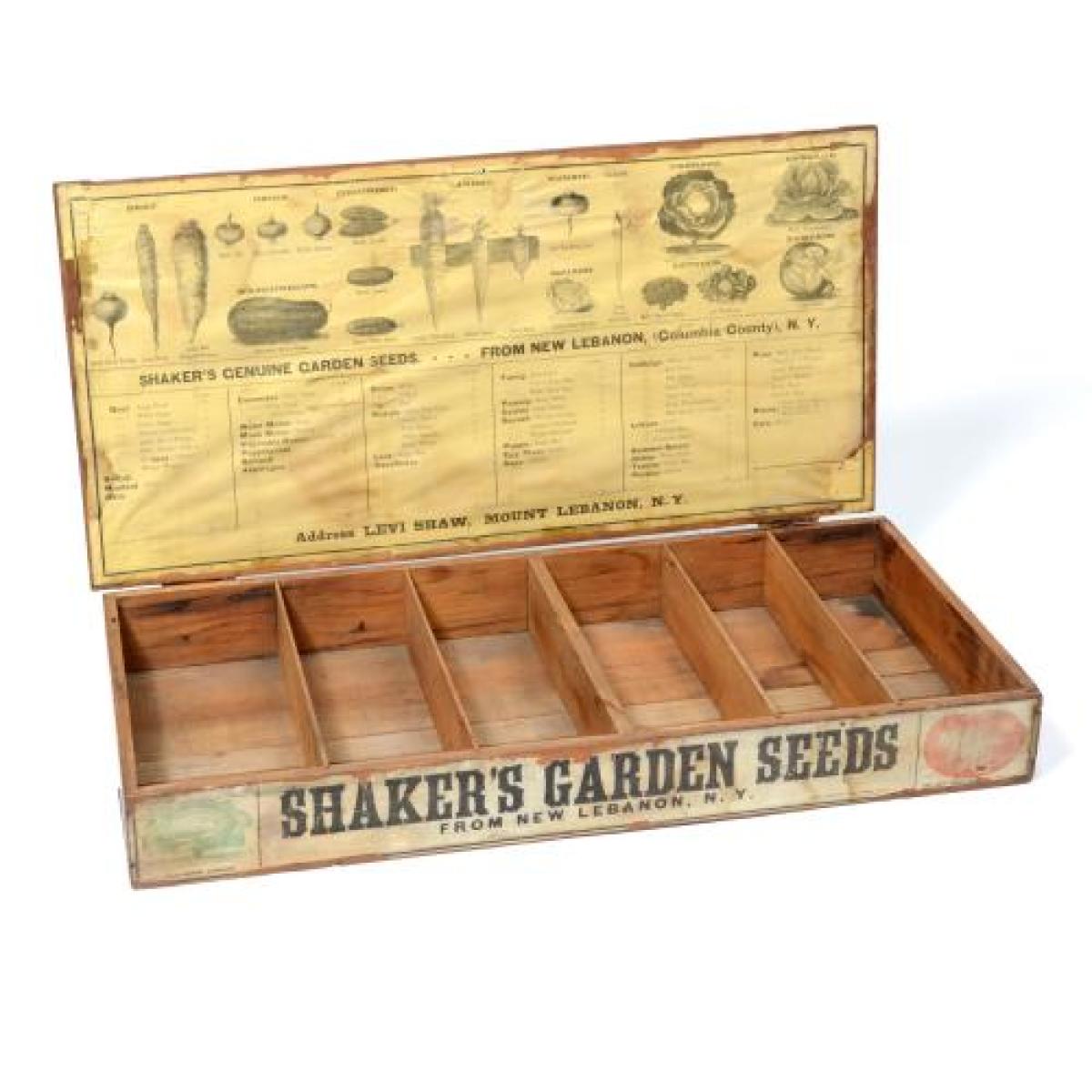

For more information about the Shaker Collection at the New York State Museum, view the online exhibition, The Shakers: America's Quiet Revolutionaries:
https://exhibitions.nysm.nysed.gov/shakers/index.html
Little Brown Jug
On View Through March 30, 2025 in New York Metropolis Hall
In September 2024, the Arts Center of the Capital Region opened a juried pottery exhibition titled, Little Brown Jug. Ceramic artists were sent a historic slip for their contemporary pottery. These pieces won the exhibit’s best in show and showcase the diversity of this brown slip glaze. The shiny, chocolate brown surface on these vessels is called Albany slip—originally mined from glacial lakes deposits in Albany. Its dark color comes from its high iron content. This slip was used on the outside of vessels as a brown glaze finish or on the inside to prevent leakage. In the mid-19th century dark brown stoneware glazes became known as Albany slip, regardless of the clay’s source. The slip used on these pieces was mined from Schaghticoke, New York.
Inspiration for many of the pieces came from 19th century stoneware. The New York State Museum is home to one of the most significant decorated stoneware collections in the nation—the Weitsman Stoneware Collection.
Related Information:
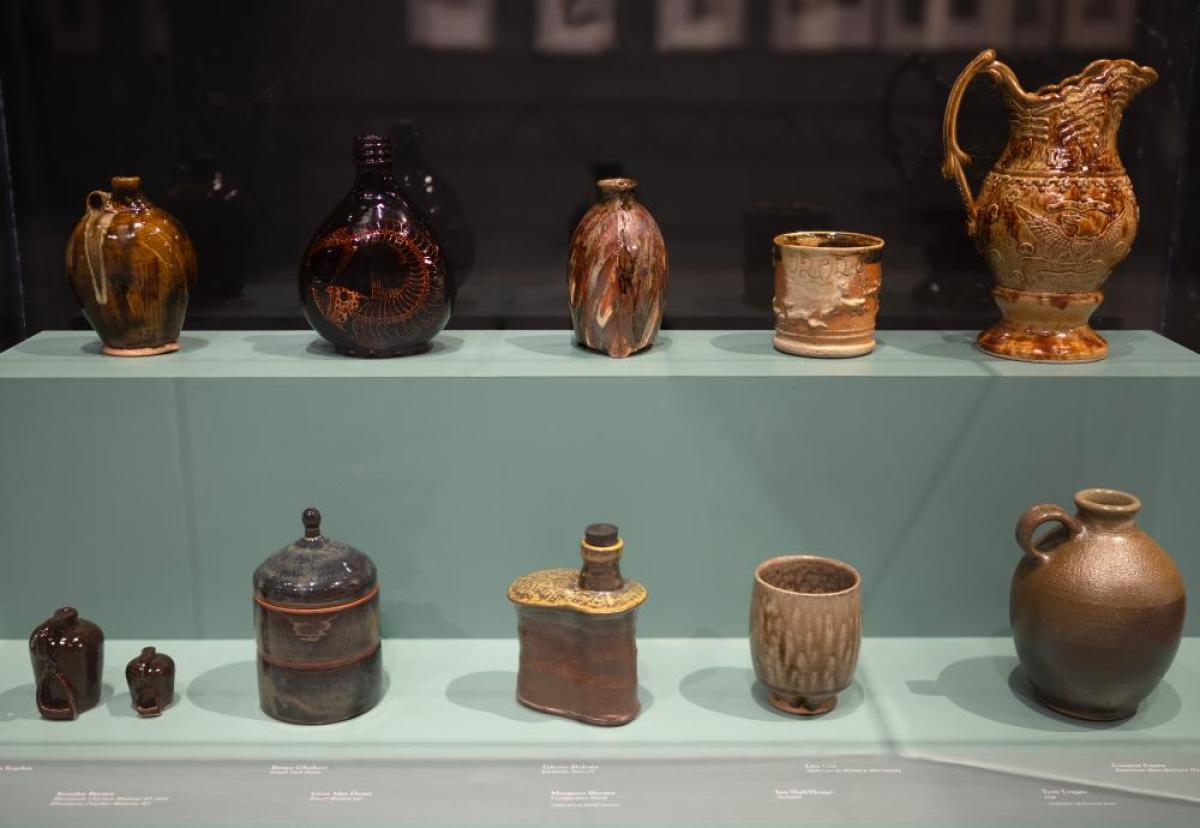
Art for the People: Decorated Stoneware from the Weitsman Collection
This exhibition showcases 40 intricately decorated 19th-century stoneware vessels, celebrated as exceptional examples of American Folk Art, alongside tools, photos, and rare historical artifacts. Featuring pieces from Adam J. Weitsman’s collection, many on display for the first time, the exhibit highlights the rich artistic and cultural heritage of New York State potteries.
The Power of Homestead Resource Page
We invite you to explore the resources compiled on this page that relate to The Power of Homestead exhibition on view at the New York State Museum from January 31, 2025 through June 29, 2025. Here you will find programming, articles, and other expanded content.
A Closer Look at the Powell Family's History
Sewing Traditions

In the 1855 Census, Hannah Powell’s occupation is listed as a dressmaker. This occupation was likely passed down, as both her aunt Hannah Weeks and grandmother Diana Kilbourne were listed with the occupation of tailoress in the Troy City Directory. Mastering the needle and thread to make dresses, hats and various garments offered African American women the opportunity to earn a living or additional income. Hannah passed these skills to her daughter, Jane E., who worked in the garment district of Troy making collars.
Artifacts Found at the Powell Site
Many buttons, beads, and thimbles were recovered from in front of the hearth and around the front porch. These were places where Betty, Hannah, and Jennie made and mended clothing.
Patent Medicine Bottles
There were few restrictions on what could be bottled and sold as medicines prior to the passage of the Pure Food and Drug Act of 1906. Companies aggressively marketed their products as patented medicinal cures for a wide variety of ailments during the latter half of the 1800s. Most elixirs were notoriously intoxicating, with examples such as Atwood’s Jaundice Bitters containing more than 25% alcohol. These remedies were cheap substitutes for expensive professional care perhaps unavailable to the Powell family and other Boght residents.
These bottles were found at the Powell site near Boght Corners north of Albany, NY.
Troy Connections
About 1865, Hannah Powell’s closest cousin Harriet Van Schaick married Charles Hegeman, a waiter and member of the Troy Vigilance Committee. Harriet and Charles made their home at 18 Franklin Street in Troy, a two-story brick dwelling shared with other families and also the Hegemans' 9 children. The two families remained close with the Hegemans’ stepping in to settle the debt on the farm in the early 1910s. Ownership of the Powell farmstead passed to the Hegemans following the death of Jane Powell in 1926.
Charles Hegeman and Harriet Van Schaick’s residence at 18 Franklin Street in Troy, New York.
Sanborn Fire Insurance Map from Troy, Rensselaer County, New York.
Sanborn Map Company, vol. 2, 1904. Map.
Library of Congress (www.loc.gov/item/sanborn06307_004/(link is external))
Abolitionist Ties
Hannah Powell’s aunt and uncle, Hannah and Edward Weeks, were married by Henry Highland Garnet at the Liberty Street Presbyterian Church of Troy. They were also recipients of Adirondack land from abolitionist Gerrit Smith. The family trekked 130 miles from Troy to North Elba but chose to settle in Westport and later moved to Keeseville. The family’s ties to abolitionists, the Liberty Street Church, and their ideal location on Lake Champlain suggest the Weeks assisted freedom seekers on their journey to Canada.
Learn more:
NYSM Exhibit Feature "Timbuctoo: Gerrit Smith’s Experiment"
https://www.nysm.nysed.gov/exhibitions/news/timbuctoo-gerrit-smiths-experiment
The Black Woods: A Scheme of Justice and Benevolence on the Adirondack Frontier
Location: Virtual event hosted by NY Archives Magazine Online Speaker Series
Date and Time: Tuesday, February 4, 2025; 12:30 pm–1:30 pm
Register: https://lp.constantcontactpages.com/ev/reg/4vq2xfz
Map showing the Weeks family journey north from Troy to Keeseville.
1816 Map of the United States by John Melish, Philadelphia.
(Courtesy of the David Rumsey Historical Map Collection)
Maps
Locations of African American-owned farms near Boght Corners
This 1854 map shows a detail of the northeast corner of Albany County and the locations of African American-owned farms near Boght Corners.
Detail from Map of Albany County, New York: From Actual Surveys, 1854. (Library of Congress)
Additional Resources
llustration, Powell Homestead, c. 1820
This artistic rendition depicts what the original Powell house may have looked like around 1820. It is based on archaeological evidence and similar 19th century examples.
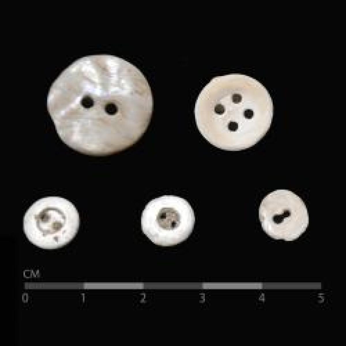
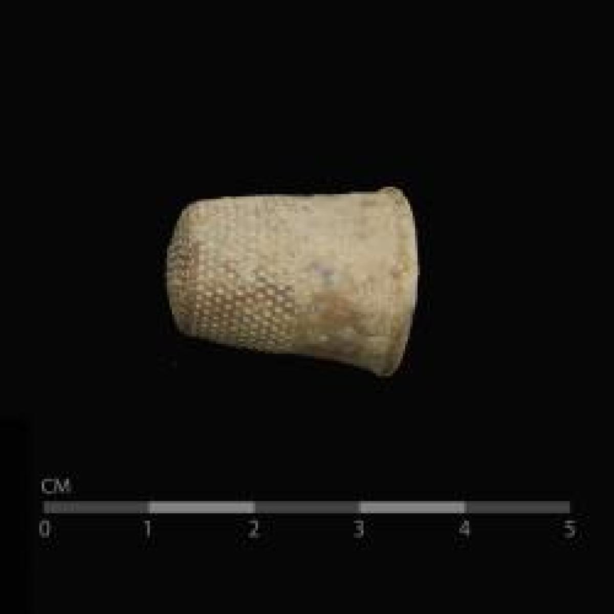
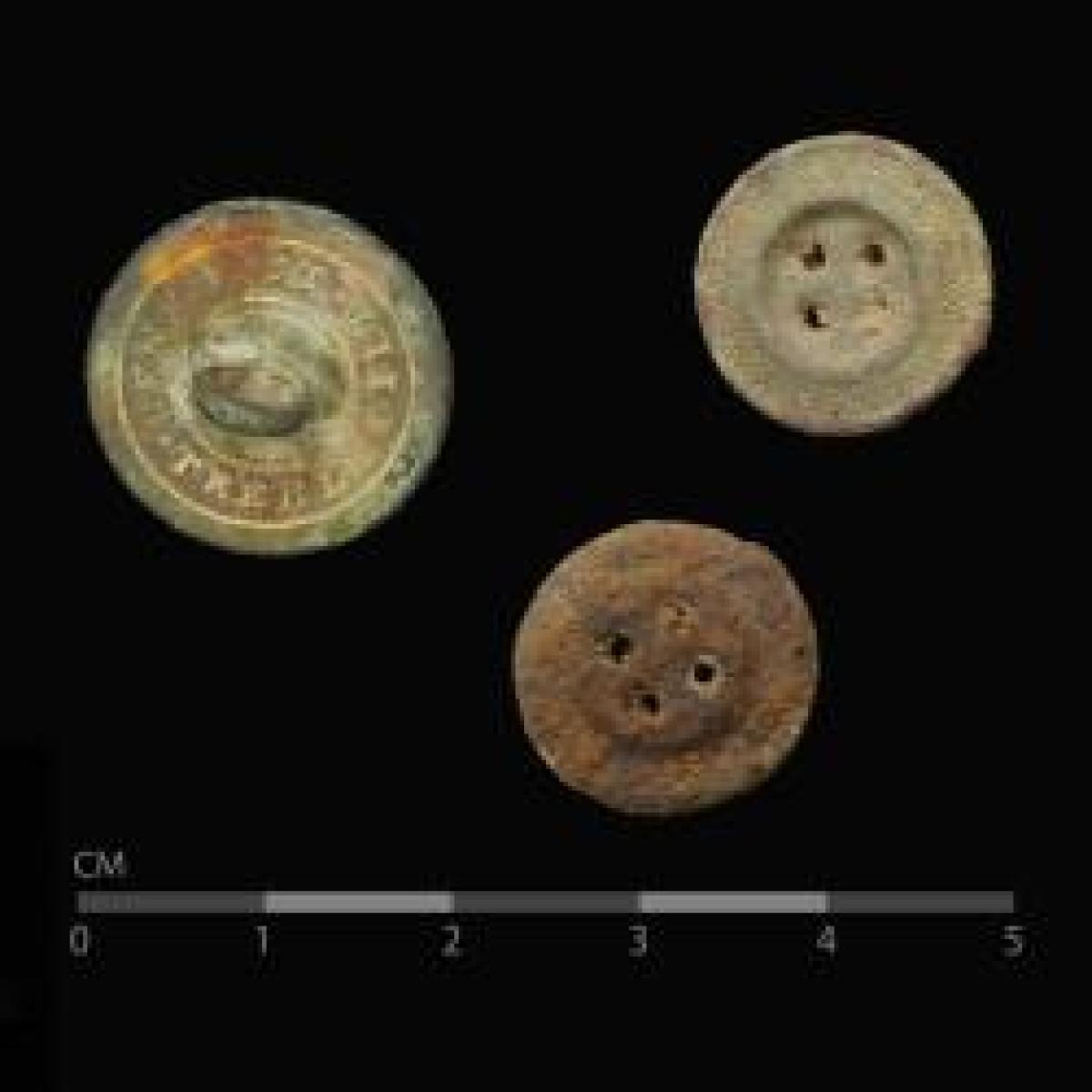
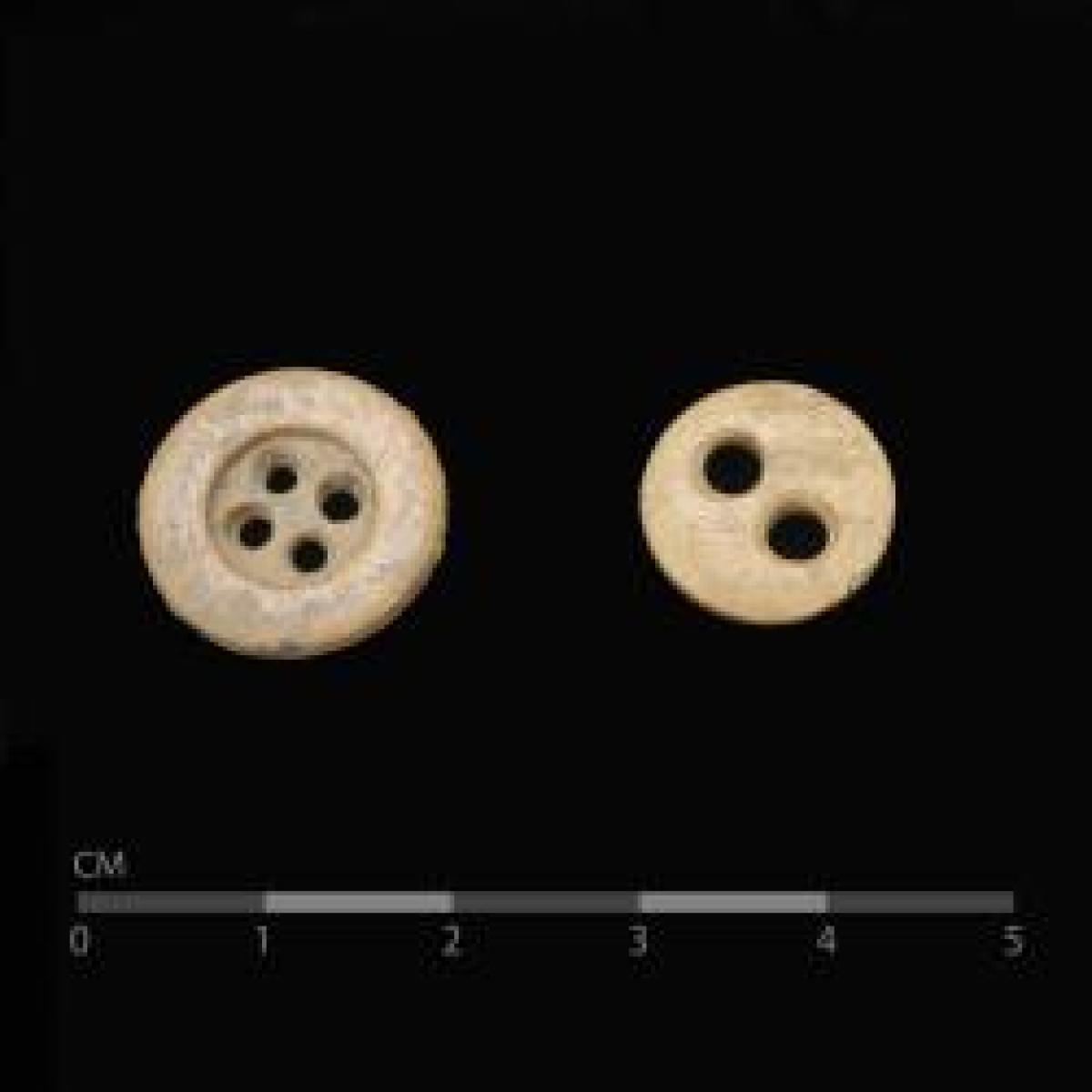
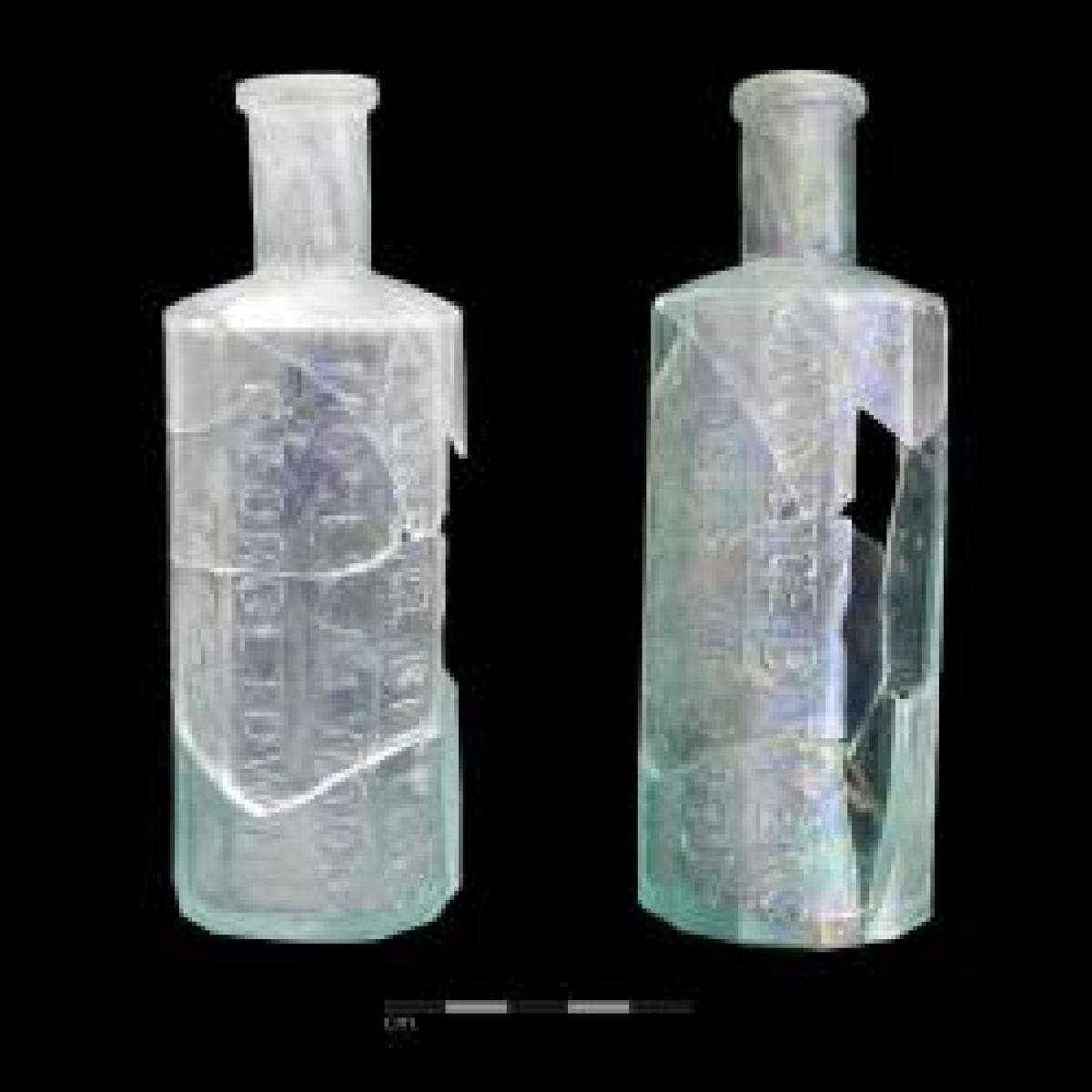

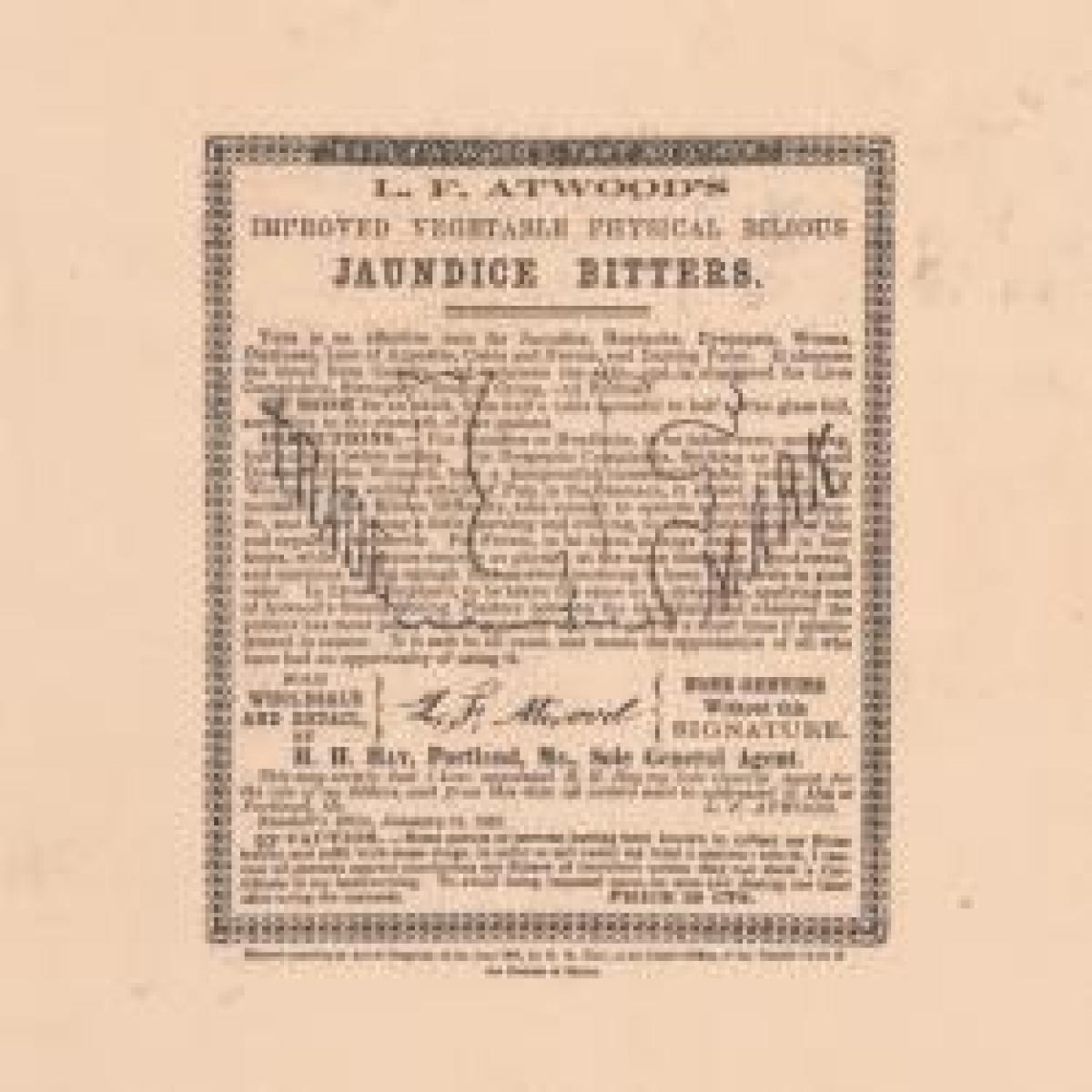
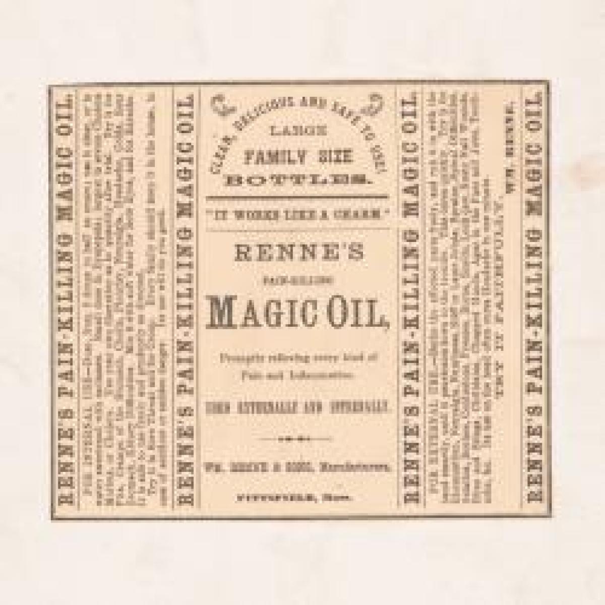
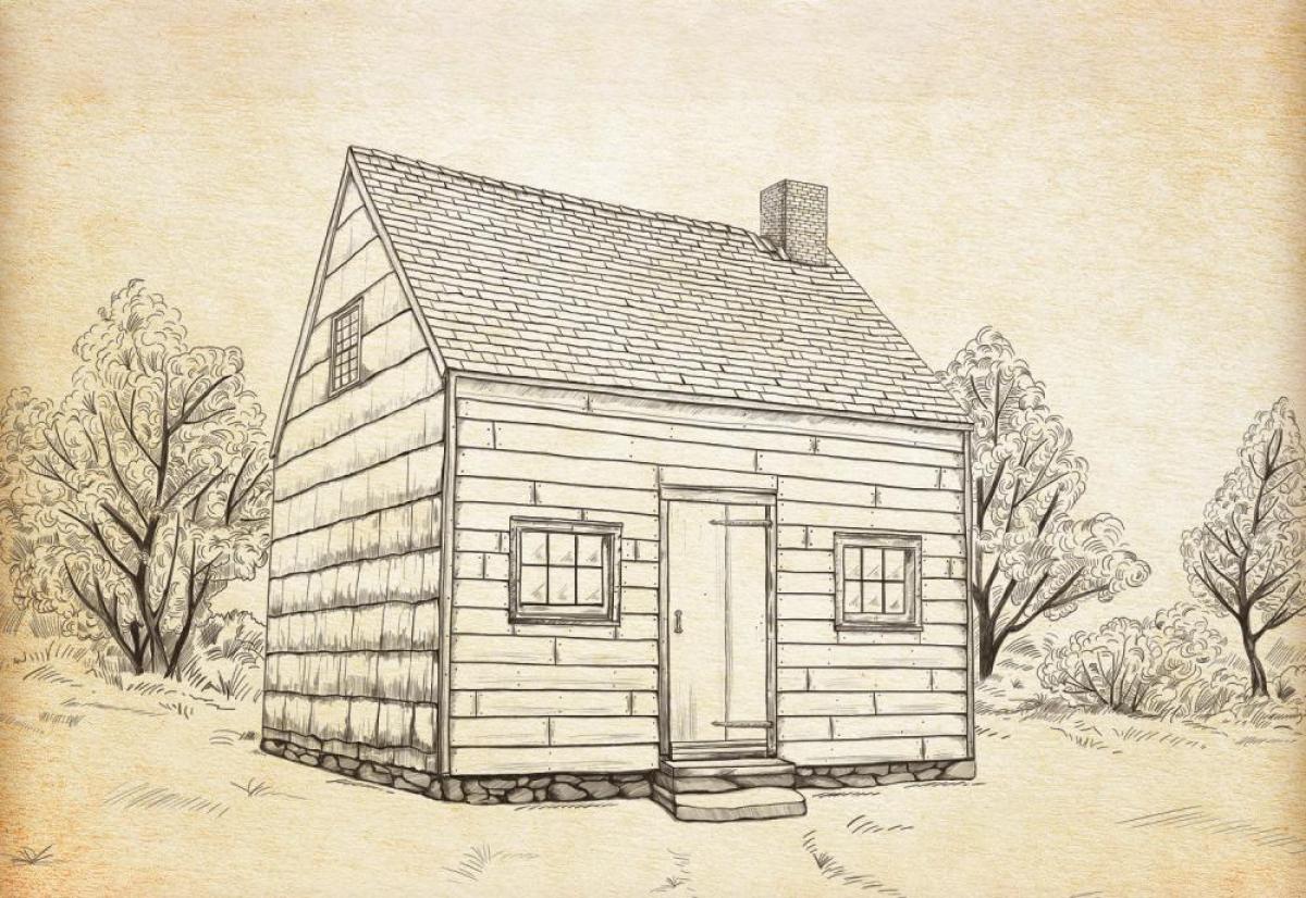
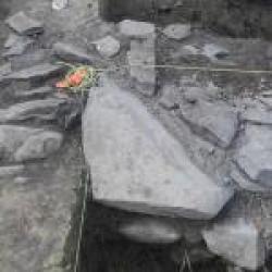
Thomas Powell Farmstead: A Virtual Tour of an African American Heritage Site
Thomas and Betty Powell, formerly enslaved by the Fonda and Lansing families, married in 1808 and worked over a decade to purchase their freedom and establish a farmstead in 1818. Three generations of Powells lived and thrived on the property, expanding their home and leaving a legacy now being preserved as a vital piece of American history.
Black History Resources
Discover a comprehensive collection of materials, exhibits, and educational tools highlighting the rich history and contributions of Black communities in New York State.
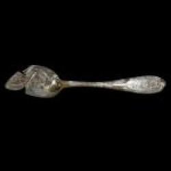
African American Farmers in the Upper Hudson Valley, 1820–1880
The Hudson River Valley's agricultural history spans from indigenous farmers to modern mechanized farming, yet the contributions of free African American farmers, like the Powell family, remain largely unrecognized. The Powell family farmstead, an African-American-owned farm in Albany County, showcases their resilience and success across three generations, with ongoing efforts to preserve this vital heritage site.
From the Times Union: "Research details Black-owned farms in region's history"(link is external)
This article highlights the efforts of NYSM archaeologists to study artifacts and records to understand the lives of 19th century African American farmers in the Capital Region.
A Place for African American Agricultural Heritage: The Lives and Landscapes of the Powell Family of Watervliet
In this article from the Journal of the New York State Archaeological Association's The Bulletin, Number 137, the NYSM's Michael Lucas explores the inspiring story of the Powell family, who transitioned from enslavement to establishing a 40-acre farmstead by 1850. The ruins of their farmstead stand as a rare testament to rural African American heritage, with ongoing preservation efforts underscoring its importance for future generations.
NYSM Historical Archaeologist Dr. Michael Lucas discusses John and Lucretia Jackson of Becker’s Corner south of Albany, and Thomas and Elizabeth Powell of Boght Corners to the north of the city, two of the first African American couples to purchase land during the early 19th century. Descendants of the founding Jackson and the Powell families held on to this land into the 20th century. Genealogical and archaeological research is crucial to understanding the importance of land-to-family legacies and long-term neighborhood continuity. The historical trajectories of the Jackson and Powell families are presented as examples of the importance of land and place.
From the NYSM Public Program: The Intersection of Archaeology and Genealogy Archaeology and genealogy are critical components for understanding our past. Learn how Dr. Paul Huey and Dr. Michael Lucas use these components to help create a more accurate picture of the material culture, architecture, and people of New York.
The Oechsle Clock Collection
Now On View in Adirondack Hall
Step into a world where every tick tells a tale. Following the opening of the Erie Canal in 1825, clockmakers flourished along its path, leaving behind a legacy of craftsmanship and commerce. Now, visitors can see six remarkable examples from The Oechsle Clock Collection, a gathering of more than 80 clocks from the 1800s to early 1900s.
On view are ingenious creations such as Theodore R. Timby’s solar clock and Andrew Van Woert Strait’s advertising clock, alongside works by other celebrated and overlooked makers. Thanks to the dedication of Russell and Janet Oechsle, these stories of time are preserved for discovery and study.
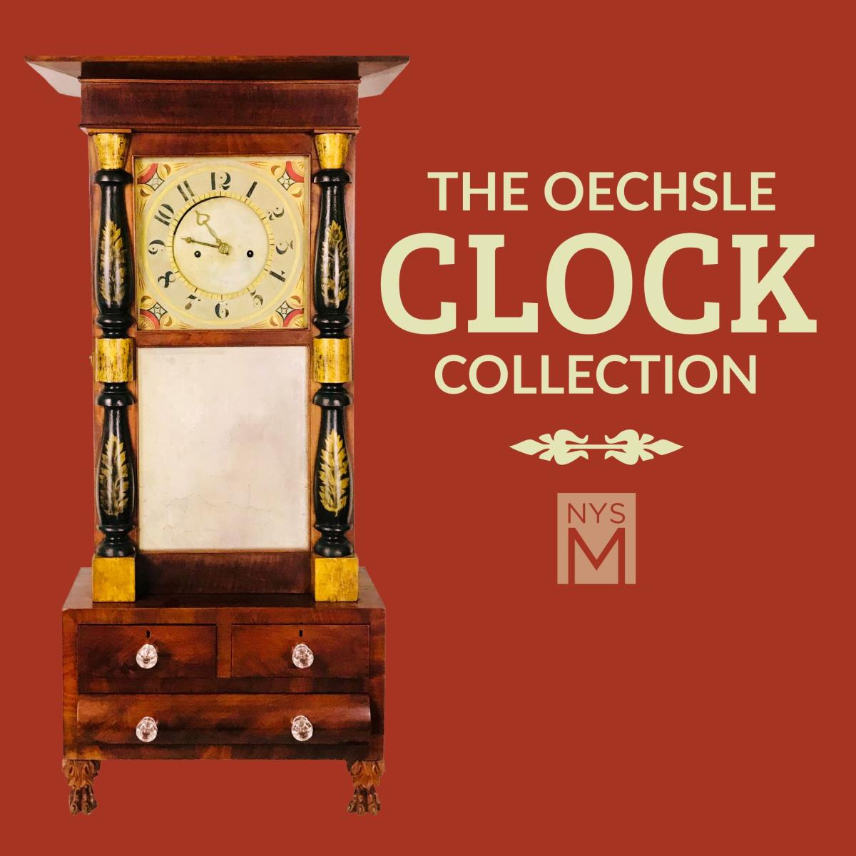
First occurrence of Dissakisite-(Ce) and Jamborite in New York
Dissakisite-(Ce) - Ca(Ce,REE)(Mg,Fe2+)(Al,Fe3+)2Si3O12(OH) - the magnesium analogue of the more common allanite (Ce), was found in a specimen from the Henry Rudy Farm, in Orange County. It occurs as millimeter-size pink crystals associated with chondrodite, spinel, and phlogopite in marble (Franklin Marble). To our knowledge, this is the first reported occurrence of this mineral in North America.
Jamborite, (Ni2+Ni3+Co, Fe)(OH)2(OH,S,H2O), was found in a specimen from Antwerp, Jefferson County. It occurs as green sub millimeter-size crystals in a cavity in quartz. This is the third occurrence of this mineral in the USA.
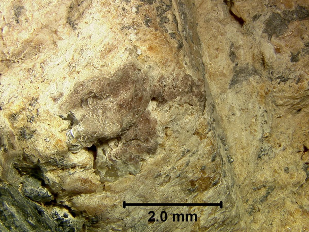
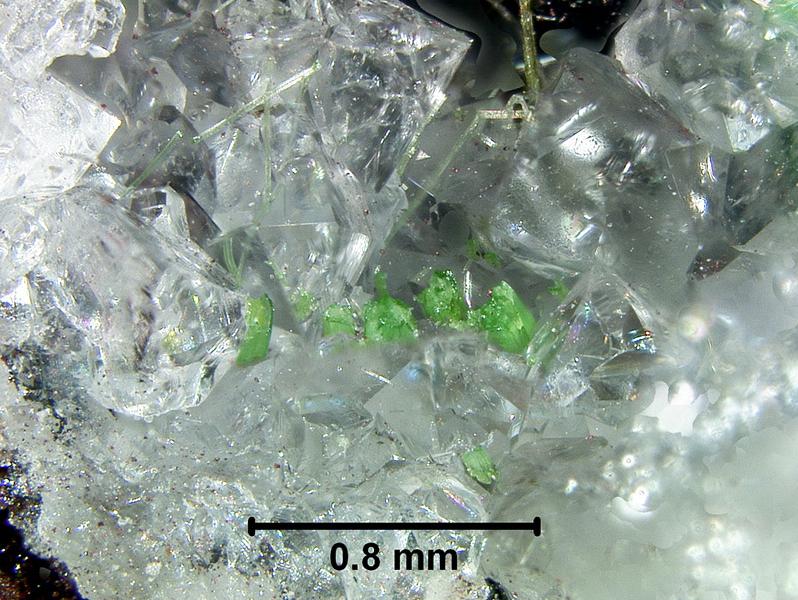
Ground Penetrating Radar
The New York State Geological Survey over the past five years has actively been developing three-dimensional mapping protocols and products. Producing accurate and reliable surficial deposits maps traditionally involves a high labor, low efficiency methods utilizing evaluation of outcrops and exposures, hand augers and sediment classification, thus the production of one 7.5 minute quadrangle (approximately six miles by eight miles) can easily consume two years’ worth of field work. In an effort to improve accuracy and efficiency in map production we utilize ground penetrating radar (GPR) to dovetail with traditional methods to remotely sense and characterize unconsolidated glacial deposits and determine stratigraphy (layering within deposits) that comprises the geologic framework.
Originally GPR developed for measuring the thickness of glaciers in the 1930s, the hardware and software made tremendous technological advances in the 1960s, 1970s and finally became affordable in the mid 1980s. Ground penetrating radar utilizes electromagnetic (radio waves) to penetrate the subsurface and produce reflections of targets similar to seismic surveys for oil and gas. The difference is that GPR has much higher resolution and is easier to process the data and render subsurface images, takes less time, and is less costly. Coarse-grained, low conductivity deposits such as sand & gravel are ideal deposits to map in detail with GPR as opposed to clay rich deposits that absorb and limit signal penetration. Antenna frequency determines the level of resolution and signal penetration. In general, low frequency antennas can penetrate deeper into the earth but cannot resolve smaller targets and high frequency antennas provide better resolution but perform at a much shallower depth. We utilize frequencies in the 400 -100 MHz range for deep (25-60 feet) geological mapping whereas the vast majority of GPR surveys utilize 2.0 GHz for internal surveying of concrete and infrastructure work (3-6 inches).
GPR has been used to: map megafaunal remains, find unmarked graves, map foundations and archaeological features, conduct forensics, locate infrastructure, and identify subsurface geologic hazards.


Related Publications
Kozlowski, A. 2015. Mapping and Materials. Material Matters Spring: 20-21. http://www.nxtbook.com/naylor/NCMB/NCMB0115/index.php#/20
Laura Sherrod1, Kenneth Schlosser1, Andrew Kozlowski2, Brian Bird2, D. Dale Werkema Jr.3 and Jarred Swiontek1; September, 2014, Geophysical Characterization of the Keene Valley Landslide in New York State, Journal of Environmental and Engineering Geophysics, Volume 19, Issue 3, pp. 139–155
Duskin, P., Pullammanappallil, S., and Kozlowski, A. L. 2008. Shear Wave Testing for Soil Loss Over Culverts. Journal of National Council on Highway Geophysics (December):
Kozlowski, Andrew. 2007. Searching Old Ground with New Methods. Legacy: The Magazine of the New York State Museum 3(1):7.